Moncoutant
Moncoutant | |
|---|---|
Part of Moncoutant-sur-Sèvre | |
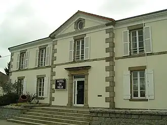 The town hall in Moncoutant | |
Location of Moncoutant | |
 Moncoutant  Moncoutant | |
| Coordinates: 46°43′28″N 0°35′15″W / 46.7244°N 0.5875°W | |
| Country | France |
| Region | Nouvelle-Aquitaine |
| Department | Deux-Sèvres |
| Arrondissement | Bressuire |
| Canton | Cerizay |
| Commune | Moncoutant-sur-Sèvre |
Area 1 | 26.32 km2 (10.16 sq mi) |
| Population (2022)[1] | 3,223 |
| • Density | 120/km2 (320/sq mi) |
| Time zone | UTC+01:00 (CET) |
| • Summer (DST) | UTC+02:00 (CEST) |
| Postal code | 79320 |
| Elevation | 153–226 m (502–741 ft) (avg. 180 m or 590 ft) |
| 1 French Land Register data, which excludes lakes, ponds, glaciers > 1 km2 (0.386 sq mi or 247 acres) and river estuaries. | |
Moncoutant (French pronunciation: [mɔ̃kutɑ̃]) is a former commune in the Deux-Sèvres department in western France. On 1 January 2019, it was merged into the new commune Moncoutant-sur-Sèvre.[2]
Geography
Moncoutant is located in a bocage area in northern Deux-Sèvres, on the Sèvre Nantaise, 50 km north of Niort and 15 km south of Bressuire.
Economy
Moncoutant is a mainly agricultural town. However, it also has numerous shops and a few industries. Since 2001, it has also become a tourist center, thanks to the opening of the fishing holiday center
History
Points of interest
See also
References
- ^ "Populations de référence 2022" [Reference populations 2022] (PDF) (in French). INSEE. December 2024.
- ^ Arrêté préfectoral 23 November 2018 (in French)
Wikimedia Commons has media related to Moncoutant.