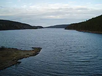
Mingevannet
| Mingevannet | |
|---|---|
 | |
 Mingevannet | |
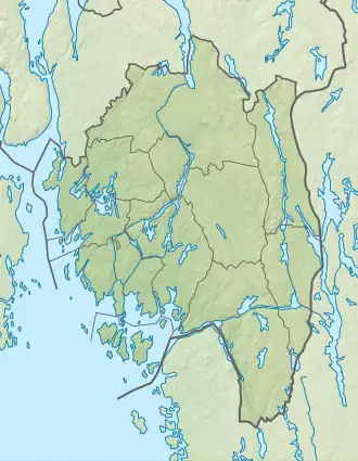
| Location | Østfold county |
| Coordinates | 59°22′39″N 11°07′10″E / 59.37750°N 11.11944°E / 59.37750; 11.11944 |
| Catchment area | 27.98 km2 (10.80 sq mi) |
| Basin countries | Norway |
| Surface area | 4.26 km2 (1.64 sq mi) |
| Shore length1 | 77.88 km (48.39 mi) |
| Surface elevation | 24 m (79 ft) |
| References | NVE[1] |
| 1 Shore length is not a well-defined measure. | |
Mingevannet is a lake in Østfold county, Norway.[2] It forms a part of the Glomma watershed together with Ågårdselva and Visterflo.
See also
References
- ^ "NVE Temakart". temakart.nve.no (in Norwegian). Retrieved 1 April 2024.
- ^ Thorsnæs, Geir (19 February 2024). "Mingevannet". Store norske leksikon (in Norwegian). Retrieved 1 April 2024.
This article is issued from Wikipedia. The text is available under Creative Commons Attribution-Share Alike 4.0 unless otherwise noted. Additional terms may apply for the media files.