Midsalip
Midsalip | |
|---|---|
| Municipality of Midsalip | |
 Flag  Seal | |
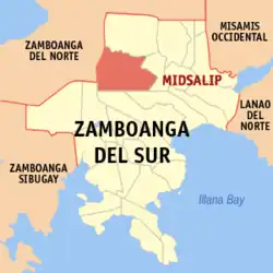 Map of Zamboanga del Sur with Midsalip highlighted | |
OpenStreetMap | |
.svg.png) Midsalip Location within the Philippines | |
| Coordinates: 8°01′58″N 123°18′53″E / 8.0328°N 123.3147°E | |
| Country | Philippines |
| Region | Zamboanga Peninsula |
| Province | Zamboanga del Sur |
| District | 1st district |
| Founded | September 9, 1964 |
| Barangays | 33 (see Barangays) |
| Government | |
| • Type | Sangguniang Bayan |
| • Mayor | Elmer M. Soronio |
| • Vice Mayor | Stewart R. Padayhag |
| • Representative | Divina Grace C. Yu |
| • Municipal Council | Members |
| • Electorate | 22,619 voters (2025) |
| Area | |
• Total | 161.56 km2 (62.38 sq mi) |
| Elevation | 399 m (1,309 ft) |
| Highest elevation | 1,174 m (3,852 ft) |
| Lowest elevation | 236 m (774 ft) |
| Population (2024 census)[3] | |
• Total | 35,643 |
| • Density | 220/km2 (570/sq mi) |
| • Households | 7,531 |
| Economy | |
| • Income class | 4th municipal income class |
| • Poverty incidence | 41.1 |
| • Revenue | ₱ 194.6 million (2022) |
| • Assets | ₱ 865.8 million (2022) |
| • Expenditure | ₱ 119.8 million (2022) |
| • Liabilities | ₱ 235.8 million (2022) |
| Service provider | |
| • Electricity | Zamboanga del Sur 1 Electric Cooperative (ZAMSURECO 1) |
| Time zone | UTC+8 (PST) |
| ZIP code | 7021 |
| PSGC | |
| IDD : area code | +63 (0)62 |
| Native languages | Subanon Cebuano Chavacano Tagalog |
| Website | www |
Midsalip, officially the Municipality of Midsalip (Cebuano: Lungsod sa Midsalip; Subanen: Benwa Midsalip; Chavacano: Municipalidad de Midsalip; Tagalog: Bayan ng Midsalip), is a municipality in the province of Zamboanga del Sur, Philippines. According to the 2020 census, it has a population of 33,711 people.[5]
Etymology
The town's name is from a Subanen word,"Migsalip" which means "to collect" or "accumulate".
History
Midsalip was formed as a municipality out of 21 barrios of the Municipality of Ramon Magsaysay and 6 barrios of the municipality of Dumingag on September 9, 1964, by virtue of Executive Order Number 94 signed by President Diosdado Macapagal.[6] This did not last long, however, as it was dissolved on February 26, 1966, due to a Supreme Court decision regarding the legality of the funds disbursed by the municipal treasurer. As a result, Midsalip was reverted to barrio status. It was not until May 8, 1967, when the Republic Act No. 4871 was passed when Midsalip became a regular municipality again.[7]
Geography
Climate
| Climate data for Midsalip, Zamboanga del Sur | |||||||||||||
|---|---|---|---|---|---|---|---|---|---|---|---|---|---|
| Month | Jan | Feb | Mar | Apr | May | Jun | Jul | Aug | Sep | Oct | Nov | Dec | Year |
| Mean daily maximum °C (°F) | 25 (77) |
25 (77) |
26 (79) |
26 (79) |
25 (77) |
24 (75) |
24 (75) |
24 (75) |
24 (75) |
24 (75) |
24 (75) |
25 (77) |
25 (76) |
| Mean daily minimum °C (°F) | 17 (63) |
17 (63) |
18 (64) |
18 (64) |
19 (66) |
19 (66) |
18 (64) |
18 (64) |
18 (64) |
19 (66) |
18 (64) |
18 (64) |
18 (64) |
| Average precipitation mm (inches) | 48 (1.9) |
44 (1.7) |
56 (2.2) |
56 (2.2) |
112 (4.4) |
135 (5.3) |
124 (4.9) |
124 (4.9) |
115 (4.5) |
134 (5.3) |
90 (3.5) |
56 (2.2) |
1,094 (43) |
| Average rainy days | 13.0 | 11.7 | 15.6 | 18.1 | 25.6 | 25.7 | 25.2 | 24.1 | 23.8 | 26.1 | 22.3 | 16.5 | 247.7 |
| Source: Meteoblue[8] | |||||||||||||
Barangay captain names
Midsalip is politically subdivided into 33 barangays. Each barangay consists of puroks while some have sitios.
- Bacahan
- Balonai
- Bibilop
- Buloron
- Cabaloran
- Canipay Norte
- Canipay Sur
- Cumarom
- Dakayakan
- Duelic
- Dumalinao
- Ecuan
- Golictop
- Guinabot
- Guitalos
- Guma
- Kahayagan
- Licuro-an
- Lumpunid
- Matalang
- New Katipunan
- New Unidos
- Palili
- Pawan
- Pili
- Pisompongan
- Piwan
- Poblacion A
- Poblacion B
- Sigapod
- Timbaboy
- Tulbong
- Tuluan
Demographics
| Year | Pop. | ±% p.a. |
|---|---|---|
| 1970 | 17,397 | — |
| 1975 | 20,927 | +3.77% |
| 1980 | 24,624 | +3.31% |
| 1990 | 22,891 | −0.73% |
| 1995 | 25,258 | +1.86% |
| 2000 | 28,909 | +2.94% |
| 2007 | 30,772 | +0.87% |
| 2010 | 31,467 | +0.82% |
| 2015 | 32,075 | +0.37% |
| 2020 | 33,711 | +1.05% |
| 2024 | 35,643 | +1.35% |
| Source: Philippine Statistics Authority[9][10][11][12][13] | ||
Economy
Poverty incidence of Midsalip
10
20
30
40
50
60
70
2000
67.92 2003
68.32 2006
37.60 2009
52.65 2012
54.91 2015
55.13 2018
45.32 2021
41.10 Source: Philippine Statistics Authority[14][15][16][17][18][19][20][21] |
References
- ^ Municipality of Midsalip | (DILG)
- ^ "2015 Census of Population, Report No. 3 – Population, Land Area, and Population Density" (PDF). Philippine Statistics Authority. Quezon City, Philippines. August 2016. ISSN 0117-1453. Archived (PDF) from the original on May 25, 2021. Retrieved July 16, 2021.
- ^ "2024 Census of Population (POPCEN) Population Counts Declared Official by the President". 2024 Philippine census. Philippine Statistics Authority. July 17, 2025. Retrieved July 18, 2025.
- ^ "PSA Releases the 2021 City and Municipal Level Poverty Estimates". Philippine Statistics Authority. April 2, 2024. Retrieved April 28, 2024.
- ^ "2024 Census of Population (POPCEN) Population Counts Declared Official by the President". 2024 Philippine census. Philippine Statistics Authority. July 17, 2025. Retrieved July 18, 2025.
- ^ "Executive Order No. 94: Creating the Municipality of Midsalip in the Province of Zamboanga del Sur". Official Gazette of the Republic of the Philippines. Manila, Philippines: Presidential Communications Development and Strategic Planning Office. September 4, 1964. Retrieved July 24, 2014.
- ^ "Republic Act No. 4871 - An Act Creating the Municipality of Midsalip in the Province of Zamboanga del Sur". Philippine Laws, Statutes & Codes. Chan Robles Virtual Law Library. May 8, 1967. Retrieved July 24, 2014.
- ^ "Midsalip: Average Temperatures and Rainfall". Meteoblue. Retrieved May 1, 2020.
- ^ "2024 Census of Population (POPCEN) Population Counts Declared Official by the President". 2024 Philippine census. Philippine Statistics Authority. July 17, 2025. Retrieved July 18, 2025.
- ^ Census of Population (2015). "Region IX (Zamboanga Peninsula)". Total Population by Province, City, Municipality and Barangay. Philippine Statistics Authority. Retrieved June 20, 2016.
- ^ Census of Population and Housing (2010). "Region IX (Zamboanga Peninsula)" (PDF). Total Population by Province, City, Municipality and Barangay. National Statistics Office. Retrieved June 29, 2016.
- ^ Censuses of Population (1903–2007). "Region IX (Zamboanga Peninsula)". Table 1. Population Enumerated in Various Censuses by Province/Highly Urbanized City: 1903 to 2007. National Statistics Office.
- ^ "Province of". Municipality Population Data. Local Water Utilities Administration Research Division. Retrieved December 17, 2016.
- ^ "Poverty incidence (PI):". Philippine Statistics Authority. Retrieved December 28, 2020.
- ^ "Estimation of Local Poverty in the Philippines" (PDF). Philippine Statistics Authority. November 29, 2005.
- ^ "2003 City and Municipal Level Poverty Estimates" (PDF). Philippine Statistics Authority. March 23, 2009.
- ^ "City and Municipal Level Poverty Estimates; 2006 and 2009" (PDF). Philippine Statistics Authority. August 3, 2012.
- ^ "2012 Municipal and City Level Poverty Estimates" (PDF). Philippine Statistics Authority. May 31, 2016.
- ^ "Municipal and City Level Small Area Poverty Estimates; 2009, 2012 and 2015". Philippine Statistics Authority. July 10, 2019.
- ^ "PSA Releases the 2018 Municipal and City Level Poverty Estimates". Philippine Statistics Authority. December 15, 2021. Retrieved January 22, 2022.
- ^ "PSA Releases the 2021 City and Municipal Level Poverty Estimates". Philippine Statistics Authority. April 2, 2024. Retrieved April 28, 2024.
External links
Places adjacent to Midsalip | |
|---|---|
| Municipalities | |
|---|---|
| Component city | |
| Highly urbanized city |
|