Microregion of São Carlos
Microregion of São Carlos | |
|---|---|
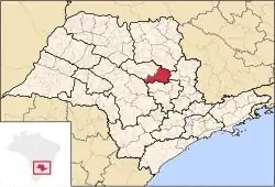 Location of the Microregion of São Carlos | |
| Coordinates: 22°01′04″S 47°53′27″W / 22.01778°S 47.89083°W | |
| Country | |
| Region | Southeast |
| State | |
| Mesoregion | Araraquara |
| Area | |
• Total | 3,185.4 km2 (1,229.9 sq mi) |
| Population (2010/IBGE) | |
• Total | 308,777 |
| • Density | 97/km2 (250/sq mi) |
| Time zone | UTC-3 (UTC-3) |
| • Summer (DST) | UTC-2 (UTC-2) |
| Postal Code | 14000-000 |
| Area code | +55 16 |
The Microregion of São Carlos (Portuguese: Microrregião de São Carlos) is a microregion located on the east-center of São Paulo state, Brazil, and is made up of 6 municipalities. It belongs to the Mesoregion of Araraquara.
The population of the Microregion is 308,777 inhabitants, in an area of 3,185.4 km2[1]
Municipalities
The microregion consists of the following municipalities,[2] listed below with their 2010 Census populations (IBGE/2010):[3]
- Analândia: 4,293
- Descalvado: 31,056
- Dourado: 8,609
- Ibaté: 30,734
- Ribeirão Bonito: 12,135
- São Carlos: 221,950
See also
References
- ^ "2010 Census of the IBGE - Synopsis - Tables 761 and 1301" (in Portuguese). IBGE.gov.br. Retrieved 22 July 2011.
- ^ Instituto Brasileiro de Geografia e Estatística, territorial division.
- ^ "2010 Census of the IBGE - Population - Table 2.1.20" (PDF). IBGE.gov.br. Retrieved 22 July 2011.
| Mesoregions |
|
|---|---|
| Microregions |
|