Mastorochoria
Mastorochoria
Μαστοροχώρια | |
|---|---|
 Mastorochoria Location within the regional unit 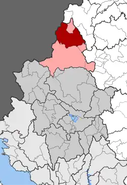 | |
| Coordinates: 40°13′N 20°49′E / 40.217°N 20.817°E | |
| Country | Greece |
| Administrative region | Epirus |
| Regional unit | Ioannina |
| Municipality | Konitsa |
| Area | |
| • Municipal unit | 271.16 km2 (104.70 sq mi) |
| Elevation | 922 m (3,025 ft) |
| Population (2021)[1] | |
| • Municipal unit | 851 |
| • Municipal unit density | 3.1/km2 (8.1/sq mi) |
| Time zone | UTC+2 (EET) |
| • Summer (DST) | UTC+3 (EEST) |
| Vehicle registration | ΙΝ |
| Website | www.mastorohoria.gr |
Mastorochoria (Greek: Μαστοροχώρια) is a former municipality in the Ioannina regional unit, Epirus, Greece. Since the 2011 local government reform it is part of the municipality Konitsa, of which it is a municipal unit.[2] The municipal unit has an area of 271.160 km2.[3] Population 851 (2021). The seat of the municipality was in Pyrsogianni.
Subdivisions
The municipal unit Mastorochoria is subdivided into the following communities (constituent villages in brackets):
- Pyrsogianni
- Asimochori
- Vourmpiani
- Gorgopotamos
- Drosopigi
- Kastaniani
- Kefalochori
- Lagkada
- Oxya (Oxya, Theotokos)
- Plagia
- Plikati
- Chionades
References
- ^ "Αποτελέσματα Απογραφής Πληθυσμού - Κατοικιών 2021, Μόνιμος Πληθυσμός κατά οικισμό" [Results of the 2021 Population - Housing Census, Permanent population by settlement] (in Greek). Hellenic Statistical Authority. 29 March 2024.
- ^ "ΦΕΚ B 1292/2010, Kallikratis reform municipalities" (in Greek). Government Gazette.
- ^ "Population & housing census 2001 (incl. area and average elevation)" (PDF) (in Greek). National Statistical Service of Greece. Archived from the original (PDF) on 2015-09-21.
External links
Wikimedia Commons has media related to Mastorochoria.