Manombo Sud
Manombo Sud | |
|---|---|
 | |
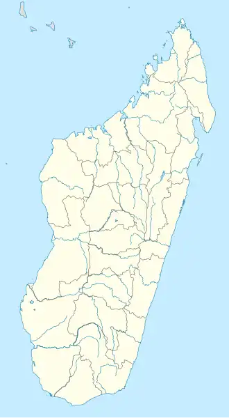 Manombo Sud Location in Madagascar | |
| Coordinates: 22°57′S 43°28′E / 22.950°S 43.467°E | |
| Country | |
| Region | Atsimo-Andrefana |
| District | Toliara II |
| Elevation | 11 m (36 ft) |
| Population (2001)[2] | |
• Total | 17,000 |
| Time zone | UTC3 (EAT) |
| Postal code | 602 |
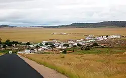
Manombo Sud is a rural municipality in Madagascar. It belongs to the district of Toliara II, which is a part of Atsimo-Andrefana Region. The population of the commune was estimated to be approximately 17,000 in the 2001 commune census.[2]
Primary and junior level secondary education are available in town. The majority (55%) of the population works in fishing. 35% are farmers, while an additional 5% receive their livelihood from raising livestock. The most important crops are cassava and sugarcane, while other important agricultural products are maize and lima beans. Services provide employment for 5% of the population.[2]
See also
- Tsifota - a fishing village of this municipality.
References
- ^ Estimated based on DEM data from Shuttle Radar Topography Mission
- ^ a b c "ILO census data". Cornell University. 2002. Retrieved 2008-03-13.
Capital: Toliara | ||
| Ampanihy Ouest (19) - 605 | 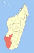 | |
| Ankazoabo - 606 - (10) |
| |
| Benenitra - 610 - (6) |
| |
| Beroroha - 611 - (9) |
| |
| Betioky-Atsimo -612 - (31) |
| |
| Morombe (9) - 618 | ||
| Sakaraha (12) - 620 | ||
| Toliara I (1) | ||
| Toliara II (22) (602) | ||
9 districts; 119 communes | ||
22°57′S 43°28′E / 22.950°S 43.467°E