Maningory River
| Maningory River | |
|---|---|
 | |
| Location | |
| Country | Madagascar |
| Region | Analanjirofo |
| City | Ampasina Maningory |
| Physical characteristics | |
| Source | |
| • location | Lake Alaotra |
| • elevation | 750 m (2,460 ft) |
| Mouth | Indian Ocean |
• location | Antakobola, Analanampotsy |
• coordinates | 17°12′21″S 49°27′45″E / 17.20583°S 49.46250°E |
• elevation | 0 m (0 ft) |
| Length | 260 km (160 mi) |
| Basin size | 12,646 km2 (4,883 sq mi) |
| Discharge | |
| • location | Near mouth |
| • average | (Period: 1971–2000)776.1 m3/s (27,410 cu ft/s)[1] |
| Basin features | |
| River system | Maningory River |
| Tributaries | |
| • left | Sandratsio |
| • right | Sahalavy, Manananaka |
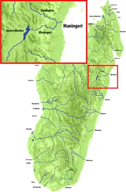
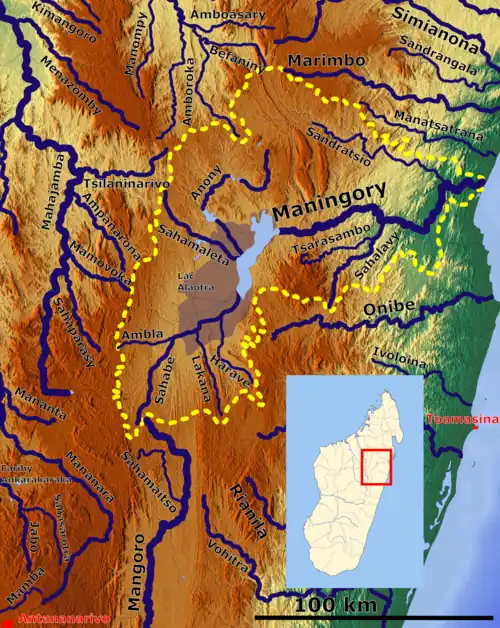
Maningory is a river in the region of Analanjirofo in north-eastern Madagascar. It takes it source in Lake Alaotra[2] and flows into the Indian Ocean near Antakobola.[3]
The Maningory Falls of 90 meters are situated 20 km from Imerimandroso.[4]
References
- ^ "Madagascar".
- ^ "Madagascar-GEOGRAPHY". countrystudies.us. U. S. Library of Congress. Retrieved 27 September 2017.
- ^ M. Aldegheri,1972.Rivers and streams on Madagascar. Dr. W. Junk B.V. Publishers
- ^ "En construction". Madagascar-guide.com. Retrieved 11 August 2017.
Wikimedia Commons has media related to Maningory.