Mandaon
Mandaon | |
|---|---|
| Municipality of Mandaon | |
 Flag | |
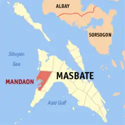 Map of Masbate with Mandaon highlighted | |
OpenStreetMap | |
.svg.png) Mandaon Location within the Philippines | |
| Coordinates: 12°13′33″N 123°17′03″E / 12.22594°N 123.28421°E | |
| Country | Philippines |
| Region | Bicol Region |
| Province | Masbate |
| District | 2nd district |
| Founded | 18 July 1949 |
| Barangays | 26 (see Barangays) |
| Government | |
| • Type | Sangguniang Bayan |
| • Mayor | Emily E. Hao |
| • Vice Mayor | Romeo R. Villanueva |
| • Representative | Elisa T. Kho |
| • Municipal Council | Members |
| • Electorate | 28,127 voters (2025) |
| Area | |
• Total | 280.80 km2 (108.42 sq mi) |
| Elevation | 20 m (70 ft) |
| Highest elevation | 181 m (594 ft) |
| Lowest elevation | 0 m (0 ft) |
| Population (2024 census)[3] | |
• Total | 44,177 |
| • Density | 160/km2 (410/sq mi) |
| • Households | 9,833 |
| Economy | |
| • Income class | 3rd municipal income class |
| • Poverty incidence | 25.4 |
| • Revenue | ₱ 248.3 million (2022) |
| • Assets | ₱ 421.6 million (2022) |
| • Expenditure | ₱ 224.4 million (2022) |
| • Liabilities | ₱ 108.4 million (2022) |
| Service provider | |
| • Electricity | Masbate Electric Cooperative (MASELCO) |
| Time zone | UTC+8 (PST) |
| ZIP code | 5411 |
| PSGC | |
| IDD : area code | +63 (0)56 |
| Native languages | Capiznon Tagalog |
| Website | www |
Mandaon, officially the Municipality of Mandaon, is a municipality in the province of Masbate, Philippines. According to the 2020 census, it has a population of 44,122 people.[5]
Mandaon is 64 kilometres (40 mi) from Masbate City.
History
Mandaon was originally a barrio of Milagros, established by Barrio Lieutenant Feliciano Aquillo Sr. In 1948, Juan Valencia, a settler from Pampanga, advocated for its elevation into a municipality. On July 18, 1949, President Elpidio Quirino, through Executive Order No. 244, officially recognized Mandaon as an independent municipality, distinct from Milagros.[6]
Geography
Barangays
Mandaon is politically subdivided into 26 barangays. [7] Each barangay consists of puroks and some have sitios.
- Alas
- Ayat
- Bat-Ongan
- Bugtong
- Buri
- Cabitan
- Cagmasoso
- Canomoy
- Centro
- Dayao
- Guincaiptan
- Laguinbanwa
- Lantangan
- Looc
- Mabatobato
- Maolingon
- Nailaban
- Nanipsan
- Pinamangcaan
- Poblacion
- Polo Dacu
- San Juan
- San Pablo
- Santa Fe
- Tagpu
- Tumalaytay
Climate
| Climate data for Mandaon, Masbate | |||||||||||||
|---|---|---|---|---|---|---|---|---|---|---|---|---|---|
| Month | Jan | Feb | Mar | Apr | May | Jun | Jul | Aug | Sep | Oct | Nov | Dec | Year |
| Mean daily maximum °C (°F) | 29 (84) |
29 (84) |
31 (88) |
32 (90) |
32 (90) |
31 (88) |
30 (86) |
30 (86) |
30 (86) |
30 (86) |
29 (84) |
29 (84) |
30 (86) |
| Mean daily minimum °C (°F) | 23 (73) |
22 (72) |
23 (73) |
23 (73) |
25 (77) |
25 (77) |
24 (75) |
25 (77) |
24 (75) |
24 (75) |
24 (75) |
23 (73) |
24 (75) |
| Average precipitation mm (inches) | 39 (1.5) |
34 (1.3) |
42 (1.7) |
36 (1.4) |
73 (2.9) |
109 (4.3) |
118 (4.6) |
108 (4.3) |
129 (5.1) |
136 (5.4) |
112 (4.4) |
89 (3.5) |
1,025 (40.4) |
| Average rainy days | 12.6 | 9.7 | 12.0 | 13.0 | 20.5 | 25.3 | 26.2 | 24.8 | 25.2 | 25.9 | 21.9 | 17.9 | 235 |
| Source: Meteoblue[8] | |||||||||||||
Demographics
|
| |||||||||||||||||||||||||||||||||||||||||||||
| Source: Philippine Statistics Authority[9][10][11][12][13] | ||||||||||||||||||||||||||||||||||||||||||||||
In the 2020 census, the population of Mandaon, Masbate, was 44,122 people,[14] with a density of 160 inhabitants per square kilometre or 410 inhabitants per square mile.
Economy
Poverty incidence of Mandaon
10
20
30
40
50
60
70
2000
63.32 2003
64.82 2006
52.30 2009
41.06 2012
44.69 2015
41.39 2018
32.38 2021
25.40 Source: Philippine Statistics Authority[15][16][17][18][19][20][21][22] |
Education
The municipality is home to the 3,668-hectare campus of the only state college in the province of Masbate: the Dr. Emilio B. Espinosa Sr. Memorial State College of Agriculture and Technology (DEBESMSCAT), named after the former congressman of the province, Dr. Emilio B. Espinosa, Sr.
- Secondary Schools
- Federico A. Estipona Memorial High School
- Cabitan National High School
- San Pablo National High School
- Buri National High School
- Bugtong National High School
- Cleofe A. Arce Memorial High School
- Lantangan High School
- Tumalaytay High School
- Elementary Schools
- Cabitan Central School
- Jose Zurbito Mesa S. Memorial Elementary School
- Bugtong Elementary School
- Pulo Dacu Elementary School
- Pinamangcaan Elementary School
References
- ^ Municipality of Mandaon | (DILG)
- ^ "2015 Census of Population, Report No. 3 – Population, Land Area, and Population Density" (PDF). Philippine Statistics Authority. Quezon City, Philippines. August 2016. ISSN 0117-1453. Archived (PDF) from the original on May 25, 2021. Retrieved July 16, 2021.
- ^ "2024 Census of Population (POPCEN) Population Counts Declared Official by the President". Philippine Statistics Authority. 17 July 2025. Retrieved 18 July 2025.
- ^ "PSA Releases the 2021 City and Municipal Level Poverty Estimates". Philippine Statistics Authority. 2 April 2024. Retrieved 28 April 2024.
- ^ "2024 Census of Population (POPCEN) Population Counts Declared Official by the President". Philippine Statistics Authority. 17 July 2025. Retrieved 18 July 2025.
- ^ "Executive Order No. 244, s. 1949". Official Gazette of the Republic of the Philippines. 18 July 1949. Archived from the original on 31 January 2023. Retrieved 31 January 2023.
- ^ "Province:". PSGC Interactive. Quezon City, Philippines: Philippine Statistics Authority. Retrieved 12 November 2016.
- ^ "Mandaon: Average Temperatures and Rainfall". Meteoblue. Retrieved 23 June 2020.
- ^ "2024 Census of Population (POPCEN) Population Counts Declared Official by the President". Philippine Statistics Authority. 17 July 2025. Retrieved 18 July 2025.
- ^ Census of Population (2015). "Region V (Bicol Region)". Total Population by Province, City, Municipality and Barangay. Philippine Statistics Authority. Retrieved 20 June 2016.
- ^ Census of Population and Housing (2010). "Region V (Bicol Region)" (PDF). Total Population by Province, City, Municipality and Barangay. National Statistics Office. Retrieved 29 June 2016.
- ^ Censuses of Population (1903–2007). "Region V (Bicol Region)". Table 1. Population Enumerated in Various Censuses by Province/Highly Urbanized City: 1903 to 2007. National Statistics Office.
- ^ "Province of". Municipality Population Data. Local Water Utilities Administration Research Division. Retrieved 17 December 2016.
- ^ "2024 Census of Population (POPCEN) Population Counts Declared Official by the President". Philippine Statistics Authority. 17 July 2025. Retrieved 18 July 2025.
- ^ "Poverty incidence (PI):". Philippine Statistics Authority. Retrieved December 28, 2020.
- ^ "Estimation of Local Poverty in the Philippines" (PDF). Philippine Statistics Authority. 29 November 2005.
- ^ "2003 City and Municipal Level Poverty Estimates" (PDF). Philippine Statistics Authority. 23 March 2009.
- ^ "City and Municipal Level Poverty Estimates; 2006 and 2009" (PDF). Philippine Statistics Authority. 3 August 2012.
- ^ "2012 Municipal and City Level Poverty Estimates" (PDF). Philippine Statistics Authority. 31 May 2016.
- ^ "Municipal and City Level Small Area Poverty Estimates; 2009, 2012 and 2015". Philippine Statistics Authority. 10 July 2019.
- ^ "PSA Releases the 2018 Municipal and City Level Poverty Estimates". Philippine Statistics Authority. 15 December 2021. Retrieved 22 January 2022.
- ^ "PSA Releases the 2021 City and Municipal Level Poverty Estimates". Philippine Statistics Authority. 2 April 2024. Retrieved 28 April 2024.
External links
- Philippine Standard Geographic Code
- Philippine Census Information
- Local Governance Performance Management System Archived 2016-03-04 at the Wayback Machine
Places adjacent to Mandaon | ||||||||||||||||
|---|---|---|---|---|---|---|---|---|---|---|---|---|---|---|---|---|
| ||||||||||||||||
Masbate City (capital and largest city) | |
| Municipalities | |
| Component city | |