Maarin al-Jabal
Maarin al-Jabal
معرين الجبل | |
|---|---|
Village | |
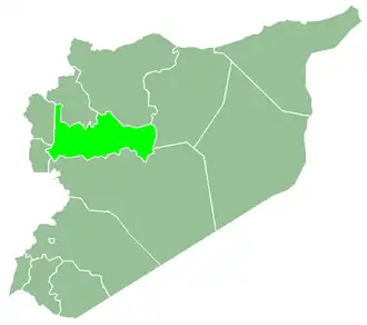
 Maarin al-Jabal Location in Syria | |
| Coordinates: 35°2′55″N 36°45′48″E / 35.04861°N 36.76333°E | |
| Country | |
| Governorate | Hama |
| District | Hama District |
| Subdistrict | Hama Nahiyah |
| Population (2004) | |
• Total | 3,710 |
| Time zone | UTC+2 (EET) |
| • Summer (DST) | UTC+3 (EEST) |
| City Qrya Pcode | C3011 |
Maarin al-Jabal (Arabic: معرين الجبل) is a Syrian village located in the Subdistrict of the Hama District in the Hama Governorate. According to the Syria Central Bureau of Statistics (CBS), Maarin al-Jabal had a population of 3,710 in the 2004 census.[1] Its inhabitants are predominantly Sunni Muslims.[2]
References
- ^ "General Census of Population 2004". Retrieved 2014-07-10.
- ^ Smith, in Robinson and Smith, 1841, vol 3, 2nd appendix, p. 179
Bibliography