Mécheria
Mécheria
بلدية المشرية | |
|---|---|
| Commune of Mécheria | |
 | |
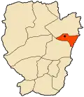 Location of Mécheria within Naâma Province | |
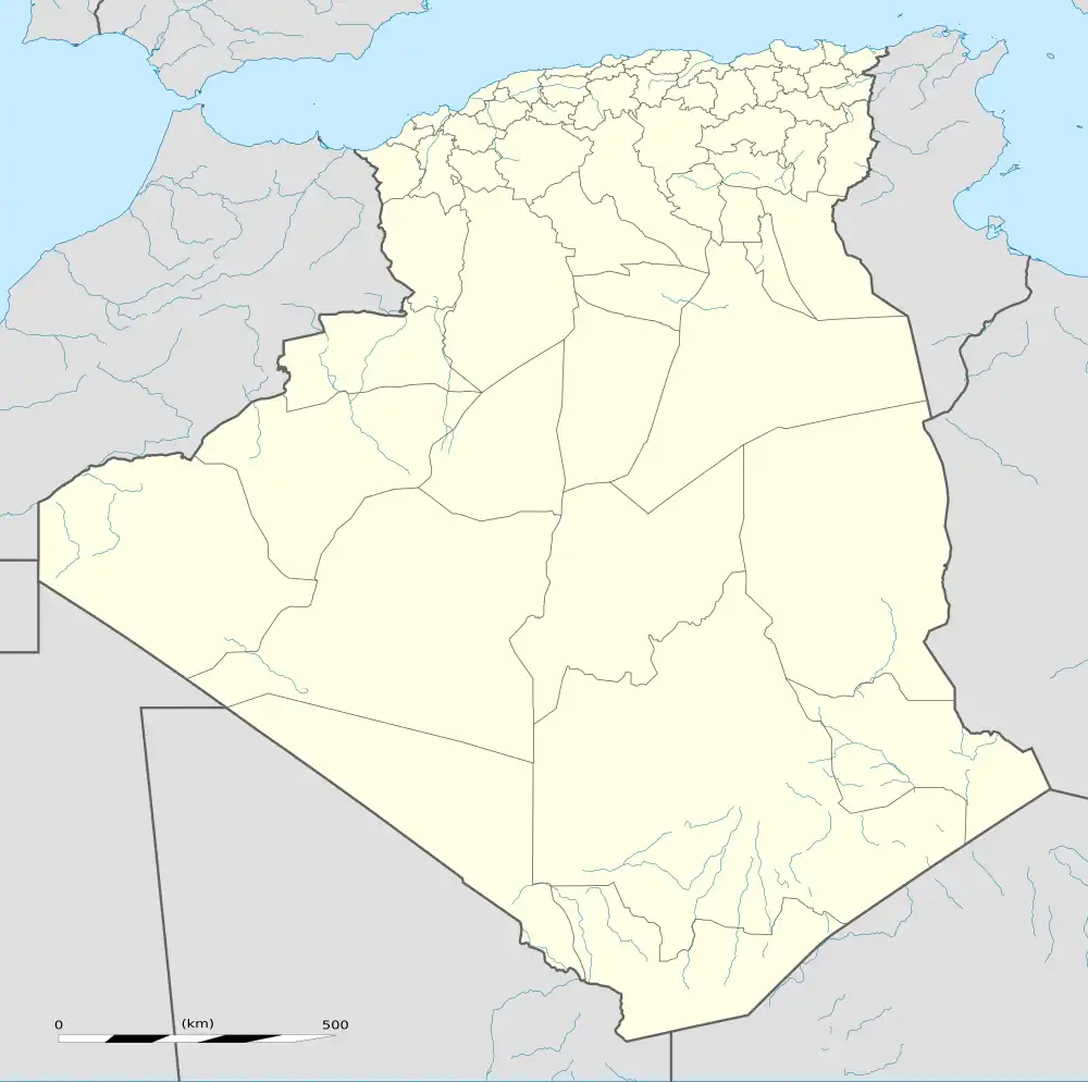 Mécheria Location of Mécheria within Algeria | |
| Coordinates: 33°33′N 0°17′W / 33.550°N 0.283°W | |
| Country | |
| Province | Naâma |
| District | Mécheria (seat) |
| Elevation | 1,180 m (3,870 ft) |
| Population (Census 2020) | |
• Total | 120,312 |
| Time zone | UTC+01 (CET) |
| Postal code | 45100 |
| ONS code | 4502 |
Mécheria is a city situated in Naâma Province, Algeria in the Atlas Mountains, capital of Mécheria District, known for its cold winter and livestock life. As of 2020, it had a population of around 120,000, making it the most populous commune in the province.
It is the birthplace of the current President of Algeria, Abdelmadjid Tebboune.
Transport
Air
Mécheria Airport is a military airport in Mécheria.
Railway
Mecheria is served by a narrow gauge railway from Mohammadia, however, replacing it with a standard gauge line has been proposed.
Climate
In Mecheria, there is a local steppe climate. Rainfall is higher in winter than in summer. The Köppen-Geiger climate classification is BWk. The average annual temperature in Mecheria is 15.4 °C (59.7 °F). About 268 mm (10.55 in) of precipitation falls annually.
On 28 January 2005, Mécheria recorded a temperature of −13.8 °C (7.2 °F), which is the lowest temperature to have ever been recorded in Algeria.[1]
| Climate data for Mecheria (1991–2020) | |||||||||||||
|---|---|---|---|---|---|---|---|---|---|---|---|---|---|
| Month | Jan | Feb | Mar | Apr | May | Jun | Jul | Aug | Sep | Oct | Nov | Dec | Year |
| Record high °C (°F) | 23.5 (74.3) |
28.4 (83.1) |
31.3 (88.3) |
34.9 (94.8) |
37.8 (100.0) |
41.2 (106.2) |
43.5 (110.3) |
42.4 (108.3) |
39.4 (102.9) |
34.6 (94.3) |
28.2 (82.8) |
26.4 (79.5) |
43.5 (110.3) |
| Mean daily maximum °C (°F) | 12.2 (54.0) |
14.1 (57.4) |
17.8 (64.0) |
21.5 (70.7) |
26.6 (79.9) |
32.4 (90.3) |
37.0 (98.6) |
35.8 (96.4) |
29.9 (85.8) |
23.7 (74.7) |
16.7 (62.1) |
12.9 (55.2) |
23.4 (74.1) |
| Daily mean °C (°F) | 7.0 (44.6) |
8.5 (47.3) |
11.8 (53.2) |
15.1 (59.2) |
19.7 (67.5) |
25.0 (77.0) |
29.3 (84.7) |
28.4 (83.1) |
23.1 (73.6) |
17.8 (64.0) |
11.5 (52.7) |
7.9 (46.2) |
17.1 (62.8) |
| Mean daily minimum °C (°F) | 1.8 (35.2) |
3.0 (37.4) |
5.8 (42.4) |
8.7 (47.7) |
12.9 (55.2) |
17.6 (63.7) |
21.6 (70.9) |
20.9 (69.6) |
16.4 (61.5) |
11.8 (53.2) |
6.2 (43.2) |
2.9 (37.2) |
10.8 (51.4) |
| Record low °C (°F) | −13.8 (7.2) |
−7.0 (19.4) |
−5.0 (23.0) |
−1.2 (29.8) |
3.1 (37.6) |
6.5 (43.7) |
12.0 (53.6) |
12.4 (54.3) |
7.5 (45.5) |
1.7 (35.1) |
−2.5 (27.5) |
−6.2 (20.8) |
−13.8 (7.2) |
| Average precipitation mm (inches) | 16.6 (0.65) |
17.5 (0.69) |
26.6 (1.05) |
24.7 (0.97) |
17.5 (0.69) |
8.4 (0.33) |
5.6 (0.22) |
13.4 (0.53) |
26.4 (1.04) |
33.1 (1.30) |
27.8 (1.09) |
16.2 (0.64) |
233.8 (9.20) |
| Average precipitation days (≥ 1.0 mm) | 4.0 | 3.6 | 3.9 | 4.1 | 3.0 | 1.6 | 1.7 | 2.5 | 3.9 | 3.6 | 3.6 | 3.8 | 39.3 |
| Source: NOAA[2] | |||||||||||||
See also
References
- ^ "Seconde Communication Nationale de L'Algerie Sur Les Changements Climatiques a la CCNUCC" (PDF) (in French). Ministere de L'Amenagement du Territoire et de L'Environnement. 2010. p. 27. Archived (PDF) from the original on 5 March 2017. Retrieved 23 October 2016.
- ^ "Mecheria Climate Normals 1991–2020". World Meteorological Organization Climatological Standard Normals (1991–2020). National Oceanic and Atmospheric Administration. Archived from the original on 27 September 2023. Retrieved 27 September 2023.
.svg.png)