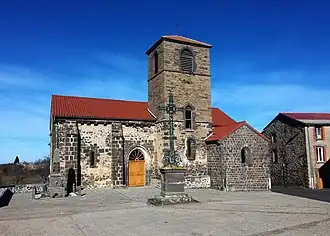
Lubilhac
Lubilhac | |
|---|---|
Commune | |
 | |
Location of Lubilhac | |
 Lubilhac  Lubilhac | |
| Coordinates: 45°15′12″N 3°14′42″E / 45.2533°N 3.245°E | |
| Country | France |
| Region | Auvergne-Rhône-Alpes |
| Department | Haute-Loire |
| Arrondissement | Brioude |
| Canton | Pays de Lafayette |
| Government | |
| • Mayor (2020–2026) | Daniel Cornet[1] |
Area 1 | 24.09 km2 (9.30 sq mi) |
| Population (2022)[2] | 102 |
| • Density | 4.2/km2 (11/sq mi) |
| Time zone | UTC+01:00 (CET) |
| • Summer (DST) | UTC+02:00 (CEST) |
| INSEE/Postal code | 43125 /43100 |
| Elevation | 565–996 m (1,854–3,268 ft) (avg. 825 m or 2,707 ft) |
| 1 French Land Register data, which excludes lakes, ponds, glaciers > 1 km2 (0.386 sq mi or 247 acres) and river estuaries. | |
Lubilhac (French pronunciation: [lybijak]) is a commune in the Haute-Loire department in south-central France.
Population
| Year | Pop. | ±% p.a. |
|---|---|---|
| 1968 | 263 | — |
| 1975 | 219 | −2.58% |
| 1982 | 183 | −2.53% |
| 1990 | 165 | −1.29% |
| 1999 | 133 | −2.37% |
| 2009 | 109 | −1.97% |
| 2014 | 100 | −1.71% |
| 2020 | 88 | −2.11% |
| Source: INSEE[3] | ||
See also
References
- ^ "Répertoire national des élus: les maires". data.gouv.fr, Plateforme ouverte des données publiques françaises (in French). 9 August 2021.
- ^ "Populations de référence 2022" (in French). The National Institute of Statistics and Economic Studies. 19 December 2024.
- ^ Population en historique depuis 1968, INSEE
Wikimedia Commons has media related to Lubilhac.