Lot 28, Prince Edward Island
Lot 28, Prince Edward Island | |
|---|---|
Township | |
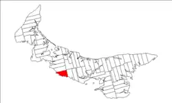 Map of Prince Edward Island highlighting Lot 28 | |
| Coordinates: 46°15′N 63°35′W / 46.250°N 63.583°W | |
| Country | Canada |
| Province | Prince Edward Island |
| County | Prince County |
| Parish | St. David's Parish. |
| Area | |
• Total | 78.80 km2 (30.42 sq mi) |
| Population (2006) | |
• Total | 813 |
| • Density | 10.3/km2 (27/sq mi) |
| Time zone | UTC-4 (AST) |
| • Summer (DST) | UTC-3 (ADT) |
| Canadian Postal code | C0A |
| Area code | 902 |
| NTS Map | 011L05 |
| GNBC Code | BAERO |
Lot 28 is a township in Prince County, Prince Edward Island, Canada. It is part of St. David's Parish. Lot 28 was awarded to Samuel Holland in the 1767 land lottery.[1]
Communities
Incorporated municipalities:
Civic address communities:
- Albany
- Augustine Cove
- Borden-Carleton
- Cape Traverse
- Crapaud
- Lady Fane
- Maple Plains
- Mount Tryon
- North Tryon
- Tryon
- Victoria
Demographics
| Year | Pop. | ±% |
|---|---|---|
| 1871 | 1,570 | — |
| 1881 | 1,692 | +7.8% |
| 1891 | 1,578 | −6.7% |
| 1901 | 1,620 | +2.7% |
| 1911 | 1,473 | −9.1% |
| 1921 | 1,471 | −0.1% |
| 1931 | 1,459 | −0.8% |
| 1941 | 1,361 | −6.7% |
| 2006 | 813 | −40.3% |
| [2] | ||
References
- ^ Clark, Andrew Hill (1959). Three Centuries and the Island. Toronto Press. pp. Appendix B.
- ^ Dominion Bureau of Statistics (1944). Cudmore, S. A. (ed.). Eighth Census of Canada 1941 (Report). Vol. II: Population by Local Subdivisions. Edmond Cloutier, Printer to the King's Most Excellent Majesty. p. 55.
Subdivisions of Prince Edward Island | |||||||
|---|---|---|---|---|---|---|---|
| Subdivisions | |||||||
| Cities | |||||||
| Towns | |||||||
| Rural municipalities |
| ||||||
| Resort municipalities | |||||||
| Former municipalities |
| ||||||
| Unincorporated communities | |||||||
| Townships | |||||||
| |||||||