| Name |
Waterway |
Location |
Coordinates |
Image |
Focal
Height |
Built[note 1] |
Automated |
Deactivated |
Status
|
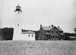
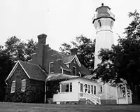
| Alpena Light |
Lake Huron |
Alpena |
45°03′38″N 83°25′22″W / 45.06042°N 83.4229°W / 45.06042; -83.4229 (Alpena Light) |
 |
044 44 ft (13 m) |
1877/1914 |
1974 |
|
Active
|
| Au Sable Light |
Lake Superior |
Burt Township, Alger County |
46°40′23″N 86°08′22″W / 46.67306°N 86.13933°W / 46.67306; -86.13933 (Au Sable Light) |
 |
100 100 ft (30 m) |
1874 |
1958 |
|
Active
|
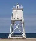
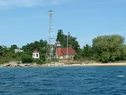
| Au Sable North Pierhead Light |
Lake Huron |
Au Sable |
44°24′24″N 83°18′59″W / 44.40662°N 83.3165°W / 44.40662; -83.3165 (Au Sable North Pierhead Light) |
|
025 25 ft (7.6 m) |
|
|
|
Active
|
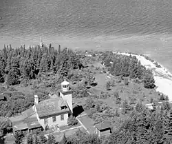
| Beaver Island Harbor Light |
Lake Michigan |
Beaver Island, northern end |
45°44′34″N 85°30′31″W / 45.74278°N 85.50861°W / 45.74278; -85.50861 (Beaver Island Harbor Light) |
 |
038 38 ft (12 m) |
1856/1870 |
1927 |
|
Active[note 2]
|
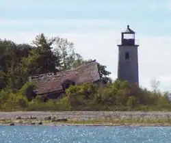
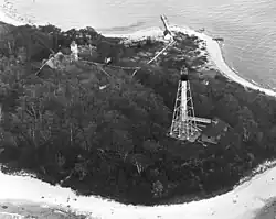
| Beaver Island Head Light |
Lake Michigan |
Beaver Island, southern tip |
45°34′35″N 85°34′21″W / 45.57639°N 85.5725°W / 45.57639; -85.5725 (Beaver Island Head Light) |
 |
103 103 ft (31 m) |
1851 |
|
1962 |
Inactive[note 3]
|
| Belle Isle Light |
Detroit River |
Belle Isle |
|
 |
000 |
|
|
|
Destroyed
|
| Big Bay Point Light |
Lake Superior |
Big Bay |
46°50′25″N 87°40′55″W / 46.84028°N 87.68194°W / 46.84028; -87.68194 (Big Bay Point Light) |
 |
089 89 ft (27 m) |
1896 |
1941 |
1961–1990 |
Active[note 4]
|
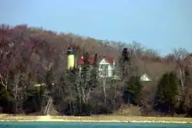
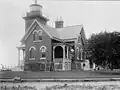
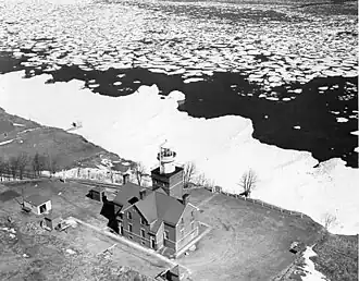
| Big Sable Point Light |
Lake Michigan |
Ludington |
44°03′28″N 86°30′52″W / 44.05772°N 86.51444°W / 44.05772; -86.51444 (Big Sable Point Light) |
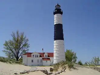 |
106 106 ft (32 m) |
1867 |
|
|
Active
|
| Bois Blanc Light |
Lake Huron |
Bois Blanc Island |
45°48′40″N 84°25′19″W / 45.811°N 84.422°W / 45.811; -84.422 (Bois Blanc Light) |
 |
032 32 ft (9.8 m) |
1867 |
|
1955 |
Inactive[note 4]
|
| Caseville Harbor Light |
Lake Huron |
Caseville |
43°56′36″N 83°16′22″W / 43.94347°N 83.27278°W / 43.94347; -83.27278 (Caseville Harbor Light) |
|
065 65 ft (20 m) |
|
|
|
Active
|
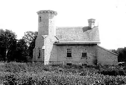
| Cedar River Light |
Lake Michigan |
Cedar River |
45°24′26″N 87°21′04″W / 45.40735°N 87.35103°W / 45.40735; -87.35103 (Cedar River Light) |
|
026 26 ft (7.9 m) |
|
|
|
Active
|
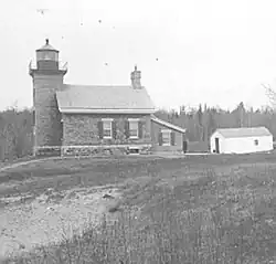
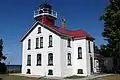
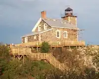
| Charity Island Light |
Lake Huron |
Charity Island |
44°01′53″N 83°26′08″W / 44.03139°N 83.43556°W / 44.03139; -83.43556 (Charity Island Light) |
 |
045 45 ft (14 m) |
1857 |
|
1939 |
Inactive[note 4]
|
| Charlevoix South Pier Light Station |
Lake Michigan |
Charlevoix |
45°19′22″N 85°16′11″W / 45.32278°N 85.26972°W / 45.32278; -85.26972 (Charlevoix South Pier Light Station) |
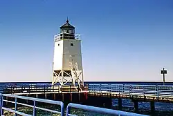 |
041 41 ft (12 m) |
1914/1948 |
|
|
Active
|
| Cheboygan Crib Light |
Lake Huron |
Cheboygan |
45°39′24″N 84°27′54″W / 45.6568°N 84.465°W / 45.6568; -84.465 (Cheboygan Crib Light) |
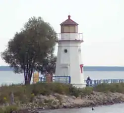 |
035 35 ft (11 m) |
1857/1901 |
1920 |
1984 |
Inactive/Moved[note 5]
|
| Cheboygan River Front Range Light |
Lake Huron |
Cheboygan |
45°38′51″N 84°28′22″W / 45.64739°N 84.47276°W / 45.64739; -84.47276 (Cheboygan River Front Range Light) |
|
048 48 ft (15 m) |
1880 |
|
|
Active
|
| Clinton River Light |
Lake St. Clair |
Mount Clemens |
|
|
000 |
1847 |
1872 |
|
Destroyed[3]
|
| Copper Harbor Front Range Light |
Lake Superior |
Copper Harbor |
47°28′52″N 87°52′00″W / 47.48111°N 87.86667°W / 47.48111; -87.86667 (Copper Harbor Front Range Light) |
|
028 28 ft (8.5 m) |
1869 |
|
|
Active
|
| Copper Harbor Light |
Lake Superior |
Copper Harbor |
47°28′28″N 87°51′37″W / 47.47447°N 87.86025°W / 47.47447; -87.86025 (Copper Harbor Light) |
 |
090 90 ft (27 m) |
1849/1933 |
1919 |
|
Active
|
| Crisp Point Light |
Lake Superior |
McMillan Township, Luce County |
46°45′10″N 85°15′26″W / 46.75288°N 85.25733°W / 46.75288; -85.25733 (Crisp Point Light) |
 |
062 62 ft (19 m) |
1904 |
|
1947 |
Inactive/Museum
|
| DeTour Reef Light |
Lake Huron |
De Tour Village |
45°56′56″N 83°54′11″W / 45.94892°N 83.90305°W / 45.94892; -83.90305 (DeTour Reef Light) |
 |
074 74 ft (23 m) |
1847/1931 |
1974 |
|
Active
|
| Detroit River Light |
Lake Erie |
Rockwood |
42°00′03″N 83°08′26″W / 42.00075°N 83.14068°W / 42.00075; -83.14068 (Detroit River Light) |
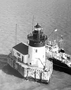 |
055 55 ft (17 m) |
1875/1885 |
1979 |
|
Active
|
| Eagle Harbor Light |
Lake Superior |
Eagle Harbor |
47°27′35″N 88°09′33″W / 47.45972°N 88.15917°W / 47.45972; -88.15917 (Eagle Harbor Light) |
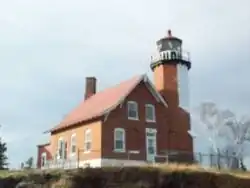 |
060 60 ft (18 m) |
1851/1871 |
1980 |
|
Active
|
| Eagle Harbor Range Lights |
Lake Superior |
Eagle Harbor |
47°27′20″N 88°09′12″W / 47.45562°N 88.15339°W / 47.45562; -88.15339 (Eagle Harbor Range Lights) |
|
000 |
1877 |
|
1911 |
Inactive[note 6][4]
|
| Eagle River Light |
Lake Superior |
Eagle River |
47°24′49″N 88°17′54″W / 47.41369°N 88.29828°W / 47.41369; -88.29828 (Eagle River Light) |
 |
000 |
1854/1857 |
|
1908 |
Inactive[note 4]
|
| Ecorse Light |
Detroit River |
Ecorse |
|
|
032 32 ft (9.8 m) |
1895 |
|
|
Destroyed[5]
|
| Ecorse Range Rear Light |
Detroit River |
Ecorse |
|
|
045 45 ft (14 m) |
1894 |
|
|
Destroyed[6]
|
| Fort Gratiot Light |
Lake Huron |
Port Huron |
43°00′23″N 82°25′21″W / 43.0063°N 82.42247°W / 43.0063; -82.42247 (Fort Gratiot Light) |
 |
082 82 ft (25 m) |
1825/1829 |
1933 |
|
Active
|
| Forty Mile Point Light |
Lake Huron |
Rogers Township, Presque Isle County |
45°29′12″N 83°54′48″W / 45.48667°N 83.91333°W / 45.48667; -83.91333 (Forty Mile Point Light) |
 |
066 66 ft (20 m) |
1897 |
1969 |
|
Active
|
| Fourteen Foot Shoal Light |
Lake Huron |
Cheboygan County |
45°40′47″N 84°26′06″W / 45.67981°N 84.435°W / 45.67981; -84.435 (Fourteen Foot Shoal Light) |
 |
051 51 ft (16 m) |
1930 |
Yes |
|
Active
|
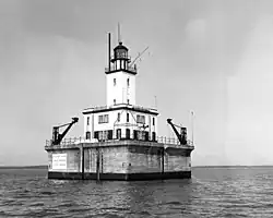
| Fourteen Mile Point Light |
Lake Superior |
Ontonagon |
46°59′34″N 89°07′33″W / 46.99285°N 89.12573°W / 46.99285; -89.12573 (Fourteen Mile Point Light) |
|
000 |
1894 |
|
1934 |
Inactive[note 4]
|
| Frankfort Light |
Lake Michigan |
Frankfort |
44°37′50″N 86°15′08″W / 44.6306°N 86.2522°W / 44.6306; -86.2522 (Frankfort Light) |
 |
072 72 ft (22 m) |
1873/1932 |
Yes |
|
Active
|
| Frankfort South Range Light |
Lake Michigan |
Frankfort |
|
|
000 |
|
|
|
Destroyed
|
| Frying Pan Island Light |
St. Marys River |
De Tour Village |
45°59′08″N 83°53′41″W / 45.98545°N 83.89471°W / 45.98545; -83.89471 (Frying Pan Island Light) |
|
000 |
1879/1882 |
|
|
Active[note 7]
|
| Gibraltar Light |
Detroit River |
Gibraltar |
|
|
000 |
1838/1873 |
|
1879 |
Destroyed[7]
|
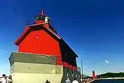
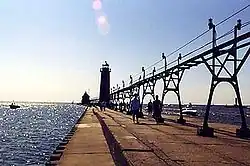
| Grand Haven North Pierhead Light |
Lake Michigan |
Grand Haven |
43°03′29″N 86°15′21″W / 43.05817°N 86.25589°W / 43.05817; -86.25589 (Grand Haven North Pierhead Light) |
|
036 36 ft (11 m) |
|
|
|
Active
|
| Grand Haven South Pierhead Entrance Light |
Lake Michigan |
Grand Haven |
43°03′25″N 86°15′21″W / 43.05694°N 86.25592°W / 43.05694; -86.25592 (Grand Haven South Pierhead Entrance Light) |
 |
042 42 ft (13 m) |
1839/1905 |
1969 |
|
Active
|
| Grand Haven South Pierhead Inner Light |
Lake Michigan |
Grand Haven |
43°03′26″N 86°15′14″W / 43.05725°N 86.25381°W / 43.05725; -86.25381 (Grand Haven South Pierhead Inner Light) |
 |
052 52 ft (16 m) |
1839/1905 |
1969 |
|
Active
|
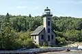
| Grand Island East Channel Light |
Lake Superior |
Munising |
46°27′01″N 86°37′21″W / 46.45017°N 86.62242°W / 46.45017; -86.62242 (Grand Island East Channel Light) |
 |
000 |
1870 |
|
1913 |
Inactive
|
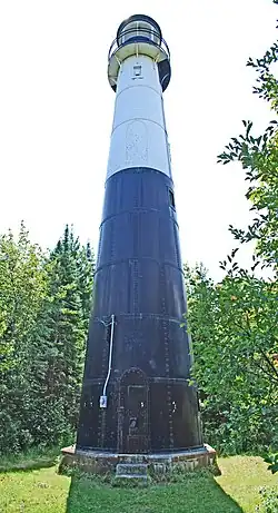
| Grand Island Harbor Rear Range Light |
Lake Superior |
Christmas |
46°26′12″N 86°41′28″W / 46.43667°N 86.69111°W / 46.43667; -86.69111 (Grand Island Harbor Rear Range Light) |
 |
070 70 ft (21 m) |
1868/1914 |
|
1969 |
Inactive
|
| Grand Island North Light |
Lake Superior |
Grand Island |
46°33′32″N 86°41′28″W / 46.55889°N 86.69111°W / 46.55889; -86.69111 (Grand Island North Light) |
 |
000 |
1854/1867 |
1927 |
1961 |
Inactive[note 4]
|
| Grand Marais Range Lights |
Lake Superior |
Grand Marais |
46°41′02″N 85°58′20″W / 46.68389°N 85.97222°W / 46.68389; -85.97222 (Grand Marais Range Lights) |
 |
054 54 ft (16 m) (inner)
40 ft (12 m) (outer) |
1895 |
|
|
Active
|
| Grand Traverse Light |
Lake Michigan |
Leelanau Peninsula |
45°13′N 85°33′W / 45.21°N 85.55°W / 45.21; -85.55 (Grand Traverse Light) |
 |
047 47 ft (14 m) |
1852/1858 |
1972 |
1972 |
Inactive/Museum
|
| Granite Island Light |
Lake Superior |
Granite Island |
46°43′15″N 87°24′43″W / 46.72083°N 87.41194°W / 46.72083; -87.41194 (Granite Island Light) |
 |
096 96 ft (29 m) |
1868 |
1939 |
|
Active[note 8]
|
| Grassy Island North Channel Range Lights |
Detroit River |
Grassy Island |
|
|
000 |
1897 |
|
|
Destroyed
|
Grassy Island South Channel Range Lights
(formerly Grassy Island Light) |
Detroit River |
Grassy Island |
|
|
000 |
1849/1896 |
|
|
Destroyed
|
| Gravelly Shoal Light |
Lake Huron |
Saginaw Bay |
44°01′06″N 83°32′14″W / 44.01833°N 83.53722°W / 44.01833; -83.53722 (Gravelly Shoal Light) |
 |
075 75 ft (23 m) |
1939 |
|
|
Active
|
| Grays Reef Light |
Lake Michigan |
Bliss Township, Emmet County |
45°46′00″N 85°09′12″W / 45.76667°N 85.15333°W / 45.76667; -85.15333 (Grays Reef Light) |
 |
082 82 ft (25 m) |
1891/1936 |
1976 |
|
Active
|
| Grosse Ile North Channel Range Lights |
Detroit River |
Grosse Ile |
|
 |
000 |
1894/1906 |
|
1963 |
Destroyed (rear)
Inactive (front)[note 4]
|
| Grosse Ile South Channel Range Lights |
Detroit River |
Grosse Ile |
|
|
000 |
|
|
|
Active[note 9]
|
| Gull Rock Light |
Lake Superior |
Manitou Island, offshore west |
47°25′02″N 87°39′49″W / 47.41722°N 87.66361°W / 47.41722; -87.66361 (Gull Rock Light) |
 |
050 50 ft (15 m) |
1867 |
1913 |
|
Active
|
| Harbor Beach Light |
Lake Huron |
Harbor Beach, Michigan |
43°50′42″N 82°37′54″W / 43.845°N 82.63167°W / 43.845; -82.63167 (Harbor Beach Light) |
 |
054 54 ft (16 m) |
1858/1885 |
1968 |
|
Active[note 10]
|
| Harwood Point East Range Front Light |
St. Marys River |
Sugar Island |
|
|
000 |
|
|
|
Destroyed
|
| Holland Harbor Light |
Lake Michigan |
Holland |
42°46′22″N 86°12′45″W / 42.77269°N 86.21242°W / 42.77269; -86.21242 (Holland Harbor Light) |
 |
052 52 ft (16 m) |
1872/1936 |
1932 |
|
Active
|
| Huron Island Light |
Lake Superior |
Powell Township, Marquette County |
46°57′48″N 87°59′54″W / 46.96333°N 87.99833°W / 46.96333; -87.99833 (Huron Island Light) |
.jpg) |
197 197 ft (60 m) |
1868/1877 |
1972 |
|
Active
|
| Ile Aux Galets Light |
Lake Michigan |
Emmet County |
45°40′35″N 85°10′23″W / 45.67639°N 85.17306°W / 45.67639; -85.17306 (Ile Aux Galets Light) |
 |
058 58 ft (18 m) |
1850/1888 |
1969 |
|
Active
|
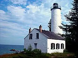
| Isle Royale Light |
Lake Superior |
Isle Royale |
47°56′52″N 88°45′40″W / 47.9479°N 88.7612°W / 47.9479; -88.7612 (Isle Royale Light) |
 |
072 72 ft (22 m) |
1875 |
1913 |
|
Active
|
Kalamazoo River Light
(Saugatuck Light) |
Lake Michigan |
Saugatuck |
|
|
000 |
1858 |
|
1914 |
Destroyed
|
| Keweenaw Waterway Lower Entrance Light |
Lake Superior |
Jacobsville |
46°58′08″N 88°25′52″W / 46.96879°N 88.4311°W / 46.96879; -88.4311 (Keweenaw Waterway Lower Entrance Light) |
|
068 68 ft (21 m) |
1868/1920 |
1973 |
|
Active
|
| Keweenaw Waterway Upper Entrance Light |
Lake Superior |
Stanton Township, Houghton County |
47°14′04″N 88°37′49″W / 47.23454°N 88.63029°W / 47.23454; -88.63029 (Keweenaw Waterway Upper Entrance Light) |
 |
082 82 ft (25 m) |
1874/1950 |
1973 |
|
Active
|
| Lake St. Clair Light |
Lake St. Clair |
Harsens Island |
42°30′31″N 82°41′54″W / 42.50854°N 82.69846°W / 42.50854; -82.69846 (Lake St. Clair Light) |
|
043 43 ft (13 m) |
1941 |
Yes |
|
Active
|
| Lansing Shoals Light |
Lake Michigan |
Newton Township, Mackinac County |
45°54′12″N 85°33′42″W / 45.90333°N 85.56167°W / 45.90333; -85.56167 (Lansing Shoals Light) |
 |
069 69 ft (21 m) |
1900/1928 |
1976 |
|
Active
|
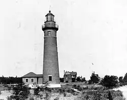
| Little Sable Point Light |
Lake Michigan |
Golden Township, Oceana County |
43°39′06″N 86°32′20″W / 43.65167°N 86.53889°W / 43.65167; -86.53889 (Little Sable Point Light) |
 |
108 108 ft (33 m) |
1874 |
1955 |
|
Active
|
| Little Traverse Light |
Lake Michigan |
Harbor Springs |
45°25′09″N 84°58′39″W / 45.41919°N 84.97741°W / 45.41919; -84.97741 (Little Traverse Point Light) |
 |
072 72 ft (22 m) |
1884/1963 |
|
|
Active[note 11]
|
| Ludington Light |
Lake Michigan |
Ludington |
43°57′13″N 86°28′10″W / 43.95361°N 86.46937°W / 43.95361; -86.46937 (Ludington Point Light) |
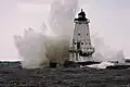 |
055 55 ft (17 m) |
1871/1924 |
1972 |
|
Active
|
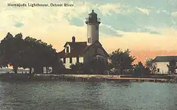
| Mama Juda Light |
Detroit River |
Mamajuda Island |
|
 |
000 |
|
|
|
Destroyed
|
| Mama Juda Range Front Light |
Detroit River |
Mamajuda Island |
|
|
000 |
|
|
|
Destroyed
|
| Manistee Main Light |
Lake Michigan |
Manistee |
|
|
000 |
|
|
|
Destroyed
|
| Manistee Pierhead lights |
Lake Michigan |
Manistee |
44°15′06″N 86°20′47″W / 44.2517°N 86.3464°W / 44.2517; -86.3464 (Manistee Pierhead lights) |
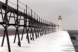 |
055 55 ft (17 m) (north)
29 ft (8.8 m) (south) |
1875/1927 |
1927 |
|
Active
|
| Manistique East Breakwater Light |
Lake Michigan |
Manistique |
45°56′41″N 86°14′52″W / 45.94478°N 86.24765°W / 45.94478; -86.24765 (Manistique East Breakwater Light) |
 |
050 50 ft (15 m) |
1915/1917 |
1969 |
|
Active
|
| Manitou Island Light |
Lake Superior |
Manitou Island |
47°25′11″N 87°35′14″W / 47.41972°N 87.58722°W / 47.41972; -87.58722 (Manitou Island Light) |
 |
081 81 ft (25 m) |
1850/1861 |
1978 |
|
Active
|
| Manning Memorial Light |
Lake Michigan |
Empire |
44°48′29″N 86°15′19″W / 44.80793°N 86.25521°W / 44.80793; -86.25521 (Manning Memorial Light) |
 |
038 38 ft (12 m) |
1990 |
Yes |
|
Active
|
| Mariners Memorial (River Rouge) Light |
Detroit River |
River Rouge |
42°16′16″N 83°06′41″W / 42.27101°N 83.11128°W / 42.27101; -83.11128 (Mariners Memorial (River Rouge) Light) |
.jpg) |
000 |
2003[8] |
|
|
Active[note 12]
|
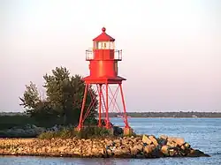
| Marquette Breakwater Outer Light |
Lake Superior |
Marquette |
46°32′02″N 87°22′29″W / 46.5338°N 87.37473°W / 46.5338; -87.37473 (Marquette Breakwater Outer Light) |
|
036 36 ft (11 m) |
1875/1908 |
|
|
Active
|
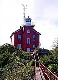
| Marquette Harbor Light |
Lake Superior |
Marquette |
46°32′48″N 87°22′34″W / 46.54669°N 87.37604°W / 46.54669; -87.37604 (Marquette Harbor Light) |
 |
077 77 ft (23 m) |
1853/1866 |
|
|
Active
|
| Martin Reef Light |
Lake Huron |
Clark Township, Mackinac County |
45°54′48″N 84°08′54″W / 45.91333°N 84.14833°W / 45.91333; -84.14833 (Martin Reef Light) |
.jpg) |
065 65 ft (20 m) |
1927 |
Yes |
|
Active
|
| McGulpin Point Light |
Straits of Mackinac |
Wawatam Township, Emmet County |
45°47′13″N 84°46′20″W / 45.7869°N 84.7722°W / 45.7869; -84.7722 (McGulpin Point Light) |
 |
102 102 ft (31 m) |
1869 |
|
|
Active
|
| Mendota (Bete Grise) Light |
Lake Superior |
Delaware |
47°22′27″N 87°58′00″W / 47.37417°N 87.96667°W / 47.37417; -87.96667 (Mendota (Bete Grise) Light) |
 |
044 44 ft (13 m) |
1870/1895 |
1933 |
1960–1998 |
Active[note 4]
|
| Menominee Pier Light |
Lake Michigan |
Menominee |
45°06′50″N 87°35′10″W / 45.11392°N 87.58603°W / 45.11392; -87.58603 (Menominee Pier Light) |
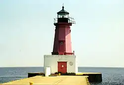 |
046 46 ft (14 m) |
1887/1927 |
1972 |
|
Active
|
| Middle Island Light |
Lake Huron |
Alpena Township, Alpena County |
45°11′35″N 83°19′16″W / 45.19306°N 83.32111°W / 45.19306; -83.32111 (Middle Island Light) |
 |
078 78 ft (24 m) |
1905 |
Yes |
|
Active
|
| Middle Lake George Light |
St. Marys River |
Sugar Island |
|
|
000 |
|
|
|
Destroyed
|
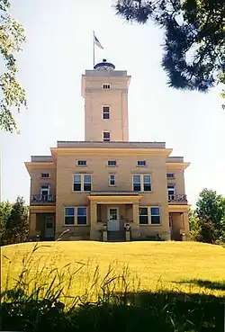
| Miller Memorial Light |
Lake St. Clair |
St. Clair Shores |
42°27′50″N 82°52′45″W / 42.46375°N 82.87917°W / 42.46375; -82.87917 (Miller Memorial Light) |
|
270 270 ft (82 m) |
|
|
|
Active
|
| Minneapolis Shoal Light |
Lake Huron |
Big Bay de Noc |
45°32′10″N 86°59′54″W / 45.53611°N 86.99833°W / 45.53611; -86.99833 (Minneapolis Shoal Light) |
 |
082 82 ft (25 m) |
1935 |
1979 |
|
Active
|
| Mission Point Light |
Lake Michigan |
Old Mission Point |
44°59′29″N 85°28′46″W / 44.99131°N 85.47947°W / 44.99131; -85.47947 (Mission Point Light) |
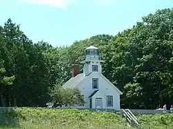 |
047 47 ft (14 m) |
1870 |
|
1933 |
Inactive
|
| Mission Point Light (1933) |
Lake Michigan |
Old Mission Point |
45°01′06″N 85°30′22″W / 45.01823°N 85.50603°W / 45.01823; -85.50603 (Mission Point Light (1933)) |
|
041 41 ft (12 m) |
1933 |
|
|
Inactive
|
| Monroe Pier Light |
Lake Erie |
Monroe |
|
|
000 |
1849/1884 |
|
1916 |
Destroyed
|
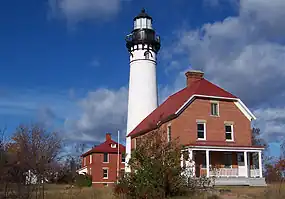
| Munising Front Range Light |
Lake Superior |
Munising |
46°24′54″N 86°39′40″W / 46.41512°N 86.66115°W / 46.41512; -86.66115 (Munising Front Range Light) |
 |
079 79 ft (24 m) |
1908 |
Yes |
|
Active
|
| Munising Rear Range Light |
Lake Superior |
Munising |
46°24′45″N 86°39′50″W / 46.41254°N 86.66396°W / 46.41254; -86.66396 (Munising Rear Range Light) |
 |
107 107 ft (33 m) |
1908 |
Yes |
|
Active
|
| Muskegon Breakwater Light |
Lake Michigan |
Muskegon |
45°11′27″N 83°20′49″W / 45.19075°N 83.34689°W / 45.19075; -83.34689 (Muskegon Breakwater Light) |
 |
070 70 ft (21 m) |
1851/1871 |
|
|
Active
|
| Muskegon Pier Light |
Lake Michigan |
Muskegon |
43°13′36″N 86°20′29″W / 43.22665°N 86.34126°W / 43.22665; -86.34126 (Muskegon Pier Light) |
 |
050 50 ft (15 m) |
1903 |
|
|
Active
|
| Naubinway Island Light |
Lake Michigan |
Naubinway |
46°04′32″N 85°26′42″W / 46.0756°N 85.44497°W / 46.0756; -85.44497 (Naubinway Island Light) |
|
032 32 ft (9.8 m) |
|
|
|
Active
|
| New Buffalo Light |
Lake Michigan |
New Buffalo |
|
|
000 |
|
|
|
Destroyed
|
| North Manitou Island Light |
Lake Michigan |
North Manitou Island |
45°03′47″N 85°57′50″W / 45.063°N 85.964°W / 45.063; -85.964 (North Manitou Island Light) |
|
000 |
1899 |
|
1935 |
Destroyed
|
| North Manitou Shoal Light Station |
Lake Michigan |
North Manitou Island |
45°01′16″N 85°57′26″W / 45.021°N 85.95713°W / 45.021; -85.95713 (North Manitou Shoal Light) |
|
079 79 ft (24 m) |
1935 |
1980 |
|
Active
|
| Old Mackinac Point Light |
Straits of Mackinac |
Mackinaw City |
45°47′15″N 84°43′46″W / 45.7875°N 84.72944°W / 45.7875; -84.72944 (Old Mackinac Point Light) |
 |
062 62 ft (19 m) |
1889/1892 |
|
1957 |
Inactive
|
| Ontonagon Harbor West Breakwater Light |
Lake Superior |
Ontonagon |
46°52′46″N 89°19′51″W / 46.87947°N 89.33084°W / 46.87947; -89.33084 (Ontonagon Harbor West Breakwater Light) |
|
031 31 ft (9.4 m) |
|
|
|
Active
|
| Ontonagon Light |
Lake Superior |
Ontonagon |
46°52′25″N 89°19′07″W / 46.87361°N 89.31861°W / 46.87361; -89.31861 (Ontonagon Light) |
 |
000 |
1852/1866 |
|
1964 |
Inactive
|
| Passage Island Light |
Lake Superior |
Isle Royale |
48°13′25″N 88°21′56″W / 48.2237°N 88.36558°W / 48.2237; -88.36558 (Passage Island Light) |
 |
078 78 ft (24 m) |
1882 |
1978 |
|
Active
|
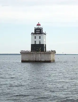
| Peche Island Rear Range Light |
Lake St. Clair |
Peche Island, offshore west |
42°21′13″N 82°55′02″W / 42.3536°N 82.9172°W / 42.3536; -82.9172 (Peche Island Rear Range Light) |
 |
114 114 ft (35 m) |
1908/1983 |
|
|
Active[note 13]
|
| Peninsula Point Light |
Lake Michigan |
Bay de Noc Township, Delta County |
45°40′06″N 86°58′00″W / 45.6682°N 86.9666°W / 45.6682; -86.9666 (Peninsula Point Light) |
 |
040 40 ft (12 m) |
1856/1866 |
1922 |
1936 |
Inactive
|
| Pentwater North Pierhead Light |
Lake Michigan |
Pentwater |
43°46′51″N 86°26′25″W / 43.78083°N 86.44028°W / 43.78083; -86.44028 (Pentwater North Pierhead Light) |
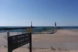 |
043 43 ft (13 m) |
|
|
|
Active
|
| Pipe Island Light |
St. Marys River |
Drummond Township, Chippewa County |
46°00′59″N 83°53′57″W / 46.01633°N 83.8993°W / 46.01633; -83.8993 (Pipe Island Light) |
|
052 52 ft (16 m) |
1888 |
1937 |
|
Active
|
| Poe Reef Light |
Lake Huron |
Bois Blanc Island, offshore |
45°41′42″N 84°21′42″W / 45.695°N 84.36167°W / 45.695; -84.36167 (Poe Reef Light) |
 |
071 71 ft (22 m) |
1893/1929 |
1974 |
|
Active
|
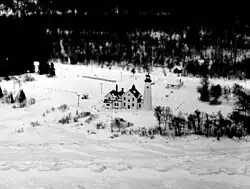
| Point Betsie Light |
Lake Michigan |
Lake Township, Benzie County |
44°41′29″N 86°15′19″W / 44.6913°N 86.2552°W / 44.6913; -86.2552 (Point Betsie Light) |
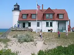 |
052 52 ft (16 m) |
1854 |
1984 |
|
Active
|
| Point Iroquois Light |
Lake Superior |
Bay Mills Township, Chippewa County |
46°29′01″N 84°37′32″W / 46.48368°N 84.62568°W / 46.48368; -84.62568 (Point Iroquois Light) |
 |
072 72 ft (22 m) |
1855/1871 |
1962 |
1971 |
Inactive
|
| Pointe aux Barques Light |
Lake Huron |
Port Hope |
44°01′24″N 82°47′36″W / 44.02333°N 82.79333°W / 44.02333; -82.79333 (Pointe aux Barques Light) |
 |
093 93 ft (28 m) |
1848/1857 |
1958 |
|
Active
|
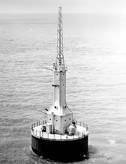
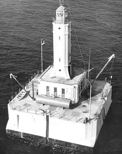
| Port Austin Light |
Lake Huron |
Port Austin, offshore |
44°05′00″N 82°59′00″W / 44.08333°N 82.98333°W / 44.08333; -82.98333 (Port Austin Light) |
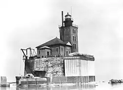 |
076 76 ft (23 m) |
1878/1899 |
Yes |
|
Active
|
| Port Sanilac Light |
Lake Huron |
Port Sanilac |
43°25′44″N 82°32′25″W / 43.42901°N 82.5402°W / 43.42901; -82.5402 (Port Sanilac Light) |
 |
069 69 ft (21 m) |
1886 |
1925 |
|
Active
|
| Portage Lake Light |
Lake Michigan |
Portage Lake |
|
|
000 |
1891 |
|
|
Destroyed
|
| Portage River (Jacobsville) Light |
Lake Superior |
Torch Lake Township, Houghton County |
46°58′41″N 88°24′50″W / 46.97803°N 88.41399°W / 46.97803; -88.41399 (Portage River (Jacobsville) Light) |
|
000 |
1856/1870 |
|
1920 |
Inactive[note 4]
|
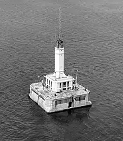
| Poverty Island Light |
Lake Michigan |
Poverty Island |
45°31′38″N 86°39′49″W / 45.52722°N 86.66361°W / 45.52722; -86.66361 (Poverty Island Light) |
 |
078 78 ft (24 m) |
1874 |
1957 |
1976 |
Inactive
|
| Presque Isle Harbor Breakwater Light |
Lake Superior |
Marquette |
46°34′27″N 87°22′28″W / 46.574144°N 87.374577°W / 46.574144; -87.374577 (Presque Isle Harbor Breakwater Light) |
|
|
|
|
|
|
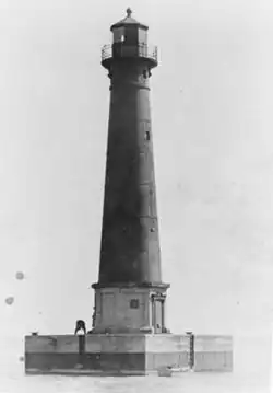
| Presque Isle Light (new) |
Lake Huron |
Presque Isle Township, Presque Isle County |
45°17′14″N 83°28′26″W / 45.28722°N 83.47389°W / 45.28722; -83.47389 (New Presque Isle Light) |
 |
123 123 ft (37 m) |
1871 |
1970 |
|
Active
|
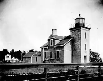
| Presque Isle Light (old) |
Lake Huron |
Presque Isle Township, Presque Isle County |
45°20′31″N 83°28′42″W / 45.34203°N 83.47828°W / 45.34203; -83.47828 (Old Presque Isle Light) |
 |
036 36 ft (11 m) |
1840 |
|
1871 |
Inactive/Museum
|
| Rock Harbor Light |
Lake Superior |
Rock Harbor |
48°05′21″N 88°34′45″W / 48.08917°N 88.57917°W / 48.08917; -88.57917 (Rock Harbor Light) |
 |
000 |
1855 |
|
1879 |
Inactive
|
| Rock of Ages Light |
Lake Superior |
Washington Island, offshore |
47°52′00″N 89°18′48″W / 47.86667°N 89.31333°W / 47.86667; -89.31333 (Rock of Ages Light) |
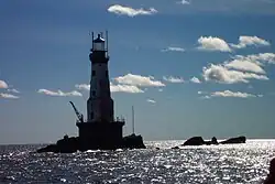 |
130 130 ft (40 m) |
1908 |
1978 |
|
Active
|
| Rouleau Point Range Front and Rear Lights |
Keweenaw Waterway |
Washington Island, offshore |
47°11′44″N 88°36′58″W / 47.19549°N 88.61601°W / 47.19549; -88.61601 (Rouleau Point Range Rear Light) (rear)
47°11′33″N 88°37′08″W / 47.19256°N 88.61885°W / 47.19256; -88.61885 (Rouleau Point Range Front Light) (front) |
|
055 55 ft (17 m) (rear)
26 ft (7.9 m) (front) |
1897/1937 |
Yes |
|
Active
|
| Round Island Light |
Straits of Mackinac |
Round Island |
45°50′14″N 84°37′00″W / 45.83717°N 84.61658°W / 45.83717; -84.61658 (Round Island Light) |
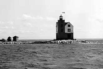 |
053 53 ft (16 m) |
1895 |
1924 |
1947–1996 |
Active
|
| Round Island Light (St. Mary's River) |
St. Marys River |
Round Island |
46°06′32″N 84°01′12″W / 46.10897°N 84.01993°W / 46.10897; -84.01993 (Round Island Light (St. Mary's River)) |
 |
000 |
1892 |
|
|
Inactive[note 4]
|
| Round Island Passage Light |
Straits of Mackinac |
Round Island Channel |
45°50′36″N 84°36′54″W / 45.84333°N 84.615°W / 45.84333; -84.615 (Round Island Passage Light) |
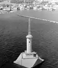 |
071 71 ft (22 m) |
1947 |
1973 |
|
Active
|
| Saginaw Bay Light |
Lake Huron |
Bay City |
|
|
000 |
1831 |
|
1876 |
Destroyed
|
| Saginaw River Rear Range Light |
Lake Huron |
Bay City |
43°38′08″N 83°51′02″W / 43.6355°N 83.85056°W / 43.6355; -83.85056 (Saginaw River Rear Range Light) |
 |
077 77 ft (23 m) |
1876 |
1954 |
1962 |
Inactive[note 4]
|
| Sand Beach North Entrance East Light |
Lake Huron |
|
|
|
000 |
|
|
|
Destroyed
|
| Sand Hills Light |
Lake Superior |
Ahmeek |
47°23′31″N 88°22′14″W / 47.39194°N 88.37042°W / 47.39194; -88.37042 (Sand Hills Light) |
 |
093 93 ft (28 m) |
1919 |
1939 |
1954 |
Inactive[note 4]
|
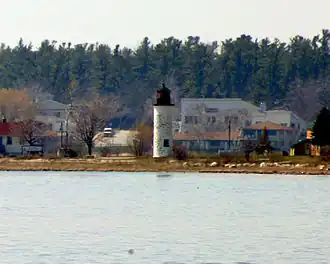
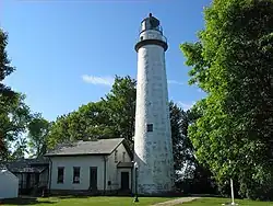
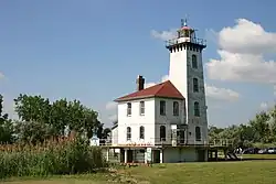
| Sand Point Light |
Lake Michigan |
Escanaba |
45°44′40″N 87°02′40″W / 45.74444°N 87.04444°W / 45.74444; -87.04444 (Sand Point Light) |
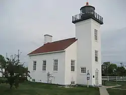 |
044 44 ft (13 m) |
1867 |
|
1934 |
Inactive/Museum
|
| Sand Point Light (Baraga) |
Lake Superior |
Baraga |
46°47′00″N 88°28′01″W / 46.78337°N 88.46685°W / 46.78337; -88.46685 (Sand Point Light (Baraga)) |
|
000 |
1878 |
|
1922 |
Inactive
|
| Seul Choix Light |
Lake Michigan |
Mueller Township, Schoolcraft County |
45°55′17″N 85°54′43″W / 45.92139°N 85.91194°W / 45.92139; -85.91194 (Seul Choix Light) |
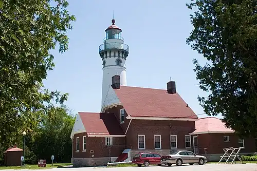 |
080 80 ft (24 m) |
1892 |
1972 |
|
Active
|
| Six Mile Point Range Rear Light |
St. Marys River |
|
|
|
000 |
|
|
|
Inactive/Moved[note 14]
|
| South Fox Island Light |
Lake Michigan |
South Fox Island |
45°22′43″N 85°50′14″W / 45.3785°N 85.8371°W / 45.3785; -85.8371 (South Fox Island Light) |
 |
039 39 ft (12 m) |
1867/1934 |
|
1969 |
Inactive
|
| South Haven Light |
Lake Michigan |
South Haven |
42°24′08″N 86°17′04″W / 42.40222°N 86.28444°W / 42.40222; -86.28444 (South Haven Light) |
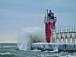 |
037 37 ft (11 m) |
1872/1903 |
Yes |
|
Active
|
| South Manitou Island Light |
Lake Michigan |
South Manitou Island |
45°00′28″N 86°05′38″W / 45.00768°N 86.09378°W / 45.00768; -86.09378 (South Manitou Island Light) |
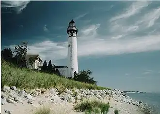 |
054 54 ft (16 m) |
1839/1872 |
1935 |
1967–2009 |
Active
|
| Spectacle Reef Light |
Lake Huron |
Cheboygan County |
45°46′24″N 84°08′12″W / 45.77333°N 84.13667°W / 45.77333; -84.13667 (Spectacle Reef Light) |
 |
086 86 ft (26 m) |
1874 |
1972 |
|
Active
|
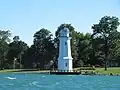
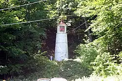
| Squaw Point Light |
Lake Michigan |
|
|
|
000 |
|
|
|
Destroyed
|
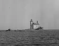
| Squaw Island Light |
Lake Michigan |
Squaw Island |
45°50′24″N 85°35′14″W / 45.8399°N 85.58713°W / 45.8399; -85.58713 (Squaw Island Light) |
 |
000 |
1892 |
|
|
Inactive[note 4]
|
| St. Clair Flats Front and Rear Range Light |
Lake St. Clair |
Harsens Island, offshore |
42°32′15″N 82°41′41″W / 42.5375°N 82.69472°W / 42.5375; -82.69472 (St. Clair Flats Front and Rear Range Light) |
|
000 |
1859 |
|
|
Active[note 15]
|
| St. Helena Island Light |
Straits of Mackinac |
St. Helena Island |
45°51′18″N 84°51′48″W / 45.855°N 84.86333°W / 45.855; -84.86333 (St. Helena Island Light) |
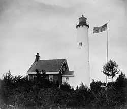 |
071 71 ft (22 m) |
1873 |
1922 |
|
Active
|
| St. Joseph North Pier Inner Light |
Lake Michigan |
St. Joseph |
42°06′58″N 86°29′37″W / 42.1161°N 86.49348°W / 42.1161; -86.49348 (St. Joseph North Pier Inner Light) |
|
053 53 ft (16 m) |
1832/1906 |
|
|
Active
|
| St. Joseph North Pier Outer Light |
Lake Michigan |
St. Joseph |
42°06′59″N 86°29′40″W / 42.11633°N 86.49456°W / 42.11633; -86.49456 (St. Joseph North Pier Outer Light) |
|
031 31 ft (9.4 m) |
1832/1906 |
|
|
Active
|
| St. Martin Island Light |
Lake Michigan |
St. Martin Island |
45°30′10″N 86°45′27″W / 45.50278°N 86.7575°W / 45.50278; -86.7575 (St. Martin Island Light) |
 |
081 81 ft (25 m) |
1905 |
|
|
Inactive
|
| St. Mary's River Lower Range Front Light |
St. Marys River |
|
|
|
000 |
|
|
|
Destroyed
|
| Stannard Rock Light |
Lake Superior |
Keweenaw Peninsula, offshore |
47°11′01″N 87°13′30″W / 47.18351°N 87.22512°W / 47.18351; -87.22512 (Stannard Rock Light) |
 |
102 102 ft (31 m) |
1882 |
1962 |
|
Active
|
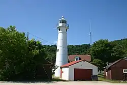
| Sturgeon Point Light |
Lake Huron |
Haynes Township, Michigan, Alcona County |
44°42′46″N 83°16′22″W / 44.71269°N 83.27272°W / 44.71269; -83.27272 (Sturgeon Point Light) |
 |
069 69 ft (21 m) |
1869 |
1939 |
|
Active
|
| Tawas Point Light |
Lake Huron |
Baldwin Township, Iosco County |
44°15′14″N 83°26′56″W / 44.254°N 83.449°W / 44.254; -83.449 (Tawas Point Light) |
 |
070 70 ft (21 m) |
1853/1876 |
|
2016
|
Inactive/Museum
|
| Thunder Bay Island Light |
Lake Huron |
Alpena County |
45°02′30″N 83°12′00″W / 45.04167°N 83.2°W / 45.04167; -83.2 (Thunder Bay Island Light) |
 |
063 63 ft (19 m) |
1832 |
1983 |
|
Active
|
| Tri-Centennial Light of Detroit |
Detroit River |
Detroit |
42°19′56″N 83°01′30″W / 42.33229°N 83.02509°W / 42.33229; -83.02509 (Tri-Centennial Light of Detroit) |
|
000 |
|
|
|
Active
|
| Vidal Shoals Channel Range Front and Rear Lights |
St. Marys River |
Sault Ste. Marie |
46°30′16″N 84°21′49″W / 46.5045°N 84.36374°W / 46.5045; -84.36374 (Vidal Shoals Channel Range Rear Light) (rear)
46°30′14″N 84°22′02″W / 46.50392°N 84.36715°W / 46.50392; -84.36715 (Vidal Shoals Channel Range Front Light) (front) |
|
066 66 ft (20 m) (rear)
32 ft (9.8 m) (front) |
|
|
|
Active
|
| Wawatam Lighthouse |
Lake Michigan |
Emmet County |
45°51′57″N 84°42′55″W / 45.86583°N 84.71528°W / 45.86583; -84.71528 |
.jpg) |
074 52 ft (16 m) |
2006 |
|
|
Active
|
| Waugoshance Light |
Lake Michigan |
Emmet County |
45°47′10″N 85°05′28″W / 45.78611°N 85.09111°W / 45.78611; -85.09111 (Waugoshance Light) |
 |
074 74 ft (23 m) |
1851 |
|
1912 |
Inactive
|
| White River Light |
Lake Michigan |
Whitehall |
43°22′29″N 86°25′28″W / 43.37473°N 86.42433°W / 43.37473; -86.42433 (White River Light) |
 |
000 |
1875 |
1945 |
1960 |
Inactive/Museum
|
| White Shoal Light |
Lake Michigan |
Emmet County |
45°50′32″N 85°08′07″W / 45.84222°N 85.13528°W / 45.84222; -85.13528 (White Shoal Light) |
 |
125 125 ft (38 m) |
1891/1910 |
1976 |
|
Active
|
| Whitefish Point Light |
Lake Superior |
Whitefish Township, Chippewa County |
46°46′14″N 84°57′24″W / 46.77056°N 84.95667°W / 46.77056; -84.95667 (Whitefish Point Light) |
 |
080 80 ft (24 m) |
1848/1861 |
1970 |
|
Active
|
| William Livingstone Memorial Light |
Detroit River |
Belle Isle |
42°20′49″N 82°57′16″W / 42.34702°N 82.95431°W / 42.34702; -82.95431 (William Livingstone Memorial Light) |
 |
058 58 ft (18 m) |
1930[9] |
|
|
Active
|
| Windmill Point Light |
Detroit River |
Detroit |
42°21′27″N 82°55′48″W / 42.35756°N 82.92996°W / 42.35756; -82.92996 (Windmill Point Light) |
 |
042 42 ft (13 m) |
1933[10] |
|
|
Active
|
| Windmill Point Range Front and Rear Lights |
Detroit River |
Detroit |
|
|
000 |
|
|
|
Destroyed
|
| Winter Point Range Front Light |
St. Marys River |
|
46°13′34″N 84°08′39″W / 46.22608°N 84.14409°W / 46.22608; -84.14409 (Winter Point Range Front Light) |
|
046 46 ft (14 m) |
|
|
|
Active
|