| Name
|
Address
|
Coordinates
|
Government recognition (CRHP №)
|

|
Image
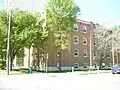
|
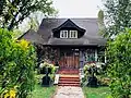
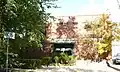
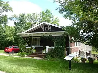
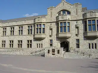
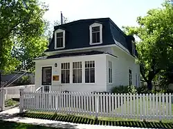
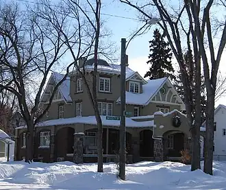
| 1020 Spadina Crescent E
|
1020 Spadina Crescent E
Saskatoon SK
|
52°08′14″N 106°38′48″W / 52.1373°N 106.6468°W / 52.1373; -106.6468 (1020 Spadina Crescent E)
|
Saskatoon municipality (9209)
|
|
|
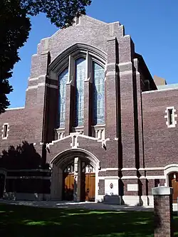
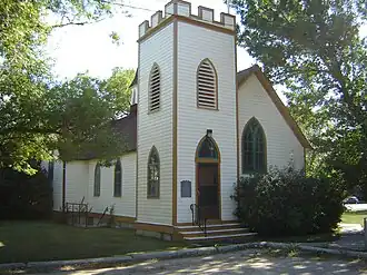
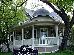
| Knox United Church
|
838 Spadina Crescent E
Saskatoon SK
|
52°07′48″N 106°39′14″W / 52.1301°N 106.6539°W / 52.1301; -106.6539 (Knox United Church)
|
Saskatoon municipality (4990)
|
|
|
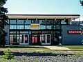
| VIA Rail (Union) Station
|
Chappel Dr. (south-west end of town)
Saskatoon SK
|
52°06′22″N 106°44′28″W / 52.106°N 106.741°W / 52.106; -106.741 (VIA Rail (Union) Station)
|
Federal (4576)
|
Q3097689
|
More images
|
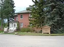
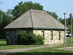
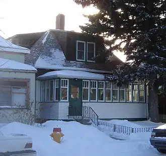
| Forestry Farm Superintendent's Residence
|
1903 Forestry Farm Park Dr.
Saskatoon SK
|
52°07′00″N 106°38′02″W / 52.1167°N 106.634°W / 52.1167; -106.634 (Forestry Farm Superintendent's Residence)
|
Saskatoon municipality (1522)
|
|
|
| Saskatoon Electrical System Substation
|
619 Main Street
Saskatoon SK
|
52°07′02″N 106°39′18″W / 52.1171°N 106.655°W / 52.1171; -106.655 (Saskatoon Electrical System Substation)
|
Saskatoon municipality (4989)
|
Q7425655
|
More images
|
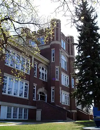
| Albert School
|
1001 11th Street East
Saskatoon SK
|
52°07′08″N 106°38′46″W / 52.119°N 106.646°W / 52.119; -106.646 (1001—11 Street East)
|
Saskatoon municipality (5177)
|
|
|
| Land Titles Building
|
311 - 21st Street East
Saskatoon SK
|
52°07′35″N 106°39′44″W / 52.126509°N 106.662176°W / 52.126509; -106.662176 (Land Titles Building, Saskatoon)
|
Saskatchewan (2217)
|
Q6483988
|

More images
|
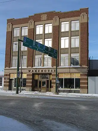
| Fairbanks-Morse Building
|
12 23rd Street East
Saskatoon SK
|
52°07′55″N 106°40′08″W / 52.1319°N 106.669°W / 52.1319; -106.669 (Fairbanks-Morse Building)
|
Saskatoon municipality (4985)
|
Q5430005
|
More images
|
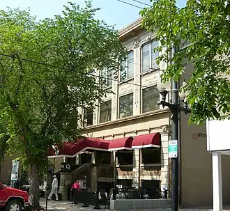
| Hutchinson Building
|
144 2nd Avenue South
Saskatoon SK
|
52°07′40″N 106°39′50″W / 52.1278°N 106.664°W / 52.1278; -106.664 (Hutchinson Building)
|
Saskatoon municipality (4987)
|
Q5950648
|
More images
|
| St. John's Anglican Cathedral
|
816 Spadina Crescent East
Saskatoon SK
|
52°07′47″N 106°39′22″W / 52.1297°N 106.656°W / 52.1297; -106.656 (St. John's Anglican Cathedral)
|
Saskatoon municipality (4992)
|
Q5052401
|
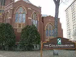
More images
|
| Independent Order of Odd Fellows Temple
|
416 21st Street East
Saskatoon SK
|
52°07′36″N 106°39′36″W / 52.1268°N 106.66°W / 52.1268; -106.66 (416 - 21st Street East)
|
Saskatoon municipality (5176)
|
|
|
| Next of Kin Memorial Avenue National Historic Site of Canada
|
Saskatoon SK
|
52°08′50″N 106°39′29″W / 52.1471°N 106.658°W / 52.1471; -106.658 (Next of Kin Memorial Avenue National Historic Site of Canada)
|
Federal (13557)
|
Q7021204
|
More images
|
| McLean Block
|
263 3rd Avenue South
Saskatoon SK
|
52°07′33″N 106°39′47″W / 52.1257°N 106.663°W / 52.1257; -106.663 (McLean Block)
|
Saskatoon municipality (13872)
|
|
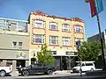
|
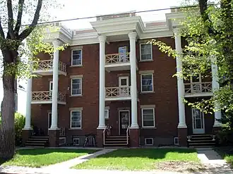
| Cambridge Court
|
129 5th Avenue North
Saskatoon SK
|
52°07′45″N 106°39′32″W / 52.1293°N 106.659°W / 52.1293; -106.659 (Cambridge Court)
|
Saskatoon municipality (13874)
|
|
|
| Larkin House
|
925 5th Avenue North
Saskatoon SK
|
52°08′38″N 106°39′25″W / 52.1439°N 106.657°W / 52.1439; -106.657 (Larkin House)
|
Saskatoon municipality (13875)
|
|
|
| Canadian Pacific Railway Station
|
305 Idylwyld Drive N
Saskatoon SK
|
52°07′56″N 106°40′16″W / 52.1323°N 106.671°W / 52.1323; -106.671 (Canadian Pacific Railway Station)
|
Federal (6502),
Saskatoon municipality (1519)
|
Q5013716
|
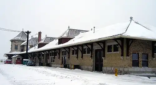
More images
|
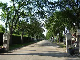
| Pioneer Cemetery or Nutana Cemetery
|
Ruth Street West and St. Henry Avenue
Saskatoon SK
|
52°06′02″N 106°41′02″W / 52.1005°N 106.684°W / 52.1005; -106.684 (Pioneer Cemetery or Nutana Cemetery)
|
Saskatoon municipality (4980)
|
Q7070417
|
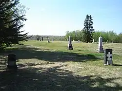
More images
|
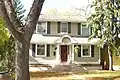
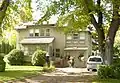
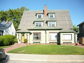
| Bowerman Residence
|
1328 Avenue K South
Saskatoon SK
|
52°06′32″N 106°41′10″W / 52.109°N 106.686°W / 52.109; -106.686 (Bowerman Residence)
|
Saskatoon municipality (9205)
|
Q4950878
|
More images
|
| Landa Residence
|
202 Avenue E South
Saskatoon SK
|
52°07′36″N 106°40′23″W / 52.1268°N 106.673°W / 52.1268; -106.673 (Landa Residence)
|
Saskatoon municipality (9206)
|
Q6484293
|

Upload Photo
|
| Aden Bowman Residence
|
1018 McPherson Avenue
Saskatoon SK
|
52°07′00″N 106°40′16″W / 52.1167°N 106.671°W / 52.1167; -106.671 (Aden Bowman Residence)
|
Saskatoon municipality (13873)
|
|
|
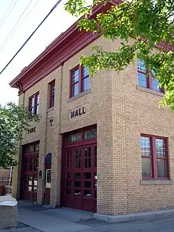
| Former Fire Hall No. 3
|
612 11th Street E
Saskatoon SK
|
52°07′13″N 106°39′11″W / 52.1204°N 106.653°W / 52.1204; -106.653 (Former Fire Hall No. 3)
|
Saskatoon municipality (1520)
|
Q5470088
|
More images
|
| Arrand Block
|
520-524 11th Street E
Saskatoon SK
|
52°07′08″N 106°39′29″W / 52.119°N 106.658°W / 52.119; -106.658 (Arrand Block)
|
Saskatoon municipality (1980)
|
Q4795840
|
More images
|
| College Building
|
University of Saskatchewan campus
Saskatoon SK
|
52°07′48″N 106°37′55″W / 52.13°N 106.632°W / 52.13; -106.632 (College Building, University of Saskatchewan)
|
Federal (6772),
Saskatchewan (3099)
|
Q7175577
|
More images
|
| Old Stone School
|
University of Saskatchewan campus
Saskatoon SK
|
52°07′46″N 106°38′28″W / 52.1295°N 106.6411°W / 52.1295; -106.6411 (Old Stone School)
|
Saskatoon municipality (9207)
|
Q7927025
|
More images
|
| F. P. Martin House
|
718 Saskatchewan Crescent East
Saskatoon SK
|
52°07′23″N 106°39′14″W / 52.1231°N 106.654°W / 52.1231; -106.654 (F.P.Martin House)
|
Saskatoon municipality (4981)
|
|
|
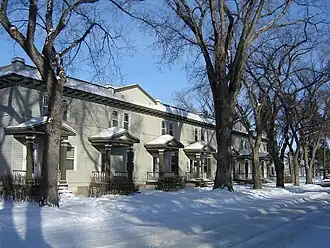
| Thirteenth Street East Row Housing
|
711-723 13th Street E
Saskatoon SK
|
52°07′16″N 106°39′11″W / 52.1211°N 106.653°W / 52.1211; -106.653 (711 – 723 13th Street East)
|
Saskatoon municipality (4984)
|
|
|
| Marr Residence
|
326 11th Street East
Saskatoon SK
|
52°07′06″N 106°39′47″W / 52.1184°N 106.663°W / 52.1184; -106.663 (326 - 11th Street East)
|
Saskatoon municipality (4986)
|
Q3944776
|
More images
|
| The Broadway Theatre
|
715 Broadway Avenue
Saskatoon SK
|
52°07′06″N 106°39′22″W / 52.1184°N 106.656°W / 52.1184; -106.656 (The Broadway Theatre)
|
Saskatoon municipality (4988)
|
Q4972523
|
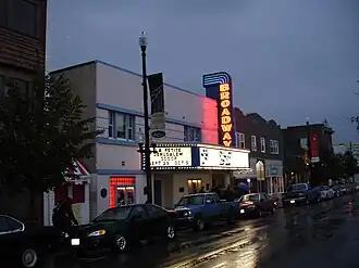
More images
|
| Rugby Chapel
|
1337 College Drive
Saskatoon SK
|
52°07′45″N 106°38′17″W / 52.1293°N 106.638°W / 52.1293; -106.638 (Rugby Chapel)
|
Saskatoon municipality (4994)
|
Q7378158
|
More images
|
| The Trounce House and The Gustin House
|
512 10th Street East
Saskatoon SK
|
52°07′03″N 106°39′32″W / 52.1175°N 106.659°W / 52.1175; -106.659 (The Trounce House and The Gustin House)
|
Saskatoon municipality (6454)
|
Q5621626
|
More images
|
| Sommerville/Petitt House
|
870 University Drive
Saskatoon SK
|
52°07′26″N 106°38′53″W / 52.124°N 106.648°W / 52.124; -106.648 (Sommerville/Petitt House)
|
Saskatoon municipality (9208)
|
Q7560469
|
More images
|
| Bottomley House
|
1118 College Drive
Saskatoon SK
|
52°07′43″N 106°38′35″W / 52.1287°N 106.643°W / 52.1287; -106.643 (Bottomley House)
|
Saskatoon municipality (13871)
|
Q110980657
|
More images
|
| Forestry Farm Park and Zoo National Historic Site of Canada
|
1903 Forestry Farm Park Dr, Saskatoon, SK S7S 1G9
Saskatoon SK
|
52°09′32″N 106°35′06″W / 52.159°N 106.585°W / 52.159; -106.585 (Forestry Farm Park and Zoo National Historic Site of Canada)
|
Federal (7610)
|
Q5469254
|
More images
|
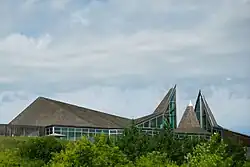
| Wanuskewin National Historic Site of Canada
|
Saskatoon SK
|
52°13′30″N 106°35′02″W / 52.2249°N 106.584°W / 52.2249; -106.584 (Wanuskewin National Historic Site of Canada)
|
Federal (15685)
|
Q3566179
|
More images
|
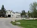
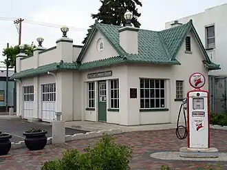
| Little Chief Service Station
|
344 20th Street W.
Saskatoon SK
|
52°07′35″N 106°40′29″W / 52.126380°N 106.674849°W / 52.126380; -106.674849 (Little Chief Service Station)
|
Saskatoon municipality (4983)
|
|
|