| River Miles (km)
|
Name
|
Image
|
From /To
|
County
Coordinates
|
Carries
|
Date
|
Ford
|
Ferry
|
Bridge
|
Notes & refs
|
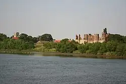
0
(0) |
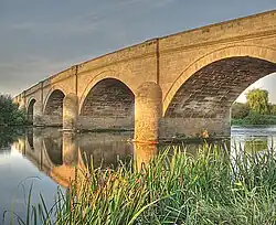
Essex Bridge |
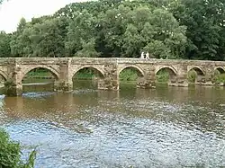 |
Great Haywood
Shugborough Hall |
Staffordshire
52°48′03″N 2°00′31″W / 52.80070°N 2.00860°W / 52.80070; -2.00860 (Essex Bridge) |
Bridleway |
|
Ford |
|
Packhorse |
Grade I Scheduled monument possibly 16th century
|
1
(1.6) |
Shugborough Viaduct |
.jpg) |
Shugborough
Colwich |
Staffordshire
52°47′15″N 2°00′10″W / 52.78758°N 2.00281°W / 52.78758; -2.00281 (Shugborough Viaduct) |
Trent Valley line |
|
|
|
Railway |
[11]
|
1.3
(2.1) |
Weetman's Bridge |
.jpg) |
Little Haywood
Cannock Chase |
Staffordshire
52°47′04″N 1°59′45″W / 52.78449°N 1.99578°W / 52.78449; -1.99578 (Weetman's Bridge) |
Meadow Lane |
1888 |
Ford |
|
Road |
Replaced earlier wooden bridge built in 1830.
|
2.3
(3.7) |
Wolseley Bridge |
 |
Wolseley
Colwich |
Staffordshire
52°46′52″N 1°58′16″W / 52.781046°N 1.971018°W / 52.781046; -1.971018 (Wolseley Bridge) |
A51 |
1799 |
|
|
Road |
Grade II
|
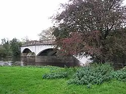
4.1
(6.6) |
Rugeley Bypass bridge (north) |
 |
Rugeley
Rugeley |
Staffordshire
52°46′32″N 1°56′42″W / 52.7755°N 1.9451°W / 52.7755; -1.9451 (Rugeley Bypass bridge (north)) |
A51 |
2007 |
|
|
Road |
Rugeley bypass.[13]
|
4.3
(6.9) |
Brindley Bank Aqueduct |
 |
Rugeley
Rugeley |
Staffordshire
52°46′25″N 1°56′35″W / 52.77350°N 1.94318°W / 52.77350; -1.94318 (Brindley Bank Aqueduct) |
Trent and Mersey Canal |
|
|
|
Canal Aqueduct |
|
5.2
(8.4) |
Rugeley Bypass bridge (east) |
 |
Colton
Rugeley |
Staffordshire
52°46′03″N 1°55′54″W / 52.76760°N 1.93168°W / 52.76760; -1.93168 (Rugeley Bypass bridge (east)) |
A51 |
2007 |
|
|
Road |
Rugeley bypass.[13]
|
5.3
(8.5) |
Colton Mill Bridge |
 |
Colton
Rugeley |
Staffordshire
52°46′04″N 1°55′46″W / 52.767778°N 1.929365°W / 52.767778; -1.929365 (Colton Mill Bridge) |
Colton Rd |
1800s |
|
|
Road |
Grade II bridge.
|
5.8
(9.3) |
Rugeley railway bridge |
 |
Colton
Rugeley |
Staffordshire
52°45′50″N 1°55′32″W / 52.76378°N 1.92556°W / 52.76378; -1.92556 (Rugeley railway bridge) |
Chase Line |
|
|
|
Railway |
|
7.2
(11.6) |
Mavesyn Ridware railway bridge |
 |
Mavesyn Ridware
Armitage |
Staffordshire
52°45′02″N 1°53′36″W / 52.75062°N 1.89326°W / 52.75062; -1.89326 (Mavesyn Ridware railway bridge)
|
Trent Valley line |
|
|
|
Railway |
|
7.7
(12.4) |
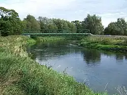
Mavesyn Ridware footbridge |
 |
Mavesyn Ridware
Armitage |
Staffordshire
52°44′48″N 1°53′06″W / 52.74668°N 1.88487°W / 52.74668; -1.88487 (Mavesyn Ridware footbridge) |
Footpath |
1866 |
|
|
Pedestrian |
|
8.5
(13.7) |
High Bridge (new) |
 |
Mavesyn Ridware
Armitage |
Staffordshire
52°44′54″N 1°51′54″W / 52.74824°N 1.86513°W / 52.74824; -1.86513 (High Bridge (new)) |
B5014 |
|
|
|
Road |
Modern span.
|
8.5
(13.7) |
High Bridge |
.jpg) |
Mavesyn Ridware
Handsacre |
Staffordshire
52°44′54″N 1°51′55″W / 52.7484°N 1.86516°W / 52.7484; -1.86516 (High Bridge) |
Footpath |
1830 |
|
|
Pedestrian |
Grade II*, modern span adjacent.
|
9.2
(14.8) |
Nethertown pipe bridge (north) |
 |
Nethertown
Kings Bromley |
Staffordshire
52°45′19″N 1°50′26″W / 52.755402°N 1.840655°W / 52.755402; -1.840655 (Nethertown pipe bridge (north)) |
Pipeline |
|
|
|
Pipe |
[3]
|
9.7
(15.6) |
Nethertown footbridge |
 |
Nethertown
Kings Bromley |
Staffordshire
52°45′14″N 1°50′23″W / 52.75401°N 1.83968°W / 52.75401; -1.83968 (Nethertown footbridge) |
Footpath |
|
|
|
Pedestrian |
|
9.8
(15.8) |
Nethertown pipe bridge (south) |
 |
Nethertown
Kings Bromley |
Staffordshire
52°45′14″N 1°50′21″W / 52.75376°N 1.83908°W / 52.75376; -1.83908 (Nethertown pipe bridge (south)) |
Pipeline |
|
|
|
Pipe |
[3]
|
11.2
(18.0) |
Kings Bromley footbridge |
_-_geograph.org.uk_-_1519560.jpg) |
Kings Bromley |
Staffordshire
52°45′08″N 1°49′21″W / 52.752101°N 1.822489°W / 52.752101; -1.822489 (Kings Bromley footbridge) |
Footpath |
|
|
|
Pedestrian |
[3]
|
12.8
(20.6) |
Yoxall Bridge |
.jpg) |
Yoxall
Kings Bromley |
Staffordshire
52°45′26″N 1°48′26″W / 52.757305°N 1.807311°W / 52.757305; -1.807311 (Yoxall Bridge) |
Minor road |
|
|
|
Road |
Grade II, modern span adjacent.
|
12.8
(20.6) |
Yoxall Bridge (new) |
 |
Yoxall
Kings Bromley |
Staffordshire
52°45′26″N 1°48′25″W / 52.75723°N 1.80703°W / 52.75723; -1.80703 (Yoxall Bridge (new)) |
A515 |
1998 |
|
|
Road |
Modern span.
|
16.8
(27.0) |
Cotton Close mill bridge |
 |
Alrewas |
Staffordshire
52°44′11″N 1°45′10″W / 52.73627°N 1.75285°W / 52.73627; -1.75285 (Cotton Close mill bridge) |
Access road |
|
|
|
Road |
Alrewas Mill.[3]
|
16.9
(27.2) |
Statfold Lane millstream bridge |
 |
Wychnor
Alrewas |
Staffordshire
52°44′06″N 1°45′02″W / 52.73500°N 1.75049°W / 52.73500; -1.75049 (Statfold Lane millstream) |
Farm track |
|
|
|
Road |
Bailey bridge, built by Transco in 1969.[15]
|
16.9
(27.2) |
Statfold Lane river bridge |
 |
Wychnor
Alrewas |
Staffordshire
52°44′14″N 1°45′02″W / 52.73727°N 1.75057°W / 52.73727; -1.75057 (Statfold Lane river) |
Farm track |
|
|
|
Road |
Bailey bridge, also built by Transco in 1969.[15]
|
17
(27) |
Alrewas footbridge |
 |
Wychnor
Alrewas |
Staffordshire
52°44′16″N 1°44′49″W / 52.73771°N 1.74708°W / 52.73771; -1.74708 (Alrewas footbridge) |
Towpath |
|
|
|
Pedestrian |
Trent and Mersey Canal towpath.
|
17.9
(28.8) |
Wychnor Bridges |
 |
Wychnor
Alrewas |
Staffordshire
52°44′23″N 1°43′49″W / 52.73968°N 1.73019°W / 52.73968; -1.73019 (Wychnor Bridges) |
A38 road |
|
Ford |
|
Road |
Dual carriageway bridges replaced earlier bridges.
|
18.6
(29.9) |
Catholme viaduct |
.jpg) |
Wychnor
Alrewas |
Staffordshire
52°44′06″N 1°43′13″W / 52.73495°N 1.72030°W / 52.73495; -1.72030 (Catholme viaduct) |
South Staffordshire line |
|
|
|
Railway |
|
18.7
(30.1) |
Wichnor Viaduct |
.jpg) |
Wychnor
Alrewas |
Staffordshire
52°44′02″N 1°43′05″W / 52.7339°N 1.71818°W / 52.7339; -1.71818 (Wichnor Viaduct) |
Cross Country Route |
1839 |
|
|
Railway |
|
18.8
(30.3) |
Mythaholme Bridge |
.jpg) |
Wychnor
Alrewas |
Staffordshire
52°44′01″N 1°43′04″W / 52.73363°N 1.71776°W / 52.73363; -1.71776 (Mythaholme Bridge) |
Footpath |
2004 |
|
|
Pedestrian |
Near National Memorial Arboretum.
|
21.3
(34.3) |
Walton Bridge |
.jpg) |
Barton
Walton |
Staffordshire
Derbyshire
52°45′41″N 1°41′03″W / 52.7613°N 1.6843°W / 52.7613; -1.6843 (Walton Bridge) |
Station Lane |
1974 |
Ford |
Ferry |
Road |
Bailey bridge.
|
24.7
(39.8) |
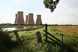
Drakelow Viaduct |
.jpg) |
Branston
Drakelow |
Staffordshire
Derbyshire
52°47′12″N 1°38′18″W / 52.78668°N 1.63835°W / 52.78668; -1.63835 (Drakelow Viaduct) |
Leicester line |
|
|
|
Railway |
Leicester Line bridge.
|
25.5
(41.0) |
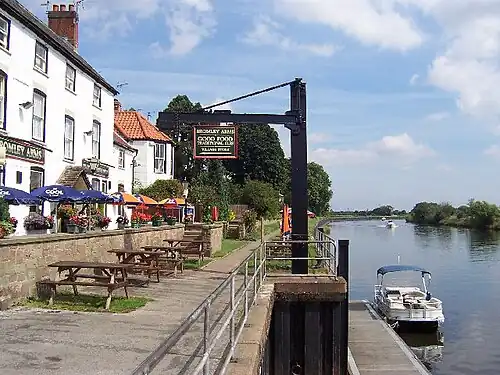
Ferry Bridge |
 |
Burton upon Trent
Stapenhill |
Staffordshire
52°47′40″N 1°37′34″W / 52.79457°N 1.626021°W / 52.79457; -1.626021 (Ferry Bridge) |
Footpath |
|
Ford |
Ferry |
Pedestrian |
Grade II.
|
25.6
(41.2) |
St Peter's Bridge |
.jpg) |
Burton upon Trent
Stapenhill |
Staffordshire
52°47′44″N 1°37′29″W / 52.79546°N 1.62485°W / 52.79546; -1.62485 (St Peter's Bridge) |
A5189 |
1985 |
|
|
Road |
|
26.1
(42.0) |
Andresey Bridge |
.jpg) |
Burton upon Trent
Andressey Island |
Staffordshire
52°48′08″N 1°37′37″W / 52.802111°N 1.627034°W / 52.802111; -1.627034 (Andresey Bridge) |
Footpath |
|
|
|
Pedestrian |
Grade II bridge across Peel's Cut.
|
26.2
(42.2) |
Cattle Bridge |
.jpg) |
Burton upon Trent
Andressey Island |
Staffordshire
52°48′09″N 1°37′31″W / 52.80259°N 1.62531°W / 52.80259; -1.62531 (Cattle Bridge) |
Footpath |
|
|
|
Pedestrian |
Spans Peel's Cut.[22]
|
26.5
(42.6) |
Burton Bridge |
.jpg) |
Burton upon Trent
Winshill |
Staffordshire
52°48′24″N 1°37′23″W / 52.80661°N 1.62309°W / 52.80661; -1.62309 (Burton Bridge) |
A511 |
|
|
|
Road |
Left Channel.
|
27
(43) |
Wetmore footbridge (south) |
|
Burton upon Trent |
Staffordshire
52°48′37″N 1°37′27″W / 52.810289°N 1.624164°W / 52.810289; -1.624164 (Wetmore footbridge (south)) |
Footpath |
|
|
|
Pedestrian |
Left Channel.[4]
|
27.3
(43.9) |
Wetmore pipe bridge |
 |
Burton upon Trent |
Staffordshire
52°48′51″N 1°37′24″W / 52.81411°N 1.62320°W / 52.81411; -1.62320 (Wetmore pipe bridge) |
Pipeline |
|
|
|
Pipe |
Left Channel.[4]
|
27.6
(44.4) |
Wetmore footbridge (north) |
.jpg) |
Burton upon Trent |
Staffordshire
52°49′02″N 1°37′18″W / 52.81716°N 1.62153°W / 52.81716; -1.62153 (Wetmore footbridge (north)) |
Footpath |
|
|
|
Pedestrian |
Left Channel.[4] Accessible via Electric Street or Wetmore Lane.
|
27.4
(44.1) |
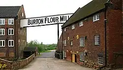
Burton Flour Mills bridge |
 |
Winshill |
Staffordshire
52°48′49″N 1°36′41″W / 52.813498°N 1.611522°W / 52.813498; -1.611522 (Burton Flour Mills bridge) |
Access road |
|
|
|
Road |
Millstream.
|
27.5
(44.3) |
Winshill pipe bridge |
.jpg) |
Winshill |
Staffordshire
52°48′57″N 1°36′37″W / 52.81581°N 1.61034°W / 52.81581; -1.61034 (Winshill pipe bridge) |
Pipeline |
|
|
|
Pipe |
Right Channel.[4]
|
30.4
(48.9) |
Newton Solney pipe bridge |
 |
Egginton
Newton Solney |
Derbyshire
52°50′12″N 1°34′47″W / 52.83676°N 1.57961°W / 52.83676; -1.57961 (Newton Solney pipe bridge) |
Pipeline |
|
|
|
Pipe |
Water pipeline.
|
31.9
(51.3) |
Willington Bridge |
 |
Willington
Repton |
Derbyshire
52°50′53″N 1°33′41″W / 52.84794888°N 1.561398215°W / 52.84794888; -1.561398215 (Willington Bridge) |
B5008 |
1839 |
Ford |
Ferry |
Road |
Previously ferry and ford.
|
34
(55) |
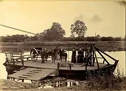
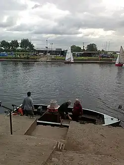
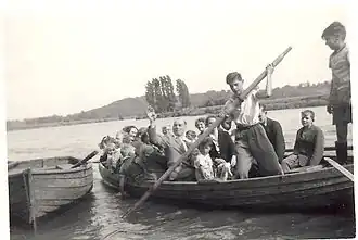
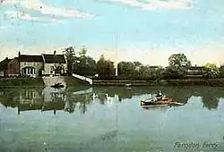
Twyford Ferry |
 |
Twyford
Milton |
Derbyshire
52°51′09″N 1°31′00″W / 52.85257°N 1.51675°W / 52.85257; -1.51675 (Twyford Ferry) |
|
|
Ford |
Ferry |
|
|
38.5
(62.0) |
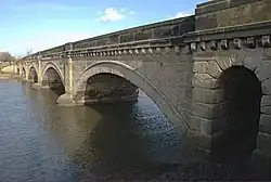
Swarkestone Bridge |
 |
Swarkestone
Stanton by Bridge |
Derbyshire
52°51′10″N 1°27′13″W / 52.85288°N 1.45356°W / 52.85288; -1.45356 (Swarkestone Bridge) |
A514 |
|
|
|
Road |
Grade I, Scheduled Monument, first mentioned in 1204.
|
40.2
(64.7) |
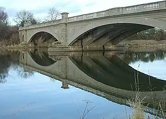
Weston-on-Trent viaduct |
.jpg) |
Weston-on-Trent
Kings Newton |
Derbyshire
52°50′37″N 1°25′26″W / 52.843712°N 1.423869°W / 52.843712; -1.423869 (viaduct) |
Cloud Trail |
1867 |
|
|
Pedestrian |
Previously a rail bridge.
|
40.5
(65.2) |
Weston Cliff Ferry |
 |
Weston-on-Trent
Kings Newton |
Derbyshire
52°50′28″N 1°25′08″W / 52.8412°N 1.4188°W / 52.8412; -1.4188 (Weston Cliff Ferry) |
|
|
|
Ferry |
|
|
42.7
(68.7) |
King's Mill Ferry |
 |
Weston-on-Trent
King's Mill |
Derbys
Leics
52°50′40″N 1°22′58″W / 52.84455°N 1.38290°W / 52.84455; -1.38290 (Kings Mill Ferry) |
|
|
Ford |
Ferry |
|
|
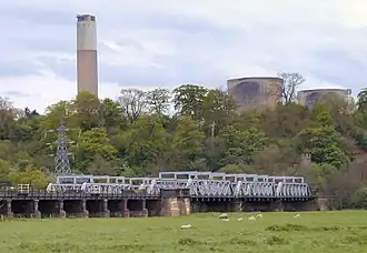
43.6
(70.2) |
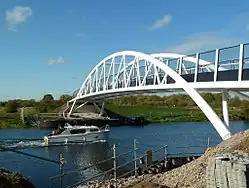
Castle Donington railway viaduct |
.jpg) |
Weston-on-Trent
Castle Donington |
Derbys
Leics
52°51′06″N 1°21′56″W / 52.85158°N 1.36553°W / 52.85158; -1.36553 (Castle Donington railway viaduct) |
Castle Donington line |
|
|
|
Railway |
[5]
|
45
(72) |
A50 Trent Bridge |
.jpg) |
Shardlow
Cavendish Bridge |
Derbys
Leics
52°51′40″N 1°20′52″W / 52.86101°N 1.34765°W / 52.86101; -1.34765 (A50 Trent Bridge) |
A50 |
1997 |
|
|
Road |
[5]
|
46.1
(74.2) |
Cavendish Bridge |
.jpg) |
Shardlow
Cavendish Bridge |
Derbys
Leics
52°51′54″N 1°20′14″W / 52.86502°N 1.33722°W / 52.86502; -1.33722 (Cavendish Bridge) |
B5010 |
1956 |
Ford |
Ferry |
Road |
Wilden Ferry.
|
47.3
(76.1) |
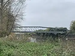
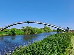
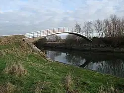
Long Horse Bridge |
 |
Shardlow
Hemington |
Derbys
Leics
52°52′16″N 1°19′09″W / 52.87114°N 1.31918°W / 52.87114; -1.31918 (Long Horse Bridge) |
Towpath |
2011 |
|
|
Pedestrian |
|
47.5
(76.4) |
Sawley Aqueduct |
 |
Sawley
Hemington |
Derbys
Leics
52°52′24″N 1°18′53″W / 52.87337°N 1.31464°W / 52.87337; -1.31464 (Sawley Aqueduct) |
Derwent Valley Aqueduct |
1909 |
|
|
Pipe |
|
47.7
(76.8) |
M1 Trent viaduct |
.jpg) |
Sawley
Hemington |
Derbys
Leics
52°52′24″N 1°18′33″W / 52.87342°N 1.30909°W / 52.87342; -1.30909 (M1 Trent viaduct) |
M1 |
1967 |
|
|
Road |
|
48.2
(77.6) |
Harrington Bridge |
 |
Sawley
Hemington |
Derbys
Leics
52°52′31″N 1°18′04″W / 52.8754°N 1.3012°W / 52.8754; -1.3012 (Harrington Bridge) |
B6540 |
1790 |
Ford |
Ferry |
Road |
Grade II bridge, replaced Sawley Ferry.
|
48.6
(78.2) |
Sawley railway viaduct |
 |
Long Eaton
Hemington |
Derbys
Leics
52°52′22″N 1°17′26″W / 52.87276°N 1.29065°W / 52.87276; -1.29065 (Sawley railway viaduct) |
Castle Donington line |
|
|
|
Railway |
|
49.4
(79.5) |
Trent Lock Scout Ferry |
 |
Trent Lock
Scout Activity Centre |
Derbys
Leics
52°52′32″N 1°16′31″W / 52.87557°N 1.27536°W / 52.87557; -1.27536 (Trent Lock Scout Ferry) |
|
1975 |
|
Ferry |
|
Scout Activity Centre ferry.[31]
|
49.5
(79.7) |
Trent Lock Ferry |
 |
Trent Lock
Ratcliffe-on-Soar |
Derbys
Notts
52°52′30″N 1°16′16″W / 52.87489°N 1.27115°W / 52.87489; -1.27115 (Trent Lock Ferry) |
|
|
|
Ferry |
|
Horse and passenger ferry.
|
49.8
(80.1) |
Redhill Viaducts |
 |
Long Eaton
Thrumpton |
Derbys
Notts
52°52′25″N 1°15′58″W / 52.8735°N 1.26617°W / 52.8735; -1.26617 (Redhill Viaduct) |
Midland Main Line |
1893 |
|
|
Railway |
Trent Viaducts.
|
49.9
(80.3) |
Thrumpton Ferry |
.jpg) |
Long Eaton
Thrumpton |
Derbys
Notts
52°52′45″N 1°14′33″W / 52.87914°N 1.24255°W / 52.87914; -1.24255 (Thrumpton Ferry) |
|
|
|
Ferry |
|
|
52
(84) |
Barton Ferry |
 |
Attenborough
Barton in Fabis |
Nottinghamshire
52°53′43″N 1°13′46″W / 52.89539°N 1.22949°W / 52.89539; -1.22949 (Barton Ferry)
|
|
|
|
Ferry |
|
Operated until 1960s.
|
56.5
(90.9) |
Clifton Bridge |
.jpg) |
Nottingham
Clifton |
Nottinghamshire
52°55′30″N 1°09′57″W / 52.9251°N 1.1658°W / 52.9251; -1.1658 (Clifton Bridge) |
A52 |
1958 |
|
|
Road |
|
57.5
(92.5) |
Wilford Toll Bridge |
.jpg) |
The Meadows
Wilford |
Nottinghamshire
52°56′16″N 1°09′17″W / 52.9377°N 1.1546°W / 52.9377; -1.1546 (Wilford Toll Bridge) |
Nottingham Express Transit |
1870 |
|
Ferry |
Railway |
Wilford Ferry.
|
57.6
(92.7) |
Great Central Railway Bridge |
|
The Meadows
Wilford |
Nottinghamshire
52°56′13″N 1°09′08″W / 52.9370°N 1.15231°W / 52.9370; -1.15231 (Wilford Toll Bridge) |
|
1895 |
|
|
Railway |
Demolished in 1985.
|
58.3
(93.8) |
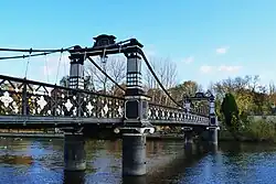
Wilford Suspension Bridge |
 |
The Meadows
West Bridgford |
Nottinghamshire
52°56′00″N 1°08′21″W / 52.9332°N 1.1393°W / 52.9332; -1.1393 (Wilford Suspension Bridge) |
Footpath |
1906 |
|
|
Pedestrian |
Footpath and pipelines
|
58.6
(94.3) |
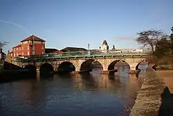
Trent Bridge, Nottingham |
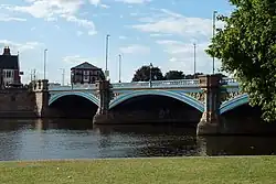 |
Nottingham
West Bridgford |
Nottinghamshire
52°56′17″N 1°08′10″W / 52.938°N 1.136°W / 52.938; -1.136 (Trent Bridge, Nottingham) |
A60 |
1871 |
|
|
Road |
The current bridge is the last in a series of bridges at this important crossing point. A bridge was first mentioned in 924.
|
58.8
(94.6) |
Navigation Bridge |
.jpg) |
Nottingham
West Bridgford |
Nottinghamshire
52°56′25″N 1°08′06″W / 52.9403°N 1.1350°W / 52.9403; -1.1350 (Navigation Bridge) |
Towpath |
|
|
|
Pedestrian |
Former horse bridge - damaged by the 1875 flood and subsequently demolished.
|
58.9
(94.8) |
Lady Bay Bridge |
 |
Nottingham
West Bridgford |
Nottinghamshire
52°56′34″N 1°07′54″W / 52.94283°N 1.13162°W / 52.94283; -1.13162 (Lady Bay Bridge) |
A6011 |
1878 |
|
|
Road |
Previously a rail bridge.
|
59.2
(95.3) |
Waterside Bridge |
_under_construction_in_Hucknall.jpg) |
Nottingham
West Bridgford |
Nottinghamshire
52°56′36″N 1°07′31″W / 52.9432°N 1.1254°W / 52.9432; -1.1254 (Waterside Bridge) |
Cycle bridge |
2026 Planned |
|
|
Cycleway |
Under construction.
|
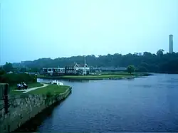
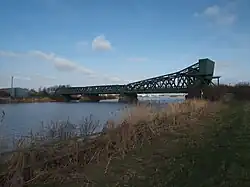
60.5
(97.4) |
Holme Sluices |
.jpg) |
Colwick
Holme Pierrepont |
Nottinghamshire
52°56′53″N 1°05′17″W / 52.94793°N 1.08799°W / 52.94793; -1.08799 (Holme Sluices) |
Access |
1952 |
|
|
Sluices |
Private bridge.
|
62.7
(100.9) |
Rectory Junction Viaduct |
 |
Netherfield
Radcliffe-on-Trent |
Nottinghamshire
52°57′04″N 1°03′15″W / 52.95116°N 1.054154°W / 52.95116; -1.054154 (Rectory Junction Viaduct) |
Nottingham–Grantham line |
1850 |
|
|
Railway |
Radcliffe Viaduct.
|
63.5
(102.2) |
Radcliffe Ferry |
 |
Stoke Bardolph
Radcliffe-on-Trent |
Nottinghamshire
52°57′05″N 1°02′29″W / 52.95133°N 1.04139°W / 52.95133; -1.04139 (Radcliffe Ferry) |
|
|
|
Ferry |
|
|
64.2
(103.3) |
Stoke Bardolph Ferry |
 |
Stoke Bardolph
Shelford |
Nottinghamshire
52°58′22″N 1°02′12″W / 52.97276°N 1.03664°W / 52.97276; -1.03664 (Stoke Bardolph Ferry) |
|
|
|
Ferry |
|
|
67.5
(108.6) |
Gunthorpe Bridge |
 |
Gunthorpe
East Bridgford |
Nottinghamshire
52°59′10″N 0°59′15″W / 52.9862°N 0.9874°W / 52.9862; -0.9874 (Gunthorpe Bridge) |
A6097 |
1925 |
Ford |
Ferry |
Road |
Earlier ford and ferry.
|
71
(114) |
Hoveringham Ferry |
 |
Hoveringham
Kneeton |
Nottinghamshire
53°00′35″N 0°57′06″W / 53.00971°N 0.95174°W / 53.00971; -0.95174 (Hoveringham Ferry) |
|
|
|
Ferry |
|
|
73.2
(117.8) |
Hazelford Ferry |
 |
Hazelford Ferry
Elston |
Nottinghamshire
53°01′57″N 0°55′03″W / 53.0324°N 0.9175°W / 53.0324; -0.9175 (Hazelford Ferry) |
|
|
|
Ferry |
|
|
75.5
(121.5) |
Fiskerton Ferry |
 |
Fiskerton
East Stoke |
Nottinghamshire
53°03′05″N 0°54′05″W / 53.05152°N 0.90149°W / 53.05152; -0.90149 (Fiskerton Ferry) |
|
|
|
Ferry |
|
|
78.5
(126.3) |
Farndon Ferry |
 |
Farndon
Farndon |
Nottinghamshire
53°03′40″N 0°51′22″W / 53.06114°N 0.85604°W / 53.06114; -0.85604 (Farndon Ferry) |
|
|
|
Ferry |
|
|
79.5
(127.9) |
Averham Viaduct |
 |
Staythorpe
Newark-on-Trent |
Nottinghamshire
53°04′35″N 0°51′02″W / 53.07649°N 0.85048°W / 53.07649; -0.85048 (Averham Viaduct) |
Nottingham–Lincoln line |
|
|
|
Railway |
Kelham Arm
|
80.9
(130.2) |
Kelham Bridge |
.jpg) |
Kelham
Newark-on-Trent |
Nottinghamshire
53°05′33″N 0°50′34″W / 53.09244947°N 0.842654209°W / 53.09244947; -0.842654209 (Kelham Bridge) |
A617 |
1857 |
|
|
Road |
Kelham Arm
|
82
(132) |
Muskham Bridge |
 |
South Muskham
Newark-on-Trent |
Nottinghamshire
53°05′52″N 0°49′31″W / 53.09775°N 0.82521°W / 53.09775; -0.82521 (Muskham Bridge) |
A616/Great North Road |
1922 |
|
|
Road |
Kelham Arm[45]
|
82
(132) |
Smeaton's Arches |
.jpg) |
South Muskham
Newark-on-Trent |
Nottinghamshire
53°05′24″N 0°49′15″W / 53.0901°N 0.82092°W / 53.0901; -0.82092 (Smeaton's Arches) |
A616/Great North Road |
1772 |
|
|
Road |
Causeway links Muskham Bridge and Trent Bridge, Newark.
|
82.7
(133.1) |
Muskham Viaduct |
.jpg) |
South Muskham
Newark-on-Trent |
Nottinghamshire
53°05′51″N 0°48′32″W / 53.0976°N 0.8088°W / 53.0976; -0.8088 (Muskham Viaduct) |
East Coast Main Line |
|
|
|
Railway |
Kelham Arm
|
80.4
(129.4) |
A46 Newark bypass, Farndon |
.jpg) |
Newark-on-Trent
Farndon |
Nottinghamshire
53°04′02″N 0°50′09″W / 53.06717°N 0.83584°W / 53.06717; -0.83584 (A46 Newark bypass, Farndon) |
A46 road |
1992 |
|
|
Road |
|
81.2
(130.7) |
Longstone Bridge |
.jpg) |
Newark-on-Trent |
Nottinghamshire
53°04′28″N 0°49′07″W / 53.07445°N 0.818642°W / 53.07445; -0.818642 (Longstone Bridge) |
Towpath |
1819 |
|
|
Pedestrian |
|
81.3
(130.8) |
Mill Bridge |
.jpg) |
Newark-on-Trent |
Nottinghamshire
53°04′29″N 0°49′02″W / 53.0748°N 0.81732°W / 53.0748; -0.81732 (Mill Bridge)
|
Mill Lane |
1952 |
|
|
Road |
|
81.4
(131.0) |
Backwater Bridge, Newark-on-Trent |
.jpg) |
Newark-on-Trent |
Nottinghamshire
53°04′37″N 0°48′52″W / 53.07695°N 0.81458°W / 53.07695; -0.81458 (Backwater Bridge, Newark-on-Trent) |
Towpath |
1952 |
|
|
Pedestrian |
|
81.6
(131.3) |
Trent Bridge, Newark |
 |
Newark-on-Trent |
Nottinghamshire
53°04′43″N 0°48′46″W / 53.078544°N 0.812663°W / 53.078544; -0.812663 (Trent Bridge, Newark) |
Great North Road |
1775 |
|
|
Road |
|
81.8
(131.6) |
Jubilee Bridge |
.jpg) |
Newark-on-Trent |
Nottinghamshire
53°04′53″N 0°48′32″W / 53.08141°N 0.80876°W / 53.08141; -0.80876 (Jubilee Bridge) |
Footpath |
2002 |
|
|
Pedestrian |
|
82.2
(132.3) |
Fiddler's Elbow Bridge |
 |
Newark-on-Trent |
Nottinghamshire
53°05′14″N 0°48′17″W / 53.0872°N 0.804855°W / 53.0872; -0.804855 (Fiddler’s Elbow Bridge) |
Towpath |
1915 |
|
|
Pedestrian |
|
82.3
(132.4) |
A46 Nether Lock Viaduct |
.jpg) |
Newark-on-Trent |
Nottinghamshire
53°05′20″N 0°48′17″W / 53.089°N 0.80481°W / 53.089; -0.80481 (A46 Nether Lock Viaduct) |
A46 road |
1992 |
|
|
Road |
|
82.4
(132.6) |
Midland Railway Viaduct |
.jpg) |
Newark-on-Trent |
Nottinghamshire
53°05′20″N 0°48′22″W / 53.08902°N 0.80609°W / 53.08902; -0.80609 (Midland Railway Viaduct) |
Nottingham–Lincoln line |
1846 |
|
|
Railway |
|
82.6
(132.9) |
Newark Dyke Bridge |
.jpg) |
North Muskham
Newark-on-Trent |
Nottinghamshire
53°05′34″N 0°48′22″W / 53.09279°N 0.80606°W / 53.09279; -0.80606 (Newark Dyke Bridge) |
East Coast Main Line |
2000 |
|
|
Railway |
|
83.1
(133.7) |
Winthorpe Bridge |
.jpg) |
North Muskham
Winthorpe |
Nottinghamshire
53°06′06″N 0°47′55″W / 53.10164°N 0.7986°W / 53.10164; -0.7986 (Winthorpe Bridge) |
A1 |
1964 |
|
|
Road |
Grade II listed.
|
86.2
(138.7) |
Muskham Ferry |
 |
North Muskham
Holme |
Nottinghamshire
53°07′14″N 0°48′29″W / 53.12058°N 0.80803°W / 53.12058; -0.80803 (Muskham Ferry) |
|
|
Ford |
Ferry |
|
Operated until the 1940s.
|
87
(140) |
Cromwell Lock |
.jpg) |
Cromwell |
Nottinghamshire
53°08′29″N 0°47′33″W / 53.14137°N 0.79248°W / 53.14137; -0.79248 (Cromwell Lock) |
|
|
|
|
|
Tidal limit.
|
90.6
(145.8) |
Carlton on Trent Ferry |
.jpg) |
Carlton-on-Trent
Collingham |
Nottinghamshire
53°10′06″N 0°48′02″W / 53.16824°N 0.80068°W / 53.16824; -0.80068 (Carlton on Trent Ferry) |
|
|
|
Ferry |
|
|
92.6
(149.0) |
Meering Ferry |
.jpg) |
Sutton-on-Trent
Meering |
Nottinghamshire
53°10′42″N 0°47′11″W / 53.17846°N 0.78626°W / 53.17846; -0.78626 (Meering Ferry) |
|
|
|
Ferry |
|
|
96.6
(155.5) |
Marnham Ferry |
 |
High Marnham
South Clifton |
Nottinghamshire
53°13′27″N 0°46′59″W / 53.22416°N 0.78318°W / 53.22416; -0.78318 (Marnham Ferry) |
|
|
|
Ferry |
|
|
96.9
(155.9) |
Fledborough Viaduct |
 |
Fledborough
North Clifton |
Nottinghamshire
53°14′07″N 0°46′44″W / 53.2353°N 0.77875°W / 53.2353; -0.77875 (Fledborough Viaduct) |
Footpath |
1897 |
|
|
Pedestrian |
Former rail bridge.
|
97
(156) |
Fledborough Ferry |
.jpg) |
Fledborough
North Clifton |
Nottinghamshire
53°14′28″N 0°46′41″W / 53.24108°N 0.77818°W / 53.24108; -0.77818 (Fledborough Ferry) |
|
|
|
Ferry |
|
|
99
(159) |
Dunham Bridge |
 |
Dunham
Newton on Trent |
Nottinghamshire
Lincolnshire
53°15′39″N 0°46′23″W / 53.2608°N 0.773°W / 53.2608; -0.773 (Dunham Bridge) |
A57 |
1832 |
|
Ferry |
Road |
Previously a ferry.
|
99
(159) |
Dunham pipe bridge |
 |
Dunham
Newton on Trent |
Nottinghamshire
Lincolnshire
53°15′37″N 0°46′23″W / 53.2602°N 0.77312°W / 53.2602; -0.77312 (Dunham pipe bridge) |
Pipeline |
1912 |
|
|
Pipe |
|
101.4
(163.2) |
Laneham Ferry |
.jpg) |
Laneham
Laughterton |
Nottinghamshire
Lincolnshire
53°16′53″N 0°46′37″W / 53.2815°N 0.7770°W / 53.2815; -0.7770 (Laneham Ferry) |
|
|
|
Ferry |
|
Closed in 1922.
|
103.6
(166.7) |
Torksey Ferry |
 |
Rampton
Torksey |
Nottinghamshire
Lincolnshire
53°18′00″N 0°44′56″W / 53.3000°N 0.7489°W / 53.3000; -0.7489 (Torksey Ferry) |
|
|
|
Ferry |
|
|
103.7
(166.9) |
Torksey Viaduct |
.jpg) |
Cottam
Torksey |
Nottinghamshire
Lincolnshire
53°18′11″N 0°44′53″W / 53.303°N 0.74819°W / 53.303; -0.74819 (Torksey Viaduct) |
Footpath |
1849 |
|
|
Railway |
Grade II*, disused railway bridge.
|
107.3
(172.7) |
Littleborough Ferry |
.jpg) |
Littleborough
Marton |
Nottinghamshire
Lincolnshire
53°19′58″N 0°45′42″W / 53.33283°N 0.76156°W / 53.33283; -0.76156 (Littleborough Ferry) |
|
|
Ford |
Ferry |
|
Probable Roman ford at Segelocum.
|
110.7
(178.2) |
Bole Ferry |
.jpg) |
Bole
Lea |
Nottinghamshire
Lincolnshire
53°22′08″N 0°47′26″W / 53.36887°N 0.79058°W / 53.36887; -0.79058 (Bole Ferry) |
|
|
|
Ferry |
|
|
112.2
(180.6) |
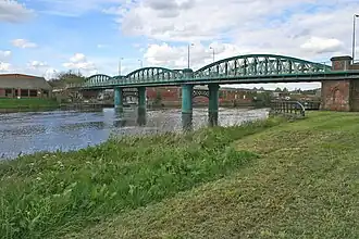
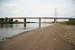
Gainsborough Trent Junction railway bridge |
.jpg) |
Bole
Gainsborough |
Nottinghamshire
Lincolnshire
53°23′02″N 0°47′04″W / 53.38387°N 0.78439°W / 53.38387; -0.78439 (Gainsborough Trent Junction railway bridge) |
Railway |
1849 |
|
|
Railway |
Rebuilt with new spans in 1992.[57][8]
|
113.5
(182.7) |
Trent Bridge, Gainsborough |
.jpg) |
Beckingham
Gainsborough |
Nottinghamshire
Lincolnshire
53°23′32″N 0°46′36″W / 53.3922°N 0.7766°W / 53.3922; -0.7766 (Trent Bridge, Gainsborough) |
A631 |
1791 |
|
Ferry |
Road |
Grade II, earlier ferry and ford.
|
116.7
(187.8) |
Walkerith Ferry |
.jpg) |
Walkeringham
Walkerith |
Nottinghamshire
Lincolnshire
53°25′34″N 0°49′03″W / 53.4261°N 0.8175°W / 53.4261; -0.8175 (Walkerith Ferry) |
|
|
|
Ferry |
|
|
117.5
(189.1) |
Stockwith Ferry |
 |
West Stockwith
East Stockwith |
Nottinghamshire
Lincolnshire
53°26′34″N 0°48′48″W / 53.44267°N 0.81327°W / 53.44267; -0.81327 (Stockwith Ferry) |
|
|
|
Ferry |
|
Ceased around 1953.
|
121.7
(195.9) |
Owston Ferry |
.jpg) |
Owston Ferry
East Ferry |
Lincolnshire
53°29′25″N 0°46′30″W / 53.49020°N 0.77490°W / 53.49020; -0.77490 (Owston Ferry) |
|
|
|
Ferry |
|
Ceased around 1951.
|
126.6
(203.7) |
Butterwick Ferry |
 |
West Butterwick
East Butterwick |
Lincolnshire
53°32′27″N 0°44′24″W / 53.54087°N 0.73987°W / 53.54087; -0.73987 (Butterwick Ferry) |
|
|
|
Ferry |
|
|
127.1
(204.5) |
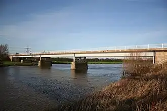
M180 Trent Bridge |
 |
West Butterwick
Burringham |
Lincolnshire
53°33′25″N 0°44′46″W / 53.55686°N 0.74623°W / 53.55686; -0.74623 (M180 Trent Bridge) |
M180 |
1979 |
|
|
Road |
|
129
(208) |
Althorpe Ferry |
.jpg) |
Althorpe
Burringham |
Lincolnshire
53°34′35″N 0°44′18″W / 53.57652°N 0.73820°W / 53.57652; -0.73820 (Althorpe Ferry) |
|
|
|
Ferry |
|
|
130
(210) |
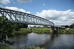
Keadby Bridge |
 |
Keadby
Gunness |
Lincolnshire
53°35′09″N 0°43′52″W / 53.5857°N 0.7311°W / 53.5857; -0.7311 (Keadby Bridge) |
A18
South Humberside Main Line |
1916 |
|
|
Road
Railway |
Grade II Bascule bridge King George V Bridge.
|
134.5
(216.5) |
Amcotts Ferry |
.jpg) |
Amcotts
Flixborough |
Lincolnshire
53°37′04″N 0°42′06″W / 53.61768°N 0.70171°W / 53.61768; -0.70171 (Amcotts Ferry) |
|
|
|
Ferry |
|
[61]
|
136.6
(219.8) |
Garthorpe Ferry |
 |
Garthorpe
Burton upon Stather |
Lincolnshire
53°39′23″N 0°41′41″W / 53.65637°N 0.69460°W / 53.65637; -0.69460 (Garthorpe Ferry) |
|
|
|
Ferry |
|
Also known as Burton Stather Ferry.
|
140
(230) |
Trent Falls |
 |
Ousefleet
Alkborough |
53°41′50″N 0°41′45″W / 53.6972°N 0.6957°W / 53.6972; -0.6957 (Trent Falls) |
|
|
|
|
|
Mouth of the Trent.
|