List of crossings of the Ottawa River
This is a list of bridges, dams, and ferries on the Ottawa River, proceeding stream upwards from the Saint Lawrence River, with the year in which they were opened.
Crossings
Within Quebec
| Span | Carries | Location | Year built | Coordinates | |
|---|---|---|---|---|---|
|
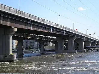
Galipeault Bridge | Sainte-Anne-de-Bellevue–
Île Bellevue– Île Perrot |
1924 | ||
| Canadian National Rail Bridge | CN Rail, Via Rail Canada (passenger trains to Ottawa/Toronto) | ||||
| Canadian Pacific Rail Bridge | CP Rail | ||||
| Span | Carries | Location | Year built | Coordinates | |
|---|---|---|---|---|---|
| Canadian National Rail Bridge | CN Rail, Via Rail Canada (passenger trains to Ottawa/Toronto) | Île Perrot–Dorion | |||
| Canadian Pacific Rail Bridge | CP Rail | ||||
|
Taschereau Bridge | ||||
| Span | Carries | Location | Year built | Notes | Coordinates | |
|---|---|---|---|---|---|---|
|
Île aux Tourtes Bridge | Senneville–
Île Girwood– Île aux Tortues– Vaudreuil-Dorion |
||||
| Oka Ferry[1][2][3] | Oka–Hudson | seasonal | ||||
| Hudson - Oka Icebridge[4] | seasonal | |||||
| Saint-André-d'Argenteuil - Pointe-Fortune Ice Bridge[5] | Saint-André-d'Argenteuil–Pointe Fortune | seasonal | ||||
| Carillon - Pointe-Fortune Ferry | Carillon–Pointe Fortune | seasonal; replaced by St-Andre d'argenteuil ice bridge in winter | ||||
Quebec–Ontario


Within Quebec
| Span | Carries | Location | Year built | Notes | Coordinates | |
|---|---|---|---|---|---|---|
| unnamed road bridge | Notre-Dame-du-Nord | |||||
| Première-Chute Generating Station | no road access | |||||
| Rapides-des-Îles Generating Station | local road access | |||||
| Rapides-des-Quinze Generating Station | no road access | Quebec | ||||
| Lac-des-Quinze Generating Station | local road access | Laverlochère-Angliers | ||||
| Grassy Narrow Bridge | Quebec | covered bridge | ||||
| Rapide-Deux Generating Station | local road access | Rapide-Deux | ||||
| Rapide-Sept Generating Station | local road access | Rapide-Sept | ||||
| unnamed road bridge | Rapides Twin | |||||
| unnamed road bridge | 47°40′08″N 77°31′25″W / 47.66876°N 77.52361°W ? | |||||
| Bourque Generating Station | local road access | Ukunemakak | ||||
| unnamed road bridge | ||||||
See also
- List of bridges in Ottawa
- List of bridges to the Island of Montreal
- List of crossings of the Rivière des Prairies
- List of crossings of the Rivière des Mille Îles
- List of hydroelectric stations
- List of Ontario generating stations on the Ottawa River
- List of reservoirs and dams in Canada
- List of reservoirs and dams in Quebec
References
- ^ "hudson-village.info". Retrieved 2 December 2016.
- ^ "Oka-Hudson". Archived from the original on 6 January 2012. Retrieved 2 December 2016.
- ^ "Oka/hudson Ferry". Archived from the original on 19 August 2011. Retrieved 10 April 2012.
- ^ "Hudson-Oka ice bridge opens". The Gazette. 22 January 2009. Archived from the original on 13 February 2010. Retrieved 27 October 2009.
- ^ "Pont De Glace". Retrieved 2 December 2016.
- ^ "Fassett – Lefaivre Ferry – Wikimapia". Retrieved 2 December 2016.
- ^ "Thurso-Clarence Ferry – Wikimapia". Retrieved 2 December 2016.
- ^ Masson – Cumberland Ferry
- ^ History
- ^ Hydro electric Archived 12 March 2007 at the Wayback Machine
- ^ "quyonferry.com". Retrieved 2 December 2016.
External links
Wikimedia Commons has media related to Bridges over the Ottawa River.