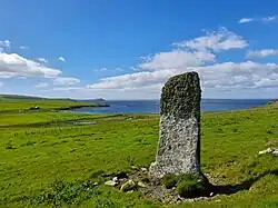
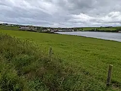
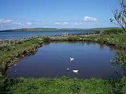
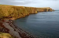
List of bays of the Orkney Islands
This List of bays of the Orkney Islands summarises the bays that are located in the islands of Orkney in Scotland.
The heading "Nearest Town" shows the nearest substantial settlement, as Kirkwall is the only town in the Orkney islands.
Auskerry
The small island of Auskerry has no bays.
Brough of Birsay
The tidal island of Brough of Birsay has no bays.
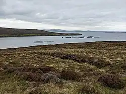
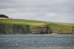
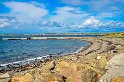
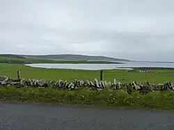
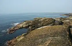
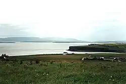
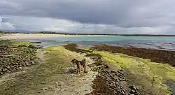
Burray
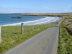
| Name | Nearest Town | Coordinates | image | Notes |
|---|---|---|---|---|
| Echnaloch Bay | Burray village | 58°51′39″N 2°55′30″W / 58.8608°N 2.9251°W | 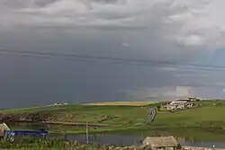 |
[1] |
| Weddell Bay | Burray village | 58°52′12″N 2°54′34″W / 58.8700°N 2.9095°W | 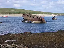 |
Calf of Eday
| Name | Nearest Town | Coordinates | image | Notes |
|---|---|---|---|---|
| Pernealy Bay | 59°14′32″N 2°43′47″W / 59.2421°N 2.7296°W |  |
Calf of Flotta
The small island of Calf of Flotta has no bays.
Cava
The small island of Cava has no bays.
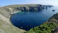
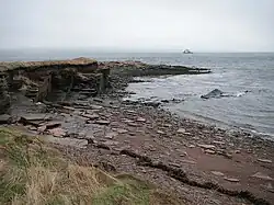
Copinsay
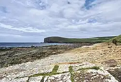
| Name | Nearest Town | Coordinates | image | Notes |
|---|---|---|---|---|
| South Bay | 58°53′51″N 2°41′11″W / 58.8974°N 2.6864°W |  |
[2] | |
| North Bay | 58°54′09″N 2°41′07″W / 58.9025°N 2.6854°W |  |
[2] | |
| Bight of Hamnavo | 58°54′06″N 2°42′15″W / 58.9016°N 2.7043°W |  |
Damsay
The small island in the Bay of Firth in Mainland has no bays.
Eday
| Name | Nearest Town | Coordinates | image | Notes |
|---|---|---|---|---|
| Bay of Backaland | Calfsound | 59°09′31″N 2°45′00″W / 59.1587°N 2.750°W | 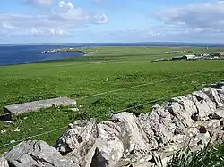 |
[3] |
| Bay of Carrick | Calfsound | 59°13′51″N 2°45′04″W / 59.2308°N 2.751°W |  |
[4] |
| Bay of Doomy | Calfsound | 59°11′44″N 2°46′48″W / 59.1955°N 2.780°W |  |
|
| Bay of Greentoft | Calfsound | 59°08′34″N 2°46′17″W / 59.1427°N 2.7714°W |  |
|
| Bay of Icevay | Calfsound | 59°11′13″N 2°45′31″W / 59.1870°N 2.7585°W |  |
|
| Bay of London | Calfsound | 59°11′30″N 2°45′28″W / 59.1916°N 2.7577°W |  |
|
| Bay of Newark | Calfsound | 59°12′28″N 2°46′48″W / 59.2078°N 2.780°W |  |
|
| Bight of Milldale | Calfsound | 59°12′04″N 2°45′00″W / 59.2010°N 2.7499°W |  |
|
| Cusbay | Calfsound | 59°13′35″N 2°47′10″W / 59.2265°N 2.786°W |  |
|
| Fersness Bay | Calfsound | 59°11′48″N 2°47′59″W / 59.1968°N 2.7998°W |  |
|
| Mill Bay | Calfsound | 59°12′27″N 2°44′59″W / 59.2076°N 2.7496°W | 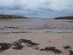 |
|
| Sealskerry Bay | Calfsound | 59°10′09″N 2°49′09″W / 59.1693°N 2.8191°W |  |
|
| Whitemaw Bay | Calfsound | 59°08′54″N 2°47′39″W / 59.1482°N 2.7942°W |  |
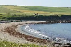
Egilsay
| Name | Nearest Town | Coordinates | image | Notes |
|---|---|---|---|---|
| Bay of Skaill | 59°08′46″N 2°56′27″W / 59.1460°N 2.9407°W |  |
||
| Bay of Vady | 59°08′21″N 2°56′13″W / 59.1393°N 2.9369°W |  |
Eynhallow
The small island of Eynhallow has no bays.
Fara
| Name | Nearest Town | Coordinates | image | Notes |
|---|---|---|---|---|
| Peat Bay | 58°51′07″N 3°10′35″W / 58.8520°N 3.1763°W | 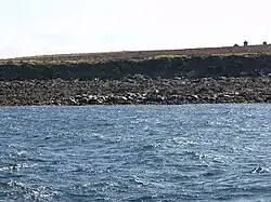 |
Faray
| Name | Nearest Town | Coordinates | image | Notes |
|---|---|---|---|---|
| Bight of Sandbister | 59°12′31″N 2°49′44″W / 59.2087°N 2.8290°W |  |
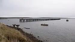
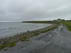
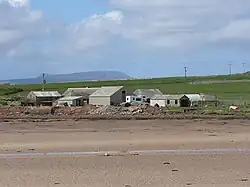
Flotta
| Name | Nearest Town | Coordinates | image | Notes |
|---|---|---|---|---|
| Kirk Bay | 58°48′59″N 3°05′54″W / 58.8163°N 3.0982°W | .jpg) |
||
| Pan Hope | 58°49′57″N 3°05′52″W / 58.8326°N 3.0979°W |  |
||
| Scat Wick | 58°48′54″N 3°07′09″W / 58.8149°N 3.1193°W | |||
| Tween the Wicks | 58°50′50″N 3°03′57″W / 58.8473°N 3.0659°W | 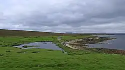 |
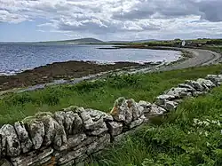
Gairsay
| Name | Nearest Town | Coordinates | image | Notes |
|---|---|---|---|---|
| Millburn Bay | Orkney | 59°04′40″N 2°57′34″W / 59.07766°N 2.9594°W | 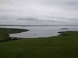 |
|
| Russness Bay | Orkney | 59°05′00″N 2°57′22″W / 59.0833°N 2.9561°W | .jpg) |
Glimps Holm
The island of Glimps Holm in the Holm Sound has no bays.
Graemsay
| Name | Nearest Town | Coordinates | image | Notes |
|---|---|---|---|---|
| Bay of Sandside | Orkney | 58°56′07″N 3°16′59″W / 58.9354°N 3.283°W | 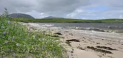 |
Helliar Holm
The small island of Helliar Holm has no bays.
Holm of Faray
| Name | Nearest Town | Coordinates | image | Notes |
|---|---|---|---|---|
| Inniens Bay | 59°14′04″N 2°50′03″W / 59.2344°N 2.8343°W |  |
Holm of Grimbister
The small island of Holm of Grimbister off the mainland coast has no bays.
Holm of Huip
The small island of Holm of Huip has no bays.
Holm of Papa
The small island of Holm of Papa has no bays.
Holm of Scockness
The small island of Holm of Scockness has no bays.
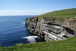
Hoy


Note: North Bay is listed twice, once under Hoy and once under South Walls. It is the same bay, with the same geographical co-ordinates shown, and lies between the two islands.
Hunda
| Name | Nearest Town | Coordinates | image | Notes |
|---|---|---|---|---|
| The Hope | Orkney | 58°51′00″N 2°59′05″W / 58.8501°N 2.9848°W |  |
[6] |
Inner Holm
The very small island of Inner Holm has no bays.
Lamb Holm
The very small island of Lamb Holm has no bays
Linga Holm
The small island of Linga Holm has no bays.
Muckle Green Holm
The small island of Muckle Green Holm has no bays.
Muckle Skerry
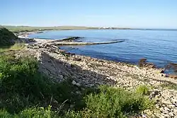
| Name | Nearest Town | Coordinates | image | Notes |
|---|---|---|---|---|
| Scartan Bay | 58°41′20″N 2°55′00″W / 58.6889°N 2.9166°W |  |
North Ronaldsay
| Name | Nearest Town | Coordinates | image | Notes |
|---|---|---|---|---|
| Bay of Ryasgeo | Hollandstoun | 59°22′44″N 2°26′05″W / 59.3788°N 2.4347°W |  |
|
| Bay of Sjaivar | Hollandstoun | 59°23′10″N 2°22′16″W / 59.3861°N 2.3710°W |  |
|
| Garso Wick | Hollandstoun | 59°23′18″N 2°24′09″W / 59.3883°N 2.4026°W |  |
|
| Lens Wick | Hollandstoun | 59°23′20″N 2°25′11″W / 59.3888°N 2.4196°W | ||
| Linklet Bay | Hollandstoun | 59°22′28″N 2°24′01″W / 59.3745°N 2.4002°W |  |
|
| South Bay | Hollandstoun | 59°21′14″N 2°26′01″W / 59.3539°N 2.4337°W |  |
Orkney Mainland


Papa Stronsay
| Name | Nearest Town | Coordinates | image | Notes |
|---|---|---|---|---|
| Bight of Stackaback | 59°08′56″N 2°35′44″W / 59.1488°N 2.5955°W | 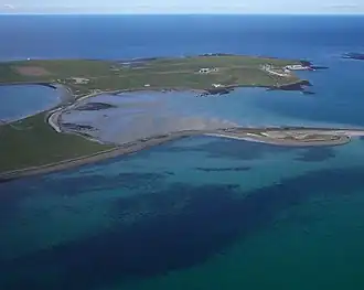 |
Papa Westray
| Name | Nearest Town | Coordinates | image | Notes |
|---|---|---|---|---|
| Bay of Burland | 59°20′14″N 2°52′42″W / 59.3373°N 2.8782°W |  |
||
| Bay of Hookin | 59°20′47″N 2°52′52″W / 59.3465°N 2.8811°W | |||
| Bay of Moclett | 59°19′36″N 2°53′45″W / 59.3268°N 2.8957°W |  |
||
| North Wick | 59°21′43″N 2°52′41″W / 59.3619°N 2.8780°W |  |
||
| South Wick | 59°21′29″N 2°52′36″W / 59.3581°N 2.8768°W |  |
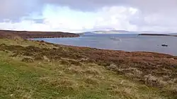
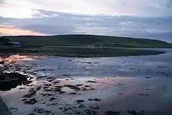
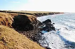
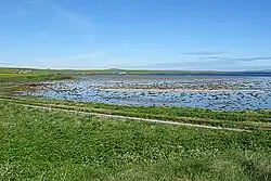
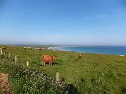
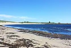
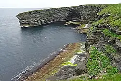
Rousay
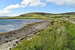
| Name | Nearest Town | Coordinates | image | Notes |
|---|---|---|---|---|
| Bay of Ham | Sourin | 59°10′20″N 2°57′53″W / 59.1721°N 2.9647°W |  |
|
| Bay of Moaness | Frotoft | 59°08′40″N 3°05′39″W / 59.1445°N 3.0941°W | ||
| Bay of Swandro | Frotoft | 59°08′47″N 3°05′44″W / 59.146306°N 3.095559°W |  |
|
| Bay of Westness | Frotoft | 59°08′30″N 3°05′05″W / 59.141663°N 3.084705°W |  |
|
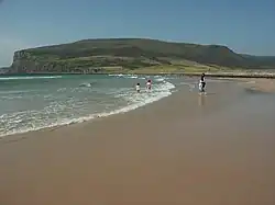
| Saviskaill Bay | Sourin | 59°11′16″N 3°00′46″W / 59.1879°N 3.0128°W | 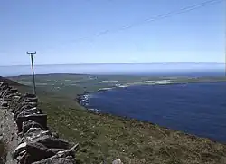 |
[19] |
Rysa Little
The small island of Rysa Little has no bays.
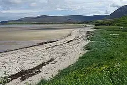
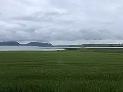
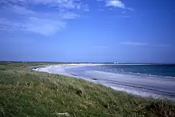
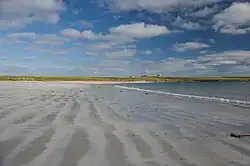
Sanday


Shapinsay
| Name | Nearest Town | Coordinates | image | Notes |
|---|---|---|---|---|
| Bay of Crook | Balfour | 59°02′47″N 2°49′16″W / 59.0465°N 2.821°W |  |
|
| Bay of Furrowend | Balfour | 59°03′17″N 2°55′18″W / 59.05479°N 2.9217°W |  |
|
| Bay of Linton | Balfour | 59°03′00″N 2°49′11″W / 59.05°N 2.8198°W | |
|
| Bay of Sandgarth | Balfour | 59°01′23″N 2°50′25″W / 59.0231°N 2.8404°W |  |
|
| Elwick Bay | Balfour | 59°01′57″N 2°54′08″W / 59.0326°N 2.9021°W |  |
|
| Innsker | Balfour | 59°04′44″N 2°50′06″W / 59.0789°N 2.8350°W |  |
|
| Veantrow Bay | Balfour | 59°04′08″N 2°52′07″W / 59.069°N 2.8687°W |  |
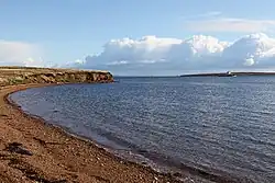
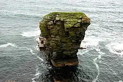
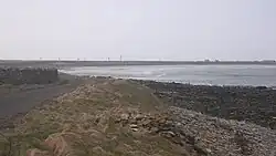
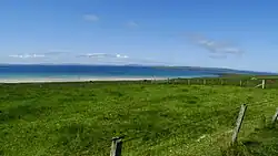
South Ronaldsay


South Walls
| Name | Nearest Town | Coordinates | image | Notes |
|---|---|---|---|---|
| Kirk Hope | Hackness | 58°47′30″N 3°08′34″W / 58.7918°N 3.1429°W |  |
|
| Myre Bay | Hackness | 58°48′10″N 3°09′52″W / 58.8027°N 3.1645°W |  |
|
| North Bay | Wyng | 58°47′42″N 3°13′58″W / 58.7951°N 3.2328°W |  |
Start Point
The small tidal island of Start Point has no bays.
Stronsay


Switha
| Name | Nearest Town | Coordinates | image | Notes |
|---|---|---|---|---|
| The Pool | 58°47′49″N 3°06′36″W / 58.7970°N 3.11°W |  |
Sweyn Holm
The small island of Sweyn Holm has no bays.
Swona
| Name | Nearest Town | Coordinates | image | Notes |
|---|---|---|---|---|
| The Brook | 58°44′52″N 3°03′28″W / 58.7479°N 3.0577°W |  |
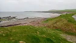
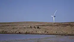
Westray


Wyre
| Name | Nearest Town | Coordinates | image | Notes |
|---|---|---|---|---|
| Bay of Bergeben | 59°06′47″N 2°59′53″W / 59.11308°N 2.9981°W |  |
||
| Bay of Cott | 59°06′46″N 2°58′49″W / 59.1129°N 2.9804°W |  |
||
| Bay of Stromnesstaing | 59°06′40″N 2°57′52″W / 59.1112°N 2.9645°W |  |
||
| Bay of Whelkmulli | 59°06′51″N 3°00′20″W / 59.1143°N 3.0056°W |  |
See also
- List of bays of Scotland
- List of bays of the Inner Hebrides
- List of bays of the Firth of Clyde
- List of bays of the Shetland Islands
References
- ^ United States. Defense Mapping Agency. Hydrographic Center (1950). Sailing Directions for the North and East Coasts of Scotland (3rd ed.). U. S. Naval Oceanographic Office. p. 244.
- ^ a b Haswell-Smith, Hamish (2008). Front cover image for The Scottish islands : the bestselling guide to every Scottish island The Scottish islands : the bestselling guide to every Scottish island. Edinburgh: Canongate. p. 10.8. ISBN 1847672779.
- ^ Sailing Directions for the North and East Coasts of Scotland (3rd ed.). Washington: United States Government Printing Office. 1962. p. 184.
- ^ Sailing Directions for the North and East Coasts of Scotland (3rd ed.). Washington: United States Government Printing Office. 1962. p. 183.
- ^ Office, United States Hydrographic (1962). Publications ... U.S. Government Printing Office. p. 248.
- ^ Department, Great Britain Hydrographic (1876). North Sea Pilot (2nd ed.). London: Hydrographic Office, Admiralty. p. 170.
- ^ United States. Defense Mapping Agency. Hydrographic Center (1950). Sailing Directions for the North and East Coasts of Scotland (3rd ed.). U. S. Naval Oceanographic Office. p. 245.
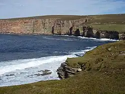
- ^ Barclay, W. J. (2005). The old red sandstone of Great Britain. Peterborough: Joint nature conservation committee. p. 73. ISBN 9781861075437.
- ^ United States. Defense Mapping Agency. Hydrographic Center (1950). Sailing Directions for the North and East Coasts of Scotland (3rd ed.). U. S. Naval Oceanographic Office. p. 221.
- ^ United States. Defense Mapping Agency. Hydrographic Center (1950). Sailing Directions for the North and East Coasts of Scotland (3rd ed.). U. S. Naval Oceanographic Office. p. 197.
- ^ a b Center, United States Defense Mapping Agency Hydrographic (1976). Sailing Directions (enroute) for Scotland (1st ed.). Defense Mapping Agency, Hydrographic Center. p. 331.
- ^ a b Center, United States Defense Mapping Agency Hydrographic (1950). Sailing Directions for the North and East Coasts of Scotland: Cape Wrath to Fife Ness and Including the Orkney, Shetland and Faeroe Islands. Washington: U.S. Government Printing Office. p. 233.
- ^ United States. Defense Mapping Agency. Hydrographic Center (1950). Sailing Directions for the North and East Coasts of Scotland (3rd ed.). U. S. Naval Oceanographic Office. p. 233.
- ^ United States. Defense Mapping Agency. Hydrographic Center (1950). Sailing Directions for the North and East Coasts of Scotland (3rd ed.). U. S. Naval Oceanographic Office. p. 227.
- ^ United States. Defense Mapping Agency. Hydrographic Center (1950). Sailing Directions for the North and East Coasts of Scotland (3rd ed.). U. S. Naval Oceanographic Office. p. 221.
- ^ Center, United States Defense Mapping Agency Hydrographic (1950). Sailing Directions for the North and East Coasts of Scotland: Cape Wrath to Fife Ness and Including the Orkney, Shetland and Faeroe Islands (3rd ed.). Washington: U.S. Government Printing Office. p. 211.
- ^ Office, United States Hydrographic (1915). British Islands Pilot: Faroes, Shetlands, and Orkney Islands and north and east coasts of Scotland. Washington: U.S. Government Printing Office. p. 246.
- ^ a b Office, United States Hydrographic (1950). Sailing Directions for the North and East Coasts of Scotland: Cape Wrath to Fife Ness and Including the Orkney, Shetland and Faeroe Islands (3rd ed.). Washington: U.S. Government Printing Office. p. 250.
- ^ Great Britain Hydrographic Department (1894). North Sea Pilot. Vol. 1 (4th ed.). London: J. D. Potter. p. 165.
- ^ Great Britain Hydrographic Dept. (1894). North Sea Pilot. Vol. 1. London: J. D. Potter. p. 152.
- ^ United States Hydrographic Office (1950). Sailing Directions for the North and East Coasts of Scotland: Cape Wrath to Fife Ness and Including the Orkney, Shetland and Faeroe Islands (3rd ed.). U.S. Government Printing Office. p. 185.
- ^ United States Hydrographic Office (1950). Sailing Directions for the North and East Coasts of Scotland: Cape Wrath to Fife Ness and Including the Orkney, Shetland and Faeroe Islands. Vol. 34 (3rd ed.). U.S. Government Printing Office. p. 190.
- ^ United States Defense Mapping Agency Hydrographic Center (1976). Sailing Directions (enroute) for Scotland (1st ed.). Defense Mapping Agency, Hydrographic Center. p. 316.
- ^ Haswell-Smith, Hamish (2004). The Scottish Islands: A Comprehensive Guide to Every Scottish Island. Edinburgh: Canongate. p. 10.24. ISBN 978-1-84195-454-7.
- ^ United States Hydrographic Office (1950). Sailing Directions for the North and East Coasts of Scotland: Cape Wrath to Fife Ness and Including the Orkney, Shetland and Faeroe Islands (3rd ed.). U.S. Government Printing Office. p. 192.
- ^ United States Defense Mapping Agency Hydrographic Center (1950). Sailing Directions for the North and East Coasts of Scotland: Cape Wrath to Fife Ness and Including the Orkney, Shetland and Faeroe Islands (3rd ed.). Washington: U.S. Government Printing Office. p. 191.
- ^ Great Britain Hydrographic Dept (1894). North Sea Pilot. London: J. D. Potter. p. 149.
- ^ Hunter, John (2007). Excavations at Pool, Sanday: a multi-period settlement from Neolithic to late Norse times. Investigations in Sanday, Orkney. Vol. 1. Orcadian. p. 170. ISBN 978-1-902957-29-6.
- ^ Great Britain Hydrographic Dept (1894). North Sea Pilot (4th ed.). London: J. D. Potter. p. 142.
- ^ United States Defense Mapping Agency Hydrographic Center (1950). Sailing Directions for the North and East Coasts of Scotland: Cape Wrath to Fife Ness and Including the Orkney, Shetland and Faeroe Islands (3rd ed.). Washington: U.S. Government Printing Office. p. 185.
- ^ a b United States. Defense Mapping Agency. Hydrographic Center (1950). Sailing Directions for the North and East Coasts of Scotland (3rd ed.). U. S. Naval Oceanographic Office. p. 243.
- ^ North Sea Pilot: Faeroes, Shetland and Orkneys. Vol. 1 (2nd ed.). London: Hydrographic Department, Admiralty. 1876. p. 118.