List of Roman sites in Lincolnshire
This is a list of all known Roman sites within the county of Lincolnshire.
Settlements
| Name | Roman Name | Type | Location | Coordinates | Dates | Notes | Image |
|---|---|---|---|---|---|---|---|
| Alkborough | Aquis | Fortified Settlement | Alkborough | ||||
| Ancaster | ? | Fortified Settlement | Ancaster | ||||
| Brant Broughton | Briga | Settlement | Brant Broughton | ||||
| Broughton | Praetorium | Broughton | |||||
| Caistor | ? | Fortified Settlement | Caistor | ||||
| Dragonby | ? | Settlement | Dragonby | ||||
| Great Casterton | ? | Fortified Settlement | Great Casterton, Rutland | Though the settlement is in Rutland, it is also the location where Ermine Street crossed the River Gwash close to the modern boundary between Rutland and Lincolnshire. | |||
| Hibaldstow | ? | Settlement | Hibaldstow | ||||
| Horncastle | Bannovalum? | Fortified Settlement | Horncastle | ||||
| Kirmington | ? | Fortified Settlement | Kirmington | On site of earlier Iron Age fortified settlement. | |||
| Kirton in Lindsey | Inmedio | Settlement | Kirton in Lindsey | ||||
| Lincoln | Lindum Colonia | Colonia/Legionary Fortress | Lincoln | ||||
| Louth | Luda | Settlement | Louth | ||||
| Ludford | ? | Settlement | Ludford | ||||
| Marton | ? | Fort | Marton | On Till Bridge Lane next to its crossing of the River Trent. | |||
| Navenby | ? | Settlement | Navenby | Sits upon Ermine Street. Evidence of Bronze and Iron Age activity. | 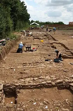
| ||
| Owmby | ? | Settlement | Owmby | ||||
| Saltersford | Causennis? | Settlement | Little Ponton and Stroxton | ||||
| Sapperton | Causennis? | Fortified Settlement | Sapperton | ||||
| Sleaford | Bannovalum? | Settlement | Sleaford | ||||
| Stow | Sidnacester | Settlement | Stow | ||||
| Tattershall | Drurobrivis | Settlement | Tattershall | ||||
| Torksey | Tiovulfingacester | Settlement | Torksey | ||||
| Wainfleet | Vainona | Settlement | Wainfleet | ||||
| Ulceby Cross | ? | Settlement | Ulceby | ||||
| Willoughby | Verometum | Settlement | Willoughby | ||||
| Winteringham | Ad Abum | Settlement | Winteringham |
Other
| Name | Roman Name | Type | Location | Coordinates | Dates | Notes | Image |
|---|---|---|---|---|---|---|---|
| Barrs Farm Villa | ? | Villa | Hemingby | TF24157331 | Historic England. "Monument No. 352988". Research records (formerly PastScape). | ||
| Baths | ? | Baths | Lincoln (Steep Hill/Danes Terrace) | ||||
| Baumber Cursus | ? | Cursus | Baumber | Possible Roman cursus | |||
| Bourne-Morton Canal | ? | Canal | Between Bourne and Morton | Only traceable through crop-marks. | |||
| Car Dyke | ? | Canal | Western Edge of The Fens | 85 miles long | 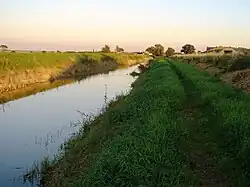
| ||
| Castellum Aquæ | ? | Water Tank | Lincoln (East Bight) | ||||
| Denton Villa | ? | Villa | Denton | SK87593094 | Historic England. "Monument No. 323786". Research records (formerly PastScape). | ||
| East Gate | ? | Gate | Lincoln (Eastgate) | 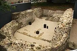
| |||
| Ermine Street | ? | Road | Between London and York, via Stamford, Grantham, Ancaster, Lincoln, Scunthorpe | 
| |||
| Forum | ? | Forum | Lincoln (Bailgate) | Granite stones mark locations of the now subsurface columns. | 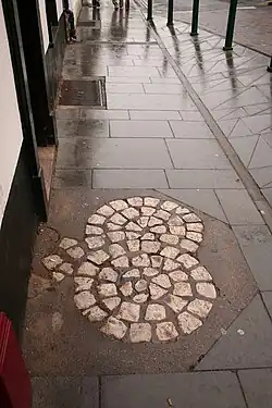
| ||
| Foss Dyke | ? | Canal | Between Lincoln and Torksey | c.120AD | |||
| Fosse Way | ? | Road | Between Exeter and Lincoln | 230 miles in length | 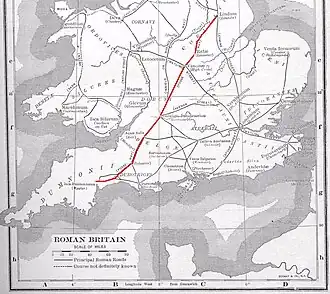
| ||
| Glentworth Hall Villa | ? | Villa | Glentworth | SK94378828 | Historic England. "Monument No. 920235". Research records (formerly PastScape). | ||
| Gravel Pit Farm Villa | ? | Villa | Kirton in Lindsey | SK939966 | Historic England. "Monument No. 1063122". Research records (formerly PastScape). | ||
| Gravestone | ? | Gravestone | Lincoln (St Mary le Wigford) | Reused by the Danes. Now set in the wall of the Norman tower. | 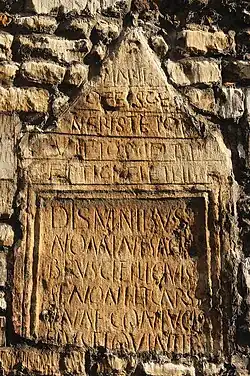
| ||
| Haceby Villa | ? | Villa | Haceby | TF01953692 | Historic England. "Monument No. 348661". Research records (formerly PastScape). | ||
| High Street | ? | Road | Between Horncastle and Caistor, via Baumber. Possibly on to The Humber. | Ancient Ridgeway used and straightened by the Romans. | |||
| Horkstow Villa | ? | Villa | Horkstow | SE98491914 | Historic England. "Monument No. 63618". Research records (formerly PastScape). | ||
| King Street | ? | Road | Between Peterborough and Ancaster via Bourne and Sapperton. | ||||
| Kirmond le Mire Villa | ? | Villa | Kirmond le Mire | TF183930 | Historic England. "Monument No. 893061". Research records (formerly PastScape). | ||
| Lady Well | ? | Natural Spring | Ancaster | Reputedly the water-source for Roman Ancaster. | |||
| Lead Coffin | ? | Coffin (Lead) | Baumber (Churchyard) | Found in Baumber churchyard in 1892. | |||
| Mareham Lane | ? | Road | Between Bourne and Sleaford, and possibly on to Lincoln. | ||||
| Mere Balk Lane | ? | Road | Between Stixwould and Saltfleetby, via Hemingby and Tathwell. | Reputedly of Roman Origin due to its straightness. | 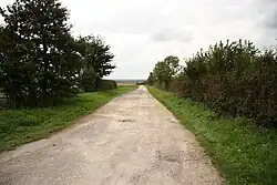
| ||
| Milestone | ? | Milestone | Lincoln (St Mary's Guildhall) | First Milestone south of Roman Lincoln. | |||
| Mint Wall | ? | Basicalla | Lincoln (West Bight) | 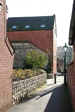
| |||
| Mount Pleasant Farm Villa | ? | Villa | Kirton in Lindsey | SE93940038 | Historic England. "Monument No. 63566". Research records (formerly PastScape). | ||
| Newport Arch | ? | Gate | Lincoln | 3rd century | Reputedly the oldest arch in the United Kingdom still used by traffic | _02.jpg)
| |
| Norton Disney Villa | ? | Villa | Norton Disney | SK85896028 | Historic England. "Monument No. 324486". Research records (formerly PastScape). | ||
| Owmby | ? | Settlement | Owmby | ||||
| Posterngate | ? | Gate | Lincoln (Saltersgate) | Under RBS Bank. Limited public access. | 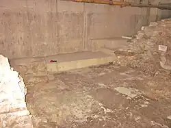
| ||
| Riseholme Barrow | ? | Burial Barrow | Riseholme | 1st century | |||
| Roxby Villa | ? | Villa | Roxby | SE92031697 | Historic England. "Monument No. 63684". Research records (formerly PastScape). | ||
| Scampton Villa | ? | Villa | Scampton | SK95527847 | Historic England. "Monument No. 326410". Research records (formerly PastScape). | ||
| South Gate (Upper) | ? | Gate | Lincoln (Steep Hill) | Fragments between numbers 25 and 26, and within 44, Steep Hill. | 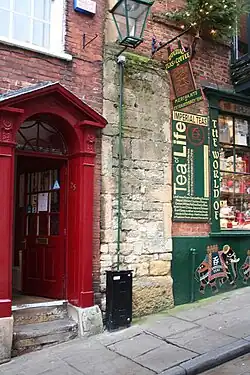
| ||
| St Paul in the Bail | ? | Church | Lincoln (Bailgate) | 4th century | 
| ||
| Stainby Villa | ? | Villa | Stainby | SK921222 | Historic England. "Monument No. 325510". Research records (formerly PastScape). | ||
| Stoke Rochford Villa | ? | Villa | Stoke Rochford | SK9328 | Historic England. "Monument No. 325445". Research records (formerly PastScape).; Historic England. "Monument No. 325448". Research records (formerly PastScape). | ||
| Sudbrooke Villa | ? | Villa | Sudbrooke | TF037765 | Excavated since 2005[1] | ||
| Till Bridge Lane | ? | Road | Between Ermine Street north of Lincoln and York, via Doncaster, Castleford and Tadcaster. | ||||
| Walesby Villa | ? | Villa | Walesby | TF14739262 | Historic England. "Monument No. 351895". Research records (formerly PastScape). | ||
| Wall | ? | City Wall | Lincoln | Surviving fragments throughout the city. | 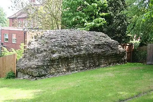
| ||
| Wall | ? | Town Wall | Horncastle | Surviving fragments throughout the town. | 
| ||
| Winterton Villa | ? | Villa | Winterton | SE90961799 | Historic England. "Monument No. 63693". Research records (formerly PastScape). | ||
| Well | ? | Well | Lincoln (Bailgate) | Next to St Paul in the Bail, now covered with glass screen. In use until the 17th century. | 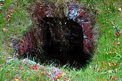
| ||
| West Gate (Lower) | ? | Gate | Lincoln (Orchard Street) | 3rd century | 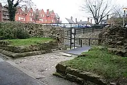
| ||
| West Gate (Upper) | ? | Gate | Lincoln (Westgate) | No remains currently visible. | 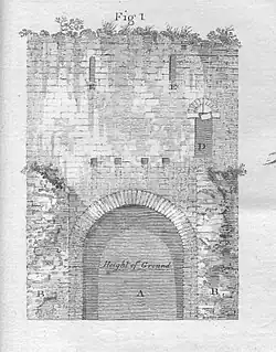
|