List of Noongar sites in the City of Melville
The City of Melville local government area lies within the traditional lands of the Beeliar people,[1] a subgroup of the Whadjuk dialectical group of the Noongar Indigenous Australians. These are several significant Noongar sites within the City of Melville.[2][3][4]
| Noongar name | European name | Notes |
|---|---|---|
| Willagee[5] | Willagee | Source of red ochre. |
| Marradungup | Atwell Gallery site | Meeting place and camping ground, including for local and visiting groups. |
| Jenalup | Blackwall Reach | Very sacred, with strong ties to the Dreamtime stories of all Western Australian Aboriginal people |
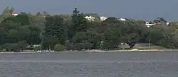
| Niergarup | Preston Point | Important place of ceremony and camping for local Noongar people. |
| Yagan Mia | Wireless Hill | Also known as Yagan's Lookout. A "home of the long-necked turtle", an important source of food.[4] |
| Bateman | The site of a large dispute with early settlers, in which many Noongar peopled died trying to protect their land. | |
| Melville Wetlands | Water is essential, and all water bodies have spiritual qualities for the Indigenous people. | |
| Booragoon Lake | Permanent camping ground for fishing and gathering. | |
| Murdoch University site, including North Lake | A burial site. | |
| Bidi Katitijiny[5] | Piney Lakes Reserve | Sacred place for women. Also used for young boys' level one initiation.[6] |
| Goolugatup | Point Heathcote | Permanent lookout, fishing and camping ground. Also used for level two initiation ceremonies. |
| Dyoondalup | Burke Drive | A source for quartz for axes and spearheads. Also used for men's business and level three initiation. |
| Dyoondalup | Point Walter | The sand bar was used as a river crossing. |
| Quaada Gabee | Bicton foreshore | Contained freshwater springs. |
| Moondaap[5] | Point Dundas | Place of the sharks |
| Margamangup | Lucky Bay foreshore (Attadale) | Fish were caught by hand from fish traps. |
| Kooyagoordup | Waylen Bay foreshore | |
| Doontanboro | Melville Water | |
| Wagoorjup | Canning Bridge | |
| Gabbi Kowangulup | Canning River mouth | |
| Booragoon | Canning River, lower reaches[7] | |
| Dyarlgarro Beeliar | Canning River[8] | |
| Gabbiljee | Bull Creek | The wetlands provide more foods than the surrounding drier areas. |
| Two Caves | Believed to be the final resting place of the Waarkarl or Rainbow Serpent. | |
| Marradungup[5] | Alfred Cove | The place where the hands are connected to the water. |
References
- ^ "Aboriginal History in the City of Melville". City of Melville. Retrieved 26 November 2018.
- ^ "Sites of Cultural Significance". City of Melville. Retrieved 26 November 2018.
- ^ Whadjuk Boodja : Aboriginal Land, City of Melville, 2016
- ^ a b Wayne, Emma (26 October 2024). "Aboriginal culture rediscovered through Noongar place names project". ABC News. Retrieved 26 October 2024.
- ^ a b c d "Melville | Place Names". Retrieved 13 July 2025.
- ^ "Bidi Katitjiny Aboriginal Women's Trail". City of Melville. Retrieved 26 November 2018.
- ^ "Perth suburb names". Landgate. 25 January 2017. Retrieved 20 May 2017.
- ^ "About the Whadjuk Region". Kaartdijin Noongar. South West Aboriginal Land & Sea Council. 28 June 2012. Retrieved 26 October 2024.