Lindon, Colorado
Lindon, Colorado | |
|---|---|
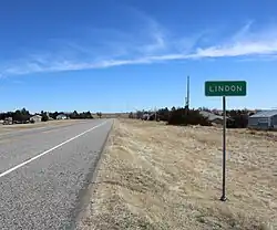 Looking east on U.S. Route 36 in Lindon | |
 Location in Washington County and the state of Colorado  Lindon, Colorado (the United States) | |
| Coordinates: 39°44′13″N 103°24′20″W / 39.73694°N 103.40556°W | |
| Country | |
| State | |
| County | Washington[1] |
| Elevation | 4,918 ft (1,499 m) |
| Time zone | UTC-7 (MST) |
| • Summer (DST) | UTC-6 (MDT) |
| ZIP code[2] | 80740 |
| GNIS feature ID | 0204815 |
Lindon is an unincorporated community and a U.S. Post Office located in Washington County, Colorado, United States. The Lindon Post Office has the ZIP Code 80740.[2]
Geography
Lindon is located at 39°44′13″N 103°24′20″W / 39.73694°N 103.40556°W (39.736894,-103.405552). Lindon's previous names included Linden and Harrisburg.
Climate
According to the Köppen Climate Classification system, Lindon has a cold semi-arid climate, abbreviated "BSk" on climate maps. The hottest temperature recorded in Lindon was 108 °F (42 °C) on June 25, 2012 and June 27, 2012, while the coldest temperature recorded was −30 °F (−34 °C) on December 22, 1989.[3]
| Climate data for Lindon, Colorado, 1991–2020 normals, extremes 1988–present | |||||||||||||
|---|---|---|---|---|---|---|---|---|---|---|---|---|---|
| Month | Jan | Feb | Mar | Apr | May | Jun | Jul | Aug | Sep | Oct | Nov | Dec | Year |
| Record high °F (°C) | 76 (24) |
79 (26) |
86 (30) |
90 (32) |
97 (36) |
108 (42) |
105 (41) |
105 (41) |
102 (39) |
92 (33) |
88 (31) |
76 (24) |
108 (42) |
| Mean maximum °F (°C) | 64.0 (17.8) |
67.0 (19.4) |
77.6 (25.3) |
83.1 (28.4) |
89.9 (32.2) |
98.0 (36.7) |
100.5 (38.1) |
98.4 (36.9) |
94.7 (34.8) |
86.6 (30.3) |
75.4 (24.1) |
65.1 (18.4) |
101.5 (38.6) |
| Mean daily maximum °F (°C) | 44.4 (6.9) |
46.5 (8.1) |
56.8 (13.8) |
63.9 (17.7) |
73.3 (22.9) |
85.3 (29.6) |
91.9 (33.3) |
89.5 (31.9) |
81.7 (27.6) |
67.8 (19.9) |
54.5 (12.5) |
44.6 (7.0) |
66.7 (19.3) |
| Daily mean °F (°C) | 28.7 (−1.8) |
30.8 (−0.7) |
40.1 (4.5) |
47.1 (8.4) |
57.0 (13.9) |
68.3 (20.2) |
74.8 (23.8) |
72.6 (22.6) |
64.0 (17.8) |
50.1 (10.1) |
38.0 (3.3) |
29.1 (−1.6) |
50.1 (10.0) |
| Mean daily minimum °F (°C) | 13.0 (−10.6) |
15.0 (−9.4) |
23.4 (−4.8) |
30.4 (−0.9) |
40.6 (4.8) |
51.3 (10.7) |
57.6 (14.2) |
55.6 (13.1) |
46.2 (7.9) |
32.5 (0.3) |
21.6 (−5.8) |
13.6 (−10.2) |
33.4 (0.8) |
| Mean minimum °F (°C) | −7.8 (−22.1) |
−5.6 (−20.9) |
5.7 (−14.6) |
15.9 (−8.9) |
26.3 (−3.2) |
38.3 (3.5) |
48.9 (9.4) |
46.9 (8.3) |
32.4 (0.2) |
14.8 (−9.6) |
2.6 (−16.3) |
−5.5 (−20.8) |
−14.5 (−25.8) |
| Record low °F (°C) | −25 (−32) |
−24 (−31) |
−20 (−29) |
0 (−18) |
11 (−12) |
30 (−1) |
40 (4) |
37 (3) |
25 (−4) |
−7 (−22) |
−15 (−26) |
−30 (−34) |
−30 (−34) |
| Average precipitation inches (mm) | 0.35 (8.9) |
0.33 (8.4) |
0.83 (21) |
1.50 (38) |
2.34 (59) |
2.28 (58) |
2.77 (70) |
2.44 (62) |
1.17 (30) |
0.94 (24) |
0.52 (13) |
0.29 (7.4) |
15.76 (399.7) |
| Average snowfall inches (cm) | 4.1 (10) |
3.9 (9.9) |
4.3 (11) |
2.8 (7.1) |
0.2 (0.51) |
0.0 (0.0) |
0.0 (0.0) |
0.0 (0.0) |
0.5 (1.3) |
2.1 (5.3) |
4.2 (11) |
4.8 (12) |
26.9 (68.11) |
| Average precipitation days (≥ 0.01 in) | 2.7 | 3.2 | 4.6 | 6.5 | 8.6 | 7.8 | 8.7 | 7.2 | 4.1 | 4.1 | 3.7 | 2.9 | 64.1 |
| Average snowy days (≥ 0.1 in) | 2.2 | 2.5 | 2.1 | 1.1 | 0.2 | 0.0 | 0.0 | 0.0 | 0.1 | 1.1 | 2.2 | 2.8 | 14.3 |
| Source 1: NOAA[4] | |||||||||||||
| Source 2: National Weather Service[3] | |||||||||||||
References
- ^ a b "US Board on Geographic Names". United States Geological Survey. October 25, 2007. Retrieved January 31, 2008.
- ^ a b "ZIP Code Lookup". United States Postal Service. December 28, 2006. Archived from the original (JavaScript/HTML) on November 22, 2010. Retrieved December 28, 2006.
- ^ a b "NOAA Online Weather Data". National Weather Service. Retrieved August 9, 2022.
- ^ "U.S. Climate Normals Quick Access". National Oceanic and Atmospheric Administration. Retrieved August 9, 2022.
Municipalities and communities of Washington County, Colorado, United States | ||
|---|---|---|
| Towns |  | |
| CDP | ||
| Unincorporated communities | ||
| Ghost towns |
| |