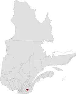
Les Sources Regional County Municipality
Les Sources | |
|---|---|
 | |
| Coordinates: 45°44′N 71°48′W / 45.733°N 71.800°W[1] | |
| Country | |
| Province | |
| Region | Estrie |
| Effective | January 1, 1982 |
| County seat | Val-des-Sources |
| Government | |
| • Type | Prefecture |
| • Prefect | Hugues Grimard |
| Area | |
• Total | 792.90 km2 (306.14 sq mi) |
| • Land | 787.13 km2 (303.91 sq mi) |
| Population (2016)[3] | |
• Total | 14,286 |
| • Density | 18.1/km2 (47/sq mi) |
| • Change 2011-2016 | |
| Time zone | UTC−5 (EST) |
| • Summer (DST) | UTC−4 (EDT) |
| Area code | 819 |
| Website | www |
| [4] | |
Les Sources (French pronunciation: [le suʁs]) is a regional county municipality in the Estrie region of Quebec, Canada. The seat is the city of Val-des-Sources. Before April 22, 2006 it was known as Asbestos regional county municipality, and before August 1990 it was known as L'Or-Blanc regional county municipality (French: white gold).
The Asbestos strike, a critical part of Quebec's labour history, occurred in the region.
Subdivisions
There are 7 subdivisions within the RCM:[2]
|
|
|
Demographics
Population
| Census | Population | Change (%) |
|---|---|---|
| 2016 | 14,286 | |
| 2011 | 14,756 | |
| 2006 | 14,466 | |
| 2001 | 14,535 | |
| 1996 | 15,005 | |
| 1991 | 15,381 | N/A |
Language
Mother tongue (2016)[3]
| Language | Population | Pct (%) |
|---|---|---|
| French only | 13,485 | 95.3% |
| English only | 420 | 3.0% |
| English and French | 90 | 0.6% |
| Other languages | 150 | 1.1% |
Transportation
Access Routes
Highways and numbered routes that run through the municipality, including external routes that start or finish at the county border:[6]
|
|
|
Attractions
- Burbank Pond Natural Interpretation Centre (Danville)
- Asbestos Musical Camp (Val-des-Sources)
- JM Asbestos Mine Visit (Val-des-Sources)
- The Little Happiness of Saint-Camille (Saint-Camille)
- Mineralogical Museum, and Museum Mine History (Val-des-Sources)
- Mont-Ham full air Centre (Saint-Joseph-de-Ham-Sud)
See also
References
- ^ "Banque de noms de lieux du Québec: Reference number 394146". toponymie.gouv.qc.ca (in French). Commission de toponymie du Québec.
- ^ a b c "Ministère des Affaires municipales, des Régions et de l'Occupation du territoire: Les Sources Regional County Municipality". Archived from the original on 2014-09-07. Retrieved 2012-03-11.
- ^ a b c d "Census Profile, 2016 Census: Les Sources, Municipalité régionale de comté [Census division], Quebec". Statistics Canada. Retrieved December 4, 2019.
- ^ 2011 Statistics Canada Census Profile: Les Sources (Asbestos) Regional County Municipality, Quebec
- ^ Statistics Canada: 1996, 2001, 2006, 2011 census
- ^ Official Transport Quebec Road Map
External links
Adjacent Counties & Equivalent Territories | |
|---|---|
| Regional county municipalities and equivalent territories | |
|---|---|
| Municipalities | |