Leffard
Leffard | |
|---|---|
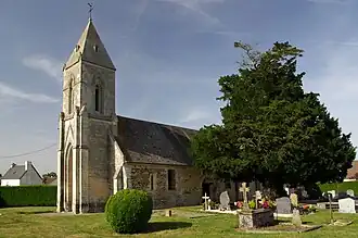 The church in Leffard | |
Location of Leffard | |
 Leffard  Leffard | |
| Coordinates: 48°55′05″N 0°18′10″W / 48.9181°N 0.3028°W | |
| Country | France |
| Region | Normandy |
| Department | Calvados |
| Arrondissement | Caen |
| Canton | Falaise |
| Intercommunality | Pays de Falaise |
| Government | |
| • Mayor (2020–2026) | Jean-Claude Meurgey[1] |
Area 1 | 6.89 km2 (2.66 sq mi) |
| Population (2022)[2] | 209 |
| • Density | 30/km2 (79/sq mi) |
| Time zone | UTC+01:00 (CET) |
| • Summer (DST) | UTC+02:00 (CEST) |
| INSEE/Postal code | 14360 /14700 |
| Elevation | 160–228 m (525–748 ft) (avg. 210 m or 690 ft) |
| 1 French Land Register data, which excludes lakes, ponds, glaciers > 1 km2 (0.386 sq mi or 247 acres) and river estuaries. | |
Leffard (French pronunciation: [lɛfaʁ] ⓘ) is a commune in the Calvados department in the Normandy region in northwestern France.
Geography
The commune is part of the area known as Suisse Normande.[3]
The commune is made up of the following collection of villages and hamlets, La Barberie, La Cocquerie, Les Champs Noyers, Le Frot, La Trébaudière and Leffard.[4]
The river Laize runs through the commune, along with three streams The Leffard, la Moussaye and The Etre.[5]
Neighbouring communes[4] | |
|---|---|
Population
| Year | Pop. | ±% |
|---|---|---|
| 1962 | 154 | — |
| 1968 | 147 | −4.5% |
| 1975 | 156 | +6.1% |
| 1982 | 180 | +15.4% |
| 1990 | 183 | +1.7% |
| 1999 | 168 | −8.2% |
| 2008 | 160 | −4.8% |
See also
References
- ^ "Répertoire national des élus: les maires". data.gouv.fr, Plateforme ouverte des données publiques françaises (in French). 9 August 2021.
- ^ "Populations de référence 2022" (in French). The National Institute of Statistics and Economic Studies. 19 December 2024.
- ^ "Map of Suisse Normande" (PDF).
- ^ a b "Leffard · France". Leffard · France.
- ^ Sandre. "Fiche cours d'eau - Laize (I25-0400)".
Wikimedia Commons has media related to Leffard.