Lantignié
Lantignié | |
|---|---|
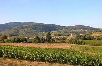 A general view of Lantignié | |
Location of Lantignié | |
 Lantignié  Lantignié | |
| Coordinates: 46°08′52″N 4°37′27″E / 46.1478°N 4.6242°E | |
| Country | France |
| Region | Auvergne-Rhône-Alpes |
| Department | Rhône |
| Arrondissement | Villefranche-sur-Saône |
| Canton | Belleville-en-Beaujolais |
| Intercommunality | Saône-Beaujolais |
| Government | |
| • Mayor (2020–2026) | Jean-Michel Tournissoux[1] |
Area 1 | 7.4 km2 (2.9 sq mi) |
| Population (2022)[2] | 851 |
| • Density | 120/km2 (300/sq mi) |
| Time zone | UTC+01:00 (CET) |
| • Summer (DST) | UTC+02:00 (CEST) |
| INSEE/Postal code | 69109 /69430 |
| Elevation | 256–841 m (840–2,759 ft) (avg. 295 m or 968 ft) |
| 1 French Land Register data, which excludes lakes, ponds, glaciers > 1 km2 (0.386 sq mi or 247 acres) and river estuaries. | |
Lantignié (French pronunciation: [lɑ̃tiɲe]) is a commune in the Rhône department in eastern France.
See also
References
- ^ "Répertoire national des élus: les maires". data.gouv.fr, Plateforme ouverte des données publiques françaises (in French). 2 December 2020.
- ^ "Populations de référence 2022" (in French). The National Institute of Statistics and Economic Studies. 19 December 2024.
Wikimedia Commons has media related to Lantignié.