Lac-Matawin
Lac-Matawin | |
|---|---|
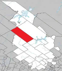 Location within Matawinie RCM. | |
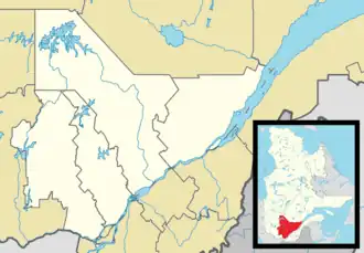 Lac-Matawin Location in central Quebec. | |
| Coordinates: 46°49′N 74°18′W / 46.817°N 74.300°W[1] | |
| Country | |
| Province | |
| Region | Lanaudière |
| RCM | Matawinie |
| Constituted | January 1, 1986 |
| Government | |
| • Federal riding | Joliette |
| • Prov. riding | Bertrand |
| Area | |
• Total | 793.80 km2 (306.49 sq mi) |
| • Land | 759.12 km2 (293.10 sq mi) |
| Population (2021)[3] | |
• Total | 10 |
| • Density | 0.0/km2 (0/sq mi) |
| • Pop 2016-2021 | |
| • Dwellings | 53 |
| Time zone | UTC−5 (EST) |
| • Summer (DST) | UTC−4 (EDT) |
| Highways | No major routes |
Lac-Matawin is an unorganized territory in the Lanaudière region of Quebec, Canada, part of the Matawinie Regional County Municipality.
See also
References
- ^ "Banque de noms de lieux du Québec: Reference number 149702". toponymie.gouv.qc.ca (in French). Commission de toponymie du Québec.
- ^ a b "Répertoire des municipalités: Geographic code 62908". www.mamh.gouv.qc.ca (in French). Ministère des Affaires municipales et de l'Habitation.
- ^ a b Statistics Canada 2021 Census - Lac-Matawin census profile
Adjacent Municipal Subdivisions | |
|---|---|
| Municipalities | |
|---|---|
| Parishes | |
| Unorganized territories | |
| |