Kuničky
Kuničky | |
|---|---|
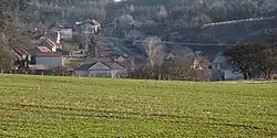 View from the west | |
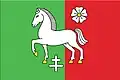 Flag 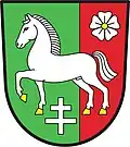 Coat of arms | |
 Kuničky Location in the Czech Republic | |
| Coordinates: 49°26′6″N 16°40′53″E / 49.43500°N 16.68139°E | |
| Country | |
| Region | South Moravian |
| District | Blansko |
| First mentioned | 1378 |
| Area | |
• Total | 4.29 km2 (1.66 sq mi) |
| Elevation | 530 m (1,740 ft) |
| Population (2025-01-01)[1] | |
• Total | 256 |
| • Density | 60/km2 (150/sq mi) |
| Time zone | UTC+1 (CET) |
| • Summer (DST) | UTC+2 (CEST) |
| Postal code | 679 02 |
| Website | www |
Kuničky is a municipality and village in Blansko District in the South Moravian Region of the Czech Republic. It has about 300 inhabitants.
Kuničky lies approximately 8 kilometres (5 mi) north of Blansko, 27 km (17 mi) north of Brno, and 179 km (111 mi) south-east of Prague.
Demographics
| Year | Pop. | ±% |
|---|---|---|
| 1869 | 245 | — |
| 1880 | 245 | +0.0% |
| 1890 | 298 | +21.6% |
| 1900 | 344 | +15.4% |
| 1910 | 358 | +4.1% |
| 1921 | 345 | −3.6% |
| 1930 | 417 | +20.9% |
| 1950 | 347 | −16.8% |
| 1961 | 354 | +2.0% |
| 1970 | 364 | +2.8% |
| 1980 | 318 | −12.6% |
| 1991 | 279 | −12.3% |
| 2001 | 267 | −4.3% |
| 2011 | 272 | +1.9% |
| 2021 | 280 | +2.9% |
| Source: Censuses[2][3] | ||
References
- ^ "Population of Municipalities – 1 January 2025". Czech Statistical Office. 2025-05-16.
- ^ "Historický lexikon obcí České republiky 1869–2011" (in Czech). Czech Statistical Office. 2015-12-21.
- ^ "Population Census 2021: Population by sex". Public Database. Czech Statistical Office. 2021-03-27.
External links
Wikimedia Commons has media related to Kuničky.