Krčmaň
Krčmaň | |
|---|---|
 Church of Saint Florian | |
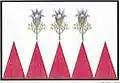 Flag 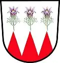 Coat of arms | |
 Krčmaň Location in the Czech Republic | |
| Coordinates: 49°31′15″N 17°20′39″E / 49.52083°N 17.34417°E | |
| Country | |
| Region | Olomouc |
| District | Olomouc |
| First mentioned | 1259 |
| Area | |
• Total | 4.98 km2 (1.92 sq mi) |
| Elevation | 223 m (732 ft) |
| Population (2025-01-01)[1] | |
• Total | 484 |
| • Density | 97/km2 (250/sq mi) |
| Time zone | UTC+1 (CET) |
| • Summer (DST) | UTC+2 (CEST) |
| Postal code | 779 00 |
| Website | www |
Krčmaň is a municipality and village in Olomouc District in the Olomouc Region of the Czech Republic. It has about 500 inhabitants.
Krčmaň lies approximately 11 kilometres (7 mi) south-east of Olomouc and 220 km (140 mi) east of Prague.
Demographics
| Year | Pop. | ±% |
|---|---|---|
| 1869 | 410 | — |
| 1880 | 506 | +23.4% |
| 1890 | 548 | +8.3% |
| 1900 | 601 | +9.7% |
| 1910 | 679 | +13.0% |
| 1921 | 700 | +3.1% |
| 1930 | 683 | −2.4% |
| 1950 | 581 | −14.9% |
| 1961 | 609 | +4.8% |
| 1970 | 574 | −5.7% |
| 1980 | 545 | −5.1% |
| 1991 | 488 | −10.5% |
| 2001 | 453 | −7.2% |
| 2011 | 448 | −1.1% |
| 2021 | 488 | +8.9% |
| Source: Censuses[2][3] | ||
References
- ^ "Population of Municipalities – 1 January 2025". Czech Statistical Office. 2025-05-16.
- ^ "Historický lexikon obcí České republiky 1869–2011" (in Czech). Czech Statistical Office. 2015-12-21.
- ^ "Population Census 2021: Population by sex". Public Database. Czech Statistical Office. 2021-03-27.
External links
Wikimedia Commons has media related to Krčmaň.