Kostelec u Heřmanova Městce
Kostelec u Heřmanova Městce | |
|---|---|
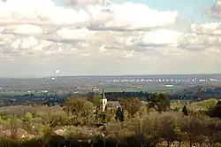 Church of Saints Peter and Paul | |
 Flag  Coat of arms | |
 Kostelec u Heřmanova Městce Location in the Czech Republic | |
| Coordinates: 49°55′24″N 15°39′6″E / 49.92333°N 15.65167°E | |
| Country | |
| Region | Pardubice |
| District | Chrudim |
| First mentioned | 1257 |
| Area | |
• Total | 7.48 km2 (2.89 sq mi) |
| Elevation | 330 m (1,080 ft) |
| Population (2025-01-01)[1] | |
• Total | 390 |
| • Density | 52/km2 (140/sq mi) |
| Time zone | UTC+1 (CET) |
| • Summer (DST) | UTC+2 (CEST) |
| Postal code | 538 03 |
| Website | www |
Kostelec u Heřmanova Městce is a municipality and village in Chrudim District in the Pardubice Region of the Czech Republic. It has about 400 inhabitants.
Administrative division
Kostelec u Heřmanova Městce consists of two municipal parts (in brackets population according to the 2021 census):[2]
- Kostelec u Heřmanova Městce (344)
- Tasovice (16)
Demographics
| Year | Pop. | ±% |
|---|---|---|
| 1869 | 487 | — |
| 1880 | 596 | +22.4% |
| 1890 | 595 | −0.2% |
| 1900 | 607 | +2.0% |
| 1910 | 605 | −0.3% |
| 1921 | 557 | −7.9% |
| 1930 | 549 | −1.4% |
| 1950 | 431 | −21.5% |
| 1961 | 433 | +0.5% |
| 1970 | 345 | −20.3% |
| 1980 | 298 | −13.6% |
| 1991 | 234 | −21.5% |
| 2001 | 266 | +13.7% |
| 2011 | 324 | +21.8% |
| 2021 | 360 | +11.1% |
| Source: Censuses[3][4] | ||
References
- ^ "Population of Municipalities – 1 January 2025". Czech Statistical Office. 2025-05-16.
- ^ "Public Census 2021 – basic data". Public Database (in Czech). Czech Statistical Office. 2022.
- ^ "Historický lexikon obcí České republiky 1869–2011" (in Czech). Czech Statistical Office. 2015-12-21.
- ^ "Population Census 2021: Population by sex". Public Database. Czech Statistical Office. 2021-03-27.
External links
Wikimedia Commons has media related to Kostelec u Heřmanova Městce.