Karints Rural LLG
Karints Rural LLG | |
|---|---|
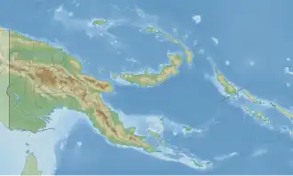 Karints Rural LLG Location within Papua New Guinea | |
| Coordinates: 6°01′23″S 143°36′11″E / 6.023°S 143.603°E | |
| Country | Papua New Guinea |
| Province | Southern Highlands Province |
| Time zone | UTC+10 (AEST) |
Karints Rural LLG is a local-level government (LLG) of Southern Highlands Province, Papua New Guinea.[1][2]
Wards
- 01. Puinj 1
- 02. Puinj 2
- 03. Map 1
- 04. Map 2
- 05. Wambip 1
- 06. Imila
- 07. Melant
- 08. Humbura 1
- 09. Humbura 2
- 10. Tulum 1
- 11. Tulum 2
- 12. Posulim
- 13. Pembi
- 14. Kusi
- 15. Pingirip
- 16. Semb Marep 1
- 17. Marep 2
- 18. Paip
- 19. Mulim
- 20. Heip
- 21. Bela
- 22. Kamberep
- 23. Was 1
- 24. Was 2
- 25. Topa
- 26. Hum
References
- ^ "Census Figures by Wards - Highlands Region". www.nso.gov.pg. 2011 National Population and Housing Census: Ward Population Profile. Port Moresby: National Statistical Office, Papua New Guinea. 2014. Archived from the original on 2019-05-18. Retrieved 2019-11-24.
- ^ "Final Figures". www.nso.gov.pg. 2011 National Population and Housing Census: Ward Population Profile. Port Moresby: National Statistical Office, Papua New Guinea. 2014. Archived from the original on 2015-09-06. Retrieved 2019-11-24.
- OCHA FISS (2018). "Papua New Guinea administrative level 0, 1, 2, and 3 population statistics and gazetteer". Humanitarian Data Exchange. 1.31.9.
- United Nations in Papua New Guinea (2018). "Papua New Guinea Village Coordinates Lookup". Humanitarian Data Exchange. 1.31.9.
| Ialibu-Pangia District | ||
|---|---|---|
| Imbonggu District | ||
| Kagua-Erave District | ||
| Mendi-Munihu District | ||
| Nipa-Kutubu District | ||