Karakalpakia (town)
Karakalpakia
Karakalpakiya | |
|---|---|
Urban-type settlement | |
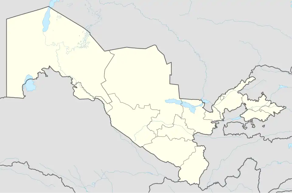 Karakalpakia Location in Uzbekistan | |
| Coordinates: 44°46′00″N 56°12′00″E / 44.76667°N 56.20000°E | |
| Country | |
| Autonomous Republic | |
| District | Qońırat District |
| Population (2016) | |
• Total | 4,500 |
| Time zone | UTC+5 (UZT) |
Karakalpakia (Karakalpak: Karakalpakiya) is an urban-type settlement of Qońırat district in the autonomous Republic of Karakalpakstan in Uzbekistan.[1] Its population was 3,013 people in 1989,[2] and 4,500 in 2016.[3]
Climate
Karakalpakia has a continental desert climate (Köppen: BWk),[4]
| Climate data for Karakalpakia (1991–2020) | |||||||||||||
|---|---|---|---|---|---|---|---|---|---|---|---|---|---|
| Month | Jan | Feb | Mar | Apr | May | Jun | Jul | Aug | Sep | Oct | Nov | Dec | Year |
| Mean daily maximum °C (°F) | −2.8 (27.0) |
−0.6 (30.9) |
8.7 (47.7) |
19.2 (66.6) |
27.1 (80.8) |
33.3 (91.9) |
35.5 (95.9) |
34.0 (93.2) |
26.4 (79.5) |
17.5 (63.5) |
6.3 (43.3) |
−0.6 (30.9) |
17.0 (62.6) |
| Daily mean °C (°F) | −6.5 (20.3) |
−5.2 (22.6) |
2.8 (37.0) |
12.2 (54.0) |
20.0 (68.0) |
26.0 (78.8) |
28.4 (83.1) |
26.4 (79.5) |
18.6 (65.5) |
10.1 (50.2) |
1.3 (34.3) |
−4.4 (24.1) |
10.8 (51.4) |
| Mean daily minimum °C (°F) | −9.8 (14.4) |
−9.1 (15.6) |
−1.8 (28.8) |
6.1 (43.0) |
12.9 (55.2) |
18.2 (64.8) |
20.7 (69.3) |
18.4 (65.1) |
11.2 (52.2) |
3.8 (38.8) |
−2.8 (27.0) |
−7.7 (18.1) |
5.0 (41.0) |
| Average precipitation mm (inches) | 15.3 (0.60) |
11.9 (0.47) |
19.2 (0.76) |
21.6 (0.85) |
16.4 (0.65) |
14.3 (0.56) |
8.1 (0.32) |
5.5 (0.22) |
4.5 (0.18) |
11.4 (0.45) |
17.1 (0.67) |
14.6 (0.57) |
159.9 (6.30) |
| Average precipitation days (≥ 1.0 mm) | 13 | 11 | 9 | 7 | 8 | 6 | 5 | 3 | 3 | 5 | 9 | 13 | 92 |
| Mean monthly sunshine hours | 95.8 | 130.8 | 184.4 | 231.1 | 305.6 | 346.5 | 356.7 | 341.0 | 280.0 | 223.1 | 125.7 | 86.3 | 2,707 |
| Source: NOAA[5] | |||||||||||||
References
- ^ "Classification system of territorial units of the Republic of Uzbekistan" (in Uzbek and Russian). The State Committee of the Republic of Uzbekistan on statistics. July 2020.
- ^ Population census-1989
- ^ Soliyev, A.S. Shaharlar geografiyasi [Geography of cities] (PDF) (in Uzbek). p. 147., listed as "Qoraqalpogʻistan"
- ^ "Table 1 Overview of the Köppen-Geiger climate classes including the defining criteria". Nature: Scientific Data.
- ^ "World Meteorological Organization Climate Normals for 1991-2020 — Karakalpakia". National Oceanic and Atmospheric Administration. Retrieved January 19, 2024.
Capital: Nukus | ||
| Districts | 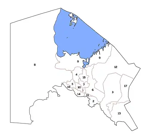 | |
| Cities | ||
| Towns | ||