Könnigde
Könnigde | |
|---|---|
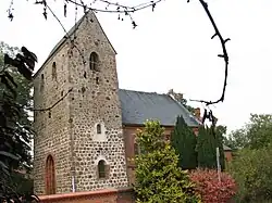 A church in Könnigde | |
 Coat of arms | |
Location of Könnigde | |
 Könnigde 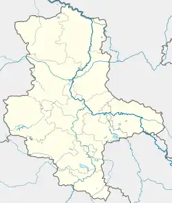 Könnigde | |
| Coordinates: 52°38′N 11°34′E / 52.633°N 11.567°E | |
| Country | Germany |
| State | Saxony-Anhalt |
| District | Stendal |
| Town | Bismark |
| Area | |
• Total | 6.59 km2 (2.54 sq mi) |
| Elevation | 38 m (125 ft) |
| Population (2006-12-31) | |
• Total | 164 |
| • Density | 25/km2 (64/sq mi) |
| Time zone | UTC+01:00 (CET) |
| • Summer (DST) | UTC+02:00 (CEST) |
| Postal codes | 39629 |
| Dialling codes | 039089 |
| Vehicle registration | SDL |
Könnigde is a village and a former municipality in the district of Stendal, in Saxony-Anhalt, Germany.
Since 1 January 2010, it is part of the town Bismark.[1]
References
- ^ "Gebietsänderungen vom 01. Januar bis 31. Dezember 2010" (in German). Federal Statistical Office of Germany. Retrieved 9 November 2024.