Kámen (Děčín District)
Kámen | |
|---|---|
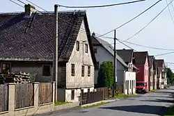 Houses in the centre of Kámen | |
_Flag.jpg) Flag _CoA.png) Coat of arms | |
 Kámen Location in the Czech Republic | |
| Coordinates: 50°48′37″N 14°16′7″E / 50.81028°N 14.26861°E | |
| Country | |
| Region | Ústí nad Labem |
| District | Děčín |
| First mentioned | 1720 |
| Area | |
• Total | 1.78 km2 (0.69 sq mi) |
| Elevation | 337 m (1,106 ft) |
| Population (2025-01-01)[1] | |
• Total | 253 |
| • Density | 140/km2 (370/sq mi) |
| Time zone | UTC+1 (CET) |
| • Summer (DST) | UTC+2 (CEST) |
| Postal code | 407 13 |
| Website | www |
Kámen (German: Heidenstein) is a municipality and village in Děčín District in the Ústí nad Labem Region of the Czech Republic. It has about 300 inhabitants.
Kámen lies approximately 8 kilometres (5 mi) north-east of Děčín, 23 km (14 mi) north-east of Ústí nad Labem, and 81 km (50 mi) north of Prague.
Demographics
| Year | Pop. | ±% |
|---|---|---|
| 1869 | 354 | — |
| 1880 | 373 | +5.4% |
| 1890 | 359 | −3.8% |
| 1900 | 333 | −7.2% |
| 1910 | 336 | +0.9% |
| 1921 | 355 | +5.7% |
| 1930 | 359 | +1.1% |
| 1950 | 216 | −39.8% |
| 1961 | 251 | +16.2% |
| 1970 | 213 | −15.1% |
| 1980 | 188 | −11.7% |
| 1991 | 145 | −22.9% |
| 2001 | 154 | +6.2% |
| 2011 | 191 | +24.0% |
| 2021 | 259 | +35.6% |
| Source: Censuses[2][3] | ||
References
- ^ "Population of Municipalities – 1 January 2025". Czech Statistical Office. 2025-05-16.
- ^ "Historický lexikon obcí České republiky 1869–2011" (in Czech). Czech Statistical Office. 2015-12-21.
- ^ "Population Census 2021: Population by sex". Public Database. Czech Statistical Office. 2021-03-27.
External links
Wikimedia Commons has media related to Kámen (Děčín District).