Jimi Rural LLG
Jimi Rural LLG | |
|---|---|
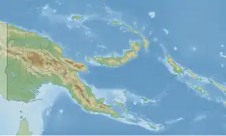 Jimi Rural LLG Location within Papua New Guinea | |
| Coordinates: 5°34′10″S 144°39′35″E / 5.569576°S 144.659631°E | |
| Country | Papua New Guinea |
| Province | Jiwaka Province |
| Time zone | UTC+10 (AEST) |
Jimi Rural LLG is a local-level government (LLG) of Jiwaka Province, Papua New Guinea.[1][2]
Wards
- Mogini
- Koriom
- Kwiop
- Togoban
- Kwima
- Kupeng
- Kompiai
- Tswenkai
- Bokopai
- Yumbigema
- Koinambe
- Kandabiamb
- Tsembant
- Gunjiji
- Gondobend
- Waim
- Tsarep
- Marent
- Tsendiap
- Tumbunki
- Runimp
- Wum
- Tsenga
- Maikmol
- Toli
- Ongolmol
- Kaul
- Karap
- Manemp
- Magin
- Korenju
- Tabibuga
- Tsingoropa
- Kwipun
- Telta
- Menjim 2
References
- ^ "Census Figures by Wards - Highlands Region". www.nso.gov.pg. 2011 National Population and Housing Census: Ward Population Profile. Port Moresby: National Statistical Office, Papua New Guinea. 2014. Archived from the original on 2019-05-18. Retrieved 2019-11-24.
- ^ "Final Figures". www.nso.gov.pg. 2011 National Population and Housing Census: Ward Population Profile. Port Moresby: National Statistical Office, Papua New Guinea. 2014. Archived from the original on 2015-09-06. Retrieved 2019-11-24.
- OCHA FISS (2018). "Papua New Guinea administrative level 0, 1, 2, and 3 population statistics and gazetteer". Humanitarian Data Exchange. 1.31.9.
- United Nations in Papua New Guinea (2018). "Papua New Guinea Village Coordinates Lookup". Humanitarian Data Exchange. 1.31.9.