Jestřebí (Náchod District)
Jestřebí | |
|---|---|
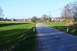 View from the southwest | |
_vlajka.jpg) Flag _znak.jpg) Coat of arms | |
 Jestřebí Location in the Czech Republic | |
| Coordinates: 50°21′44″N 16°10′56″E / 50.36222°N 16.18222°E | |
| Country | |
| Region | Hradec Králové |
| District | Náchod |
| First mentioned | 1459 |
| Area | |
• Total | 4.30 km2 (1.66 sq mi) |
| Elevation | 448 m (1,470 ft) |
| Population (2025-01-01)[1] | |
• Total | 170 |
| • Density | 40/km2 (100/sq mi) |
| Time zone | UTC+1 (CET) |
| • Summer (DST) | UTC+2 (CEST) |
| Postal code | 549 01 |
| Website | www |
Jestřebí (German: Habichtsau) is a municipality and village in Náchod District in the Hradec Králové Region of the Czech Republic. It has about 200 inhabitants. It lies in the Metuje River valley.
Demographics
| Year | Pop. | ±% |
|---|---|---|
| 1869 | 222 | — |
| 1880 | 209 | −5.9% |
| 1890 | 194 | −7.2% |
| 1900 | 197 | +1.5% |
| 1910 | 204 | +3.6% |
| 1921 | 198 | −2.9% |
| 1930 | 175 | −11.6% |
| 1950 | 130 | −25.7% |
| 1961 | 161 | +23.8% |
| 1970 | 163 | +1.2% |
| 1980 | 189 | +16.0% |
| 1991 | 175 | −7.4% |
| 2001 | 169 | −3.4% |
| 2011 | 151 | −10.7% |
| 2021 | 132 | −12.6% |
| Source: Censuses[2][3] | ||
References
- ^ "Population of Municipalities – 1 January 2025". Czech Statistical Office. 2025-05-16.
- ^ "Historický lexikon obcí České republiky 1869–2011" (in Czech). Czech Statistical Office. 2015-12-21.
- ^ "Population Census 2021: Population by sex". Public Database. Czech Statistical Office. 2021-03-27.
External links
Wikimedia Commons has media related to Jestřebí (Náchod District).