Japan National Route 179
 | ||||
|---|---|---|---|---|
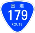
| 国道179号 | ||||
 | ||||
| Route information | ||||
| Length | 158.7 km[1] (98.6 mi) | |||
| Existed | 1 April 1963–present | |||
| Major junctions | ||||
| North end | ||||
| South end | ||||
| Location | ||||
| Country | Japan | |||
| Highway system | ||||
| ||||
National Route 179 is a national highway of Japan connecting Himeji, Hyōgo and Yurihama, Tottori in Japan, with a total length of 158.7 km (98.61 mi).
History
Route 179 originally ran from Tsuyama to Chizu. This was redesignated as Route 53 in 1963.
References
- ^ "一般国道の路線別、都道府県別道路現況" [Road statistics by General National Highway route and prefecture] (PDF) (in Japanese). Ministry of Land, Infrastructure, Transport and Tourism. Retrieved 18 February 2020.
Wikimedia Commons has media related to Route 179 (Japan).