Jackfork Sandstone
| Jackfork Sandstone | |
|---|---|
| Stratigraphic range: Pennsylvanian | |
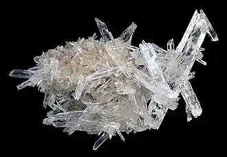 Quartz from the Jackfork Sandstone | |
| Type | Formation |
| Underlies | Johns Valley Shale |
| Overlies | Stanley Shale |
| Thickness | 3,500 to 6,000 feet |
| Lithology | |
| Primary | Sandstone |
| Other | Shale, conglomerate |
| Location | |
| Region | Ouachita Mountains |
| Country | United States |
| Type section | |
| Named for | Jackfork Mountain, Pittsburg and Pushmataha Counties, Oklahoma[1] |
| Named by | J. A. Taff, 1902 |
The Jackfork Sandstone, also referred to as the Jackfork Group, is a geologic formation associated with the Ouachita Fold and Thrust Belt exposed in western Arkansas and southeastern Oklahoma.[2] It is named for Jackfork Mountain in Pittsburg and Pushmataha counties, Oklahoma.[2][3]
The Jackfork Sandstone is a thin- to massive-bedded, fine- to coarse-grained, brown, tan, or gray quartzitic sandstone with subordinate brown, silty sandstone and dark gray shale.[2] It outcrops from Pulaski County, Arkansas in the east to Atoka County, Oklahoma in the west, a distance of over 200 miles. It is highly weather-resistant, resulting in a continuous chain of prominent ridges, including Rich Mountain, the second highest natural point in the Ouachita Mountains.
Paleoflora
- A. parksii[4]
- Archaeocalamites
- A. stanleyensis[4]
- L. subclypeatum[4]
- L. peniculus[4]
- N. antecedens[4]
- Rhabdocarpos
- R. costatulus[4]
- Rhynchogonium
- R. choctavense[4]
- Sigillaria[4]
- Trigonocarpum
References
- ^ Taff, J.A. (1902). "Description of the Atoka quadrangle". U.S. Geological Survey Geological Atlas of the United States. 79: 4.
- ^ a b c "Stratigraphic Summary of the Arkansas River Valley and Ouachita Mountains". Arkansas Geological Survey. Archived from the original on 2018-05-29. Retrieved 2017-12-15.
- ^ Joseph A. Taff (1902). "Description of the Atoka Quadrangle" (PDF). Folios of the Geologic Atlas. 79: 4. doi:10.3133/GF79. Wikidata Q63225784.
- ^ a b c d e f g h i j k l m n White, David (1937). "Fossil plants from the Stanley Shale and Jackfork Sandstone in southeastern Oklahoma and western Arkansas" (PDF). U.S. Geological Survey Professional Paper. 186-C: 43–66.