Jack, Alabama
Jack, Alabama | |
|---|---|
 Jack, Alabama  Jack, Alabama | |
| Coordinates: 31°34′27″N 86°00′01″W / 31.57417°N 86.00028°W | |
| Country | United States |
| State | Alabama |
| County | Coffee |
| Elevation | 390 ft (119 m) |
| Time zone | UTC-6 (Central (CST)) |
| • Summer (DST) | UTC-5 (CDT) |
| ZIP code | 36346 |
| Area code | 334 |
| GNIS feature ID | 156519[1] |
Jack is an unincorporated community in Coffee County, Alabama, United States. Jack is located on Alabama State Route 87, 11.7 miles (18.8 km) north-northeast of Elba. Jack has a post office with ZIP code 36346.[2][3] Jack has a single K-12 school, Zion Chapel. There are 1,379 residents in Jack, with a median age of 44.9. Of this, 46.56% are males and 53.44% are females.
References
- ^ "Jack". Geographic Names Information System. United States Geological Survey, United States Department of the Interior.
- ^ United States Postal Service (2012). "USPS - Look Up a ZIP Code". Retrieved February 15, 2012.
- ^ "Postmaster Finder - Post Offices by ZIP Code". United States Postal Service. Archived from the original on October 17, 2020. Retrieved January 14, 2013.
Municipalities and communities of Coffee County, Alabama, United States | ||
|---|---|---|
| Cities | 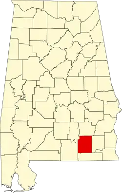 | |
| Towns | ||
| Unincorporated communities | ||
| Footnotes | ‡This populated place also has portions in an adjacent county or counties | |