Ixtlán District
Ixtlán District | |
|---|---|
District | |
 Oaxaca regions and districts: Sierra Norte to the Northeast | |
| Coordinates: 17°19′50″N 96°29′14″W / 17.33056°N 96.48722°W | |
| Country | |
| State | Oaxaca |
| Population (2010) | |
• Total | 37,753 |
Ixtlán District is located in the Sierra Norte region, in the northeastern area of the State of Oaxaca, Mexico.
The district includes 26 municipalities, bringing together a total of 161 settlements. At the 2000 census, they contained a total of 40,218 inhabitants, the majority of whom were indigenous Zapotec speakers.[1]
-
 Scenery near Santo Domingo Cacalotepec
 -
 Entrance to church in Capulalpam de Méndez
 -
 Main street of Guelatao de Juarez
 -
 General view of Ixtlan de Juárez
 -
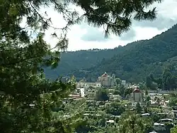
 An economically sustainable, community-owned fish farm, located near Ixtlan.
 -
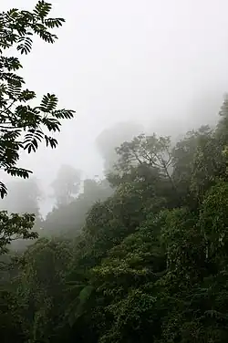 The Cloud Forest of Santiago Comaltepec is some of the best conserved in the world
Municipalities
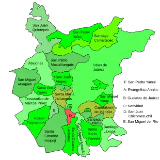
The district includes the following municipalities:[2]
- Abejones
- Capulalpam de Méndez
- Evangelista Analco
- Guelatao de Juárez
- Ixtlán de Juárez
- Natividad
- Nuevo Zoquiapam
- San Juan Atepec
- San Juan Chicomezúchil
- San Juan Quiotepec
- San Miguel Aloápam
- San Miguel Amatlán
- San Miguel del Río
- San Miguel Yotao
- San Pablo Macuiltianguis
- San Pedro Yaneri
- San Pedro Yólox
- Santa Ana Yareni
- Santa Catarina Ixtepeji
- Santa Catarina Lachatao
- Santa María Jaltianguis
- Santa María Yavesía
- Santiago Comaltepec
- Santiago Laxopa
- Santiago Xiacuí
- Teococuilco de Marcos Pérez
See also
References
- ^ El Premio Gobierno y Gestión Local. "Associatióon de Municipios del Distrito de Ixtlán de Juárez". Archived from the original on 2009-12-28. Retrieved 2010-07-08. (in Spanish)
- ^ "Enciclopedia de los Municipios de México: Estado de Oaxaca". Archived from the original on 2010-07-10. Retrieved 2010-07-08.