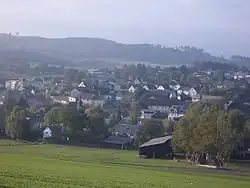
Issigau
Issigau | |
|---|---|
 Issigau | |
 Coat of arms | |
Location of Issigau within Hof district 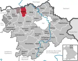 | |
 Issigau 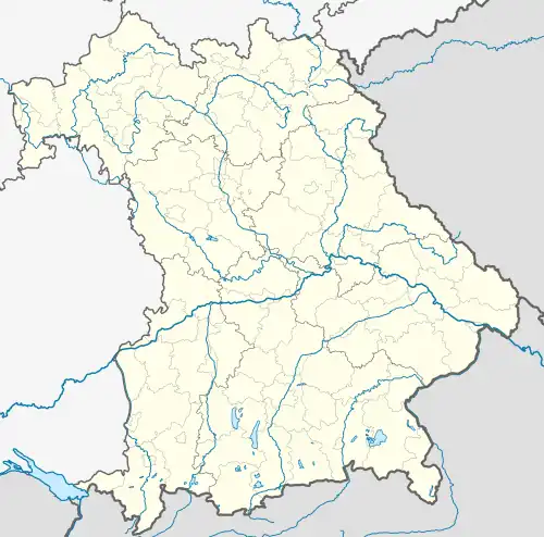 Issigau | |
| Coordinates: 50°22′N 11°43′E / 50.367°N 11.717°E | |
| Country | Germany |
| State | Bavaria |
| Admin. region | Oberfranken |
| District | Hof |
| Municipal assoc. | Lichtenberg, Bavaria |
| Subdivisions | 10 Ortsteile |
| Government | |
| • Mayor (2020–26) | Dieter Gemeinhardt[1] (CSU) |
| Area | |
• Total | 18.69 km2 (7.22 sq mi) |
| Elevation | 524 m (1,719 ft) |
| Population (2024-12-31)[2] | |
• Total | 978 |
| • Density | 52/km2 (140/sq mi) |
| Time zone | UTC+01:00 (CET) |
| • Summer (DST) | UTC+02:00 (CEST) |
| Postal codes | 95188 |
| Dialling codes | 09293 |
| Vehicle registration | HO |
| Website | www.issigau.de |
Issigau is a municipality in Upper Franconia in the district of Hof in Bavaria in Germany. In lies on the Issig River.
References
- ^ Liste der ersten Bürgermeister/Oberbürgermeister in kreisangehörigen Gemeinden, Bayerisches Landesamt für Statistik, 15 July 2021.
- ^ "Gemeinden, Kreise und Regierungsbezirke in Bayern, Einwohnerzahlen am 31. Dezember 2024; Basis Zensus 2022" [Municipalities, counties, and administrative districts in Bavaria; Based on the 2022 Census] (CSV) (in German). Bayerisches Landesamt für Statistik.
Towns and municipalities in Hof (district) | ||
|---|---|---|
 | ||