Isera
Isera | |
|---|---|
| Comune di Isera | |
Location of Isera | |
 Isera Location of Isera in Italy 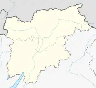 Isera Isera (Trentino-Alto Adige/Südtirol) | |
| Coordinates: 45°53′N 11°1′E / 45.883°N 11.017°E | |
| Country | Italy |
| Region | Trentino-Alto Adige/Südtirol |
| Province | Trentino (TN) |
| Frazioni | Marano, Cornalé, Reviano, Folaso, Patone, Lenzima, Bordala |
| Area | |
• Total | 14.1 km2 (5.4 sq mi) |
| Population (Dec. 2004)[2] | |
• Total | 2,496 |
| • Density | 180/km2 (460/sq mi) |
| Demonym | Iserotti |
| Time zone | UTC+1 (CET) |
| • Summer (DST) | UTC+2 (CEST) |
| Postal code | 38060 |
| Dialing code | 0464 |
| Patron saint | San Vincenzo |
| Website | Official website |
Isera (Iséra in local dialect) is a comune (municipality) in Trentino in the northern Italian region Trentino-Alto Adige/Südtirol, located about 20 kilometres (12 mi) southwest of Trento. As of 31 December 2004, it had a population of 2,496 and an area of 14.1 square kilometres (5.4 sq mi).[3]
The municipality of Isera contains the frazioni (subdivisions, mainly villages and hamlets) Marano, Cornalé, Reviano, Folaso, Patone, Lenzima and Bordala.
Isera borders the following municipalities: Villa Lagarina, Ronzo-Chienis, Rovereto, Nogaredo and Mori.
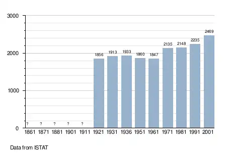
Demographic evolution
References
- ^ "Superficie di Comuni Province e Regioni italiane al 9 ottobre 2011". Italian National Institute of Statistics. Retrieved 16 March 2019.
- ^ "Popolazione Residente al 1° Gennaio 2018". Italian National Institute of Statistics. Retrieved 16 March 2019.
- ^ All demographics and other statistics: Italian statistical institute Istat.
External links
- (in Italian) Homepage of the city