Interstate 75
 Interstate 75 | |
|---|---|
I-75 highlighted in red | |
| Route information | |
| Length | 1,786.47 mi[1] (2,875.04 km) |
| Existed | 1957–present |
| NHS | Entire route |
| Major junctions | |
| South end | |
| |
| North end | Canadian border on Int'l Bridge at the Sault Sainte Marie Border Crossing |
| Location | |
| Country | United States |
| States | Florida, Georgia, Tennessee, Kentucky, Ohio, Michigan |
| Highway system | |
Interstate 75 (I-75) is a major north–south Interstate Highway in the Great Lakes and Southeastern regions of the United States. As with most Interstates that end in 5, it is a major cross-country, north–south route, traveling from State Road 826 (SR 826, Palmetto Expressway) and SR 924 (Gratigny Parkway) on the Hialeah–Miami Lakes border (northwest of Miami, Florida) to Sault Ste. Marie, Michigan, at the Canadian border. It is the second-longest north–south Interstate Highway (after I-95) and the seventh-longest Interstate Highway overall.[2]
I-75 passes through six different states. The highway runs the length of the Florida peninsula from the Miami area and up the Gulf Coast through Tampa. Farther north in Georgia, I-75 continues on through Macon and Atlanta before running through Chattanooga and Knoxville and the Cumberland Mountains in Tennessee. I-75 crosses Kentucky, passing through Lexington before crossing the Ohio River into Cincinnati, Ohio. In Ohio, the highway runs up the western side through Dayton and Lima before crossing into Michigan north of Toledo. I-75 runs northeasterly along the Lake Erie shoreline and Detroit River into the city of Detroit before turning northwesterly to Flint and northward to the Mackinac Bridge where the freeway crosses the strait between Lakes Huron and Michigan. Farther north, I-75 approaches the Canadian border at Sault Ste. Marie, downriver from Lake Superior, 1,786.5 miles (2,875.1 km) from its origins near the subtropical Atlantic Ocean.
Route description
| mi[1] | km | |
|---|---|---|
| FL | 470.88 | 757.81 |
| GA | 355.11 | 571.49 |
| TN | 161.86 | 260.49 |
| KY | 191.78 | 308.64 |
| OH | 211.30 | 340.05 |
| MI | 395.54 | 636.56 |
| Total | 1786.47 | 2875.04 |


Florida
I-75 starts at an interchange with SR 924 and SR 826 on the Hialeah–Miami Lakes border in suburban Miami. After an intersection with the Homestead Extension of Florida's Turnpike and an interchange with I-595 and the Sawgrass Expressway (SR 869), the Interstate leaves the Miami metropolitan area and turns westward to travel through the Everglades along the tolled Alligator Alley, which brings the highway to the Gulf Coast and Naples, where it again heads north. Passing through Bonita Springs, Fort Myers, and Sarasota, I-75 is six lanes all the way to Georgia. The freeway enters the Tampa Bay area before the interchange with I-275 northbound, which handles St. Petersburg-bound traffic. Within the Tampa metro are three more major junctions: one with the Lee Roy Selmon Expressway which carries traffic into Downtown Tampa, one with I-4 (a turbine interchange) which carries traffic across the center of the state to the East Coast, and another as I-275 traffic defaults back onto northbound. The freeway proceeds to enter suburban portions of Pasco, Hernando, and Sumter counties on its way to Ocala and Gainesville. At Lake City, Florida, I-10, intersects with I-75. Afterward, the northmost stretch of I-75 in Florida exits the Sunshine State into southern Georgia.
Georgia
I-75 enters Georgia near Lake Park, and it continues northward through the towns of Valdosta, Tifton, and Cordele until it reaches the Macon area, where it intersects with I-16 eastbound toward I-75's route. After Macon, it passes the small town of Forsyth. The freeway reaches no major junctions again until in the Atlanta metropolitan area. The first metropolitan freeway met is I-675, then followed by I-285, Atlanta's only beltway dubbed as the Perimeter Beltway. It crosses inside the I-285 beltway and heads north several miles toward Downtown Atlanta. I-75 then runs concurrently with I-85 due north over the Downtown Connector through the central business district of Atlanta, where it intersects with I-20. The areas where I-85 and I-75 run concurrently are some of the most traffic-prone Interstate Highways in the nation. After the two Interstates split, I-75 diverts from I-85 and heads toward the northwest suburbs of Atlanta, with the major cities being Marietta and Kennesaw that it bypasses. To the northwest of Marietta, the highway runs concurrently with I-575. After the interchange with I-575, the highway leaves the Atlanta metro area and traverses the Blue Ridge Mountains in the north Georgia region as it heads toward Chattanooga.
Tennessee
The freeway enters Tennessee directly in the Chattanooga metropolitan area, where it intersects with I-24. Exiting Chattanooga to the northeast, I-75 passes through an area known for dense fog. Twelve people were killed and 42 were injured in a 1990 I-75 fog disaster on that stretch of I-75 in heavy fog on December 11, 1990.[3] I-75 does not meet any other freeways until it overlaps I-40 near Farragut and heads eastbound. Together, they enter the outskirts of Knoxville, where I-75 overlaps itself with a different road, this time I-640, but only for a short time. When the two meet I-275, I-75 encounters some of its highest points of elevation through the Cumberland Mountains, cutting through the uppermost peaks and ridges.
Kentucky
I-75 continues northbound through the hilly terrain of the Cumberland Plateau region of Kentucky, passing through London and Richmond and eventually reaching Lexington, where it briefly runs concurrently with I-64 before splitting off in the direction of Georgetown. Afterward, the route heads in the direction of Ohio. Near Walton, I-71 runs concurrently with I-75 for the next 20 miles (32 km) or so and heads toward Cincinnati. The two concurrent Interstates then make an interchange with I-275, the Cincinnati beltway. After passing through Covington, the I-71/I-75 highway traverses the Ohio River via the lower level of the Brent Spence Bridge and continues into Downtown Cincinnati.
Ohio
Immediately after entering Cincinnati, I-75 diverges from I-71, remaining generally due north through the Cincinnati metro area while I-71 curves more to the east and northeast through downtown Cincinnati and its surrounding suburbs. I-74, Ohio State Route 562, and Ohio State Route 126 all intersect the freeway as it makes its way northward. After another interchange with the I-275 beltway, the freeway continues within the metro area, passing through Middletown and heading toward Dayton, where I-675, I-70, and U.S. Route 35 have interchanges with I-75. The interchange of I-75 with I-70 is known as the Freedom Veterans Crossroads.[4] After exiting the city of Dayton, I-75 makes its way northbound through Ohio, passing through smaller cities of Troy, Piqua, Sidney, Wapakoneta, Lima, Findlay and Bowling Green before finally reaching Toledo located on the western shore of Lake Erie and the border of Michigan. I-75 meets the I-475 interchange in the southern suburbs of Toledo in Perrysburg and then I-80, I-90, and the Ohio Turnpike. As the Interstate passes through downtown Toledo, I-475 meets with I-75 again just north of the downtown area of Toledo. It then continues through some industrial areas as it progresses north before approaching I-280, which is the last major junction in Ohio. I-75 then passes by the Lake Erie neighborhoods of Shoreland and Point Place, just before entering the US state of Michigan with the sign welcoming motorists to Michigan.
Michigan
Upon entering Michigan, I-75 follows the northwestern shore of Lake Erie, passing through the residential neighborhoods of Toledo and Luna Pier until about Monroe in which it then heads northeast to enter Detroit. The freeway has an interchange with I-275 in northern Monroe County. On a further note, it does not meet with any major junctions until in Downtown Detroit. Once near downtown, I-75 meets several interchanges: an interchange that leads into Canada via the Ambassador Bridge (international bridge border crossing) to Windsor, Ontario; an interchange with I-375; I-94; I-96; M-10; M-8. I-696 also intersects I-75 in the northern metro area. When the freeway reaches Pontiac, there is a junction with M-59 and in Flint further northward. It meets I-475 and I-69 and overlaps U.S. Route 23 (US 23). The Interstate then heads north toward Saginaw where I-675 acts as a spur route into the city. Further north in Bay City, US 10 provides access to Midland as well as downtown Bay City. When it nears Standish, US 23 diverts from I-75 to Lake Huron, where it heads further north. The last major interchange in the state of Michigan before it crosses the international border into Canada is at 4 Mile Road just south of Grayling where US 127 ends with traffic merging onto northbound I-75 and southbound taking drivers through the center of the state. At Mackinaw City, I-75 has interchanges with US 31 and US 23 before crossing the Mackinac Bridge to reach the Upper Peninsula of Michigan. I-75 is the only Interstate located in the Upper Peninsula of Michigan and it continues until it crosses the Canadian border via the Sault Ste. Marie International Bridge.
History
This limited access highway that was planned in the 1950s roughly follows the general route of many older at-grade highways, including US 2, US 27, US 25, and US 41, among others. Some of these older US Highways (several of which are still in existence) previously had replaced the eastern route of the old Dixie Highway.
I-75 was planned to end in Tampa, Florida, in the original plan for 41,000 miles (66,000 km) of Interstate Highways. However, beginning in the 1960s, there was a huge growth in the population of Southwest Florida (Sarasota, Fort Myers, Naples, Cape Coral, etc.), hence the need for new highways, especially a north–south freeway, as well as one connecting Florida's Gulf Coast to South Florida.[5] At first, Florida state legislators proposed a toll in the new highway, and, by 1968, it was decided that the federal government would pay 90 percent toward the extension of I-75 to southwestern and southeastern Florida.[6] This included subsuming a toll highway from Naples to the Fort Lauderdale area, the Alligator Alley, and furthermore to connect this expressway with I-95 in North Miami—though due to some local opposition, I-75 presently ends a few miles short of I-95.
I-75 was completed in Kentucky in 1970. The last segment in Michigan opened to traffic on November 1, 1973.[7] The last section of I-75 in Tennessee was completed on December 20, 1974.[8] On December 21, 1977, I-75 was completed from Tampa to Sault Ste. Marie with its final segment opening between northern Marietta and Cartersville, Georgia. It was estimated to have cost $3.5 billion in 1977 dollars (equivalent to $13.7 billion in 2023[9]) to build the original section.[10] The final stretch of I-75 in South Florida was completed in 1986 in Miami-Dade and Broward counties, and the last stretch to receive the signs for I-75 was the reconstructed (rebuilt and widened) Alligator Alley on November 25, 1992.[11]
On September 7, 2024, the Interstate 75 Kentucky Shooting occurred near London, Kentucky in which multiple shots were fired at cars passing by, injuring 5.
Junction list
- Florida
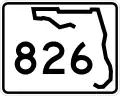
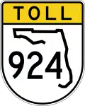 SR 826 / SR 924 on the Hialeah–Miami Lakes city line
 I-595 on the Davie–Sunrise-Weston tripoint
 US 27 in Weston
 US 17 on the Solana–Cleveland CDP line
 US 301 in Ellenton
 I-275 east-northeast of Terra Ceia
- US 301 in Palm River-Clair Mel
 I-4 in Mango
- I-275 on the Lutz–Wesley Chapel CDP line
 US 98 west-northwest of Ridge Manor
 Florida's Turnpike southeast of Ocala
- US 27 in Ocala
 US 441 in Alachua
 US 41 / US 441 in Ellisville
 US 90 in Lake City
 I-10 west-northwest of Five Points
 US 129 north-northeast of Suwannee Springs
- Georgia

 US 84 / US 221 in Valdosta
- US 41 northwest of Valdosta. The highways travel concurrently to Hahira.
 US 82 in Tifton
- US 41 in Tifton
 US 280 in Cordele
- US 41 in Unadilla
- US 41 in Perry
 US 341 in Perry
 I-475 southwest of Macon
- US 41 in Macon
 US 80 in Macon
 I-16 in Macon
 US 23 northwest of Macon
- I-475 northwest of Bolingbroke
 I-675 in Stockbridge
 US 19 / US 41 west of Morrow
 I-285 in Forest Park
- US 19 / US 41 on the Atlanta–Hapeville city line
 I-85 in Atlanta. The highways travel concurrently through Atlanta.
 I-20 in Atlanta

 US 29 / US 78 / US 278 in Atlanta
- I-85 in Atlanta. End of the concurrency with I-85.
- US 41 in Atlanta
- US 41 in Atlanta
- I-285 in Cumberland
 I-575 north-northwest of Marietta
 US 411 in Cartersville
- US 41 in Resaca
 US 41 / US 76 in Dalton
- US 41 / US 76 southeast of Ringgold
- Tennessee
- US 41 / US 76 in East Ridge
 I-24 on the East Ridge–Chattanooga city line
 US 11 / US 64 in Chattanooga. The highways travel concurrently to north of
Collegedale.
US 11 / US 64 in Chattanooga. The highways travel concurrently to north of
Collegedale. US 74 in Cleveland
 US 321 in Lenoir City
 I-40 west of Farragut. The highways travel concurrently to Knoxville.
 I-140 in Knoxville
 US 11 / US 70 in Knoxville
 I-40 / I-640 in Knoxville. I-75/I-640 travels concurrently through Knoxville.
 US 25W in Knoxville. The highways travel concurrently through Knoxville.
- I-275 / I-640 / US 25W in Knoxville
- US 441 in Rocky Top
- US 25W in Rocky Top. The highways travel concurrently to Caryville.
- US 25W in Jellico
- Kentucky
- US 25W in Goldbug
- US 25W in Corbin
 US 25 east-southeast of Mount Vernon
- US 25 in Mount Vernon
- US 25 in Richmond
 US 25 / US 421 south-southeast of Lexington. The highways travel concurrently to Lexington.
 US 60 in Lexington
 I-64 in Lexington. The highways travel concurrently through Lexington.
 US 27 / US 68 in Lexington
 US 460 in Georgetown
 US 62 in Georgetown
 I-71 in Walton. The highways travel concurrently to Cincinnati, Ohio.
 US 42 / US 127 in Florence
- I-275 in Erlanger
- US 25 / US 42 / US 127 in Fort Mitchell
- US 25 / US 42 / US 127 in Covington
- Ohio

 US 22 / US 27 / US 42 / US 52 / US 127 in Cincinnati
 US 50 in Cincinnati
- US 27 / US 52 / US 127 in Cincinnati. I-75/US 27/US 52 travel concurrently through Cincinnati.
 I-74 / US 27 / US 52 / US 127 in Cincinnati
- I-275 in Sharonville
- I-675 southeast of Miamisburg
 US 35 in Dayton
 I-70 in Vandalia
 US 40 in Vandalia
 US 36 in Piqua
 US 33 in Wapakoneta
- US 68 in Findlay
 US 224 in Findlay
 US 6 in Bowling Green
- I-475 / US 23 in Perrysburg. I-75/US 23 travels concurrently through Perrysburg.
 US 20 / US 23 in Perrysburg
 I-80 / I-90 in Rossford
 US 24 in Toledo
- I-475 in Toledo
 I-280 in Toledo
- Michigan
- I-275 north-northeast of Monroe
- US 24 in Taylor
 I-96 in Detroit
 I-375 in Detroit
 I-94 in Detroit
 I-696 on the Ferndale–Hazel Park–Royal Oak–Madison Heights city line
- US 24 west-northwest of Clarkston
- I-475 west of Grand Blanc
- US 23 south-southwest of Flint. The highways travel concurrently to southwest of Standish.
 I-69 in Flint
- I-475 west of Beecher
- I-675 east of Saginaw
- I-675 north-northwest of Zilwaukee
 US 10 west of Bay City
- US 127 south of Grayling
 US 31 north-northeast of Carp Lake
- US 23 in Mackinaw City
 US 2 in St. Ignace
- Sault Ste. Marie International Bridge at the Canada–United States border in Sault Ste. Marie
Auxiliary routes
- Tampa–St. Petersburg, Florida: I-175 (not directly connected), I-275, I-375 (not directly connected)
- Macon, Georgia: I-475
- Atlanta, Georgia: I-675
- Suburban spur to Canton, Georgia: I-575 in the Atlanta area
- Knoxville, Tennessee: I-275
- Cincinnati, Ohio: I-275
- Dayton, Ohio: I-675
- Toledo, Ohio: I-475
- Detroit, Michigan: I-275, I-375
- Flint, Michigan: I-475
- Saginaw, Michigan: I-675
1Cancelled | ||
References
- ^ a b DeSimone, Tony (October 31, 2002). "Table 1: Main Routes of the Dwight D. Eisenhower National System Of Interstate and Defense Highways as of October 31, 2002". Route Log and Finder List. Federal Highway Administration. Archived from the original on April 22, 2012. Retrieved October 2, 2007.
- ^ "7 of the Longest U.S. Interstates That Are Worth the Road Trip". Popular Mechanics. July 19, 2022. Archived from the original on December 26, 2022.
- ^ Staff (October 28, 1992). "Safety Recommendation in reply to H-92-92" (PDF). National Transportation Safety Board. Archived (PDF) from the original on October 9, 2022. Retrieved December 28, 2008.
- ^ Keeter, Brian (October 25, 2004). "Nation's Top Highway Official Dedicates Key Dayton, Ohio, Interstate Interchange to State's Military Personnel" (Press release). Federal Highway Administration. Archived from the original on June 24, 2011. Retrieved March 26, 2011.
- ^ "West Coast Turnpike Study Ordered By Kirk". St. Petersburg Times. April 20, 1967. p. 1B.
- ^ "I-75 Extension Should Kill Toll Road - Cramer". Daytona Beach Morning Journal. August 16, 1968. p. 16.
- ^ "Around the State: West Branch". Traverse City Record-Eagle. United Press International. November 2, 1973. p. 3. OCLC 30098364. Archived from the original on July 11, 2018. Retrieved July 10, 2018 – via Newspapers.com.
- ^ "Dunn Opens 96 Interstate Miles". The Tennessean. Nashville. December 21, 1974. p. 32. Archived from the original on June 14, 2019. Retrieved April 18, 2018 – via Newspapers.com.
- ^ Johnston, Louis; Williamson, Samuel H. (2023). "What Was the U.S. GDP Then?". MeasuringWorth. Retrieved November 30, 2023. United States Gross Domestic Product deflator figures follow the MeasuringWorth series.
- ^ Ayres, B. Drummond (December 22, 1977). "I-75 Link Opens First Full Interstate Route". The New York Times. p. 14. Archived from the original on December 4, 2021. Retrieved December 4, 2021.
- ^ Staff. "Previous Interstate Facts of the Day". Celebrating the Eisenhower Interstate Highway System. Federal Highway Administration. Archived from the original on April 26, 2006. Retrieved May 11, 2010.
- ^ Rand McNally (2014). The Road Atlas (Walmart ed.). Chicago: Rand McNally. pp. 26–29, 43, 50–51, 78, 80, 95. ISBN 978-0-528-00771-2.
- Rand McNally (2005). The Road Atlas (Map) (2005 ed.). Chicago: Rand McNally. ISBN 9780886408473.
- Transportation Statistics Office. "GIS Data / Map Directory". Florida Department of Transportation. Archived from the original on February 6, 2007.
- Pavement Management Office (February 2, 2007). "Pavement Management Reports". Florida Department of Transportation. Archived from the original on February 3, 2007.
- Office of Transportation Data (2003). Interstate Mileage Report (438 Report) (PDF) (Report). Georgia Department of Transportation. Archived from the original (PDF) on February 18, 2006.
External links
 Geographic data related to Interstate 75 at OpenStreetMap
- Interstate 75 at Michigan Highways
- Interstate 75 on Cincinnati-Transit.net
| Signed | |
|---|---|
| Unsigned | |
| Lists | |
| Other | |
Routes in italics are no longer a part of the system. Major Interstates are highlighted. | |