Indian Springs, Texas
Indian Springs, Texas | |
|---|---|
| Coordinates: 30°41′21″N 94°44′56″W / 30.68917°N 94.74889°W | |
| Country | |
| State | |
| County | Polk |
| Area | |
• Total | 1.9 sq mi (4.9 km2) |
| • Land | 1.8 sq mi (4.7 km2) |
| • Water | 0.1 sq mi (0.2 km2) |
| Elevation | 358 ft (109 m) |
| Population (2010) | |
• Total | 785 |
| • Density | 410/sq mi (160/km2) |
| Time zone | UTC-6 (Central (CST)) |
| • Summer (DST) | UTC-5 (CDT) |
| Zip Code | 77351 |
| GNIS feature ID | 2586941[1] |
Indian Springs is a census-designated place (CDP) in Polk County, Texas, United States. This was a new CDP for the 2010 census, with a population of 785.[2]
Geography
Indian Springs has a total area of 1.9 square miles (4.9 km2), of which 1.8 square miles (4.7 km2) is land and 0.1 square miles (0.26 km2) is water.[3]
Demographics
| Census | Pop. | Note | %± |
|---|---|---|---|
| 2010 | 785 | — | |
| 2020 | 892 | 13.6% | |
| U.S. Decennial Census[4] 1850–1900[5] 1910[6] 1920[7] 1930[8] 1940[9] 1950[10] 1960[11] 1970[12] 1980[13] 1990[14] 2000[15] 2010[16] 2020[17] | |||
Indian Springs first appeared as a census designated place in the 2010 U.S. Census.[16]
2020 census
| Race / Ethnicity (NH = Non-Hispanic) | Pop 2010[18] | Pop 2020[17] | % 2010 | % 2020 |
|---|---|---|---|---|
| White alone (NH) | 709 | 750 | 90.32% | 84.08% |
| Black or African American alone (NH) | 2 | 7 | 0.25% | 0.78% |
| Native American or Alaska Native alone (NH) | 28 | 37 | 3.57% | 4.15% |
| Asian alone (NH) | 7 | 2 | 0.89% | 0.22% |
| Native Hawaiian or Pacific Islander alone (NH) | 0 | 0 | 0.00% | 0.00% |
| Other race alone (NH) | 0 | 1 | 0.00% | 0.11% |
| Mixed race or Multiracial (NH) | 2 | 44 | 0.25% | 4.93% |
| Hispanic or Latino (any race) | 37 | 51 | 4.71% | 5.72% |
| Total | 785 | 892 | 100.00% | 100.00% |
Education
The community is within the Livingston Independent School District.[19]
References
- ^ a b U.S. Geological Survey Geographic Names Information System: Indian Springs, Texas
- ^ "Population and Housing Unit Counts, 2010 Census of Population and Housing" (PDF). Texas: 2010.
- ^ "Indian Springs, Texas :: Boundary Map of Indian Springs, Texas". Maptechnica.com. Retrieved December 18, 2016.
- ^ "Decennial Census by Decade". United States Census Bureau.
- ^ "1900 Census of Population - Population of Texas By Counties And Minor Civil Divisions" (PDF). United States Census Bureau.
- ^ "1910 Census of Population - Supplement for Texas" (PDF). United States Census Bureau.
- ^ "1920 Census of Population - Number of Inhabitants - Texas" (PDF). United States Census Bureau.
- ^ "1930 Census of Population - Number of Inhabitants - Texas" (PDF). United States Census Bureau.
- ^ "1940 Census of Population - Number of Inhabitants - Texas" (PDF). United States Census Bureau.
- ^ "1950 Census of Population - Number of Inhabitants - Texas" (PDF). United States Census Bureau.
- ^ "1960 Census of Population - Number of Inhabitants - Texas" (PDF). United States Census Bureau.
- ^ "1970 Census of Population - Number of Inhabitants - Texas" (PDF). United States Census Bureau.
- ^ "1980 Census of Population - Number of Inhabitants - Texas" (PDF). United States Census Bureau.
- ^ "1990 Census of Population - Population and Housing Unit Counts - Texas" (PDF). United States Census Bureau.
- ^ "2000 Census of Population - Population and Housing Unit Counts - Texas" (PDF). United States Census Bureau.
- ^ a b "2010 Census of Population - Population and Housing Unit Counts - Texas" (PDF). United States Census Bureau.
- ^ a b "P2 Hispanic or Latino, and Not Hispanic or Latino by Race – 2020: DEC Redistricting Data (PL 94-171) – Indian Springs CDP, Texas". United States Census Bureau.
- ^ "P2 Hispanic or Latino, and Not Hispanic or Latino by Race – 2010: DEC Redistricting Data (PL 94-171) – Indian Springs CDP, Texas". United States Census Bureau.
- ^ "2020 CENSUS - SCHOOL DISTRICT REFERENCE MAP: Polk County, TX" (PDF). U.S. Census Bureau. Retrieved December 4, 2021.
Municipalities and communities of Polk County, Texas, United States | ||
|---|---|---|
| Cities | 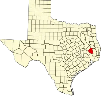 | |
| Towns | ||
| CDPs | ||
| Other communities | ||
| Ghost town | ||
| Indian reservation | ||
| Footnotes | ‡This populated place also has portions in an adjacent county or counties | |