Huayacundo Arma District
Huayacundo Arma
Wayakuntu Arma | |
|---|---|
 | |
| Country | |
| Region | Huancavelica |
| Province | Huaytará |
| Founded | February 9, 1962 |
| Capital | Huayacundo Arma |
| Area | |
• Total | 12.81 km2 (4.95 sq mi) |
| Elevation | 3,150 m (10,330 ft) |
| Population | |
• Total | 448 |
| • Density | 35/km2 (91/sq mi) |
| Time zone | UTC-5 (PET) |
| UBIGEO | 090604 |
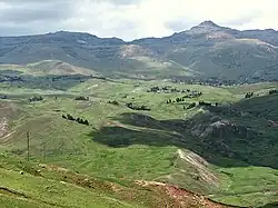
Huayacundo Arma District is one of sixteen districts of the province Huaytará in Peru.[1]
References
- ^ (in Spanish) Instituto Nacional de Estadística e Informática. Banco de Información Distrital Archived 2008-04-23 at the Wayback Machine. Retrieved April 11, 2008.
| |
|---|---|
| Acobamba | |
| Angaraes | |
| Castrovirreyna | |
| Churcampa | |
| Huancavelica | |
| Huaytará | |
| Tayacaja | |
13°32′02″S 75°18′53″W / 13.5340°S 75.3146°W