Hruška (Prostějov District)
Hruška | |
|---|---|
%252C_n%C3%A1ves.jpg) Church of Saint John of Nepomuk | |
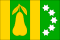 Flag 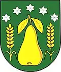 Coat of arms | |
 Hruška Location in the Czech Republic | |
| Coordinates: 49°21′32″N 17°13′36″E / 49.35889°N 17.22667°E | |
| Country | |
| Region | Olomouc |
| District | Prostějov |
| First mentioned | 1078 |
| Area | |
• Total | 4.48 km2 (1.73 sq mi) |
| Elevation | 220 m (720 ft) |
| Population (2025-01-01)[1] | |
• Total | 258 |
| • Density | 58/km2 (150/sq mi) |
| Time zone | UTC+1 (CET) |
| • Summer (DST) | UTC+2 (CEST) |
| Postal code | 798 27 |
| Website | www |
Hruška is a municipality and village in Prostějov District in the Olomouc Region of the Czech Republic. It has about 300 inhabitants.
Hruška lies approximately 16 kilometres (10 mi) south-east of Prostějov, 27 km (17 mi) south of Olomouc, and 218 km (135 mi) east of Prague.
Demographics
| Year | Pop. | ±% |
|---|---|---|
| 1869 | 409 | — |
| 1880 | 439 | +7.3% |
| 1890 | 456 | +3.9% |
| 1900 | 521 | +14.3% |
| 1910 | 512 | −1.7% |
| 1921 | 489 | −4.5% |
| 1930 | 524 | +7.2% |
| 1950 | 414 | −21.0% |
| 1961 | 435 | +5.1% |
| 1970 | 368 | −15.4% |
| 1980 | 330 | −10.3% |
| 1991 | 278 | −15.8% |
| 2001 | 258 | −7.2% |
| 2011 | 223 | −13.6% |
| 2021 | 236 | +5.8% |
| Source: Censuses[2][3] | ||
References
- ^ "Population of Municipalities – 1 January 2025". Czech Statistical Office. 2025-05-16.
- ^ "Historický lexikon obcí České republiky 1869–2011" (in Czech). Czech Statistical Office. 2015-12-21.
- ^ "Population Census 2021: Population by sex". Public Database. Czech Statistical Office. 2021-03-27.
External links
Wikimedia Commons has media related to Hruška (Prostějov District).