Hobbs Run
| Hobbs Run Tributary to Dunkard Creek | |
|---|---|
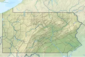 Location of Hobbs Run mouth  Hobbs Run (the United States) | |
| Location | |
| Country | United States |
| State | Pennsylvania |
| County | Greene County |
| Physical characteristics | |
| Source | Calvin Run divide |
| • location | about 2 miles northwest of Mount Morris, Pennsylvania[2] |
| • coordinates | 39°45′21″N 080°05′31″W / 39.75583°N 80.09194°W[1] |
| • elevation | 1,240 ft (380 m)[2] |
| Mouth | Dunkard Creek |
• location | at Mount Morris, Pennsylvania[2] |
• coordinates | 39°43′59″N 080°04′27″W / 39.73306°N 80.07417°W[1] |
• elevation | 900 ft (270 m)[1] |
| Length | 1.88 mi (3.03 km)[3] |
| Basin size | 0.70 square miles (1.8 km2)[4] |
| Discharge | |
| • location | Dunkard Creek |
| • average | 1.03 cu ft/s (0.029 m3/s) at mouth with Dunkard Creek[4] |
| Basin features | |
| Progression | generally southeast[3] |
| River system | Monongahela River |
| Tributaries | |
| • left | unnamed tributaries |
| • right | unnamed tributaries |
| Bridges | Hobbs Run Road (x2), Big Shannon Run Road |
Hobbs Run is a 1.88 mi (3.03 km) long first-order tributary to Dunkard Creek in Greene County. This is the only stream of this name in the United States.
Course
Hobbs Run rises about 2 miles south of Mount Morris, Pennsylvania and then flows southeasterly to join Dunkard Creek at Mount Morris, Pennsylvania.[2]
Watershed
Hobbs Run drains 0.70 square miles (1.8 km2) of area, receives about 43.1 in/year of precipitation, and is about 84% forested.[4]
See also
References
- ^ a b c "Geographic Names Information System". edits.nationalmap.gov. US Geological Survey. Retrieved April 5, 2024.
- ^ a b c d "Map Viewer". www.arcgis.com. US Geological Survey. Retrieved April 4, 2024.
- ^ a b "ArcGIS Web Application". epa.maps.arcgis.com. US EPA. Retrieved April 4, 2024.
- ^ a b c "Hobbs Run Watershed Report". watersgeo.epa.gov. US EPA. Retrieved April 5, 2024.