Hlubočec
Hlubočec | |
|---|---|
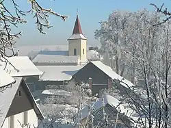 Chapel of Saints John and Paul | |
 Flag 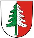 Coat of arms | |
 Hlubočec Location in the Czech Republic | |
| Coordinates: 49°50′26″N 17°58′13″E / 49.84056°N 17.97028°E | |
| Country | |
| Region | Moravian-Silesian |
| District | Opava |
| First mentioned | 1487 |
| Area | |
• Total | 9.38 km2 (3.62 sq mi) |
| Elevation | 441 m (1,447 ft) |
| Population (2025-01-01)[1] | |
• Total | 574 |
| • Density | 61/km2 (160/sq mi) |
| Time zone | UTC+1 (CET) |
| • Summer (DST) | UTC+2 (CEST) |
| Postal code | 747 69 |
| Website | www |
Hlubočec (German: Tiefengrund) is a municipality and village in Opava District in the Moravian-Silesian Region of the Czech Republic. It has about 600 inhabitants.
History
The first written mention of Hlubočec is from 1487.[2]
Demographics
| Year | Pop. | ±% |
|---|---|---|
| 1869 | 617 | — |
| 1880 | 661 | +7.1% |
| 1890 | 663 | +0.3% |
| 1900 | 700 | +5.6% |
| 1910 | 727 | +3.9% |
| 1921 | 672 | −7.6% |
| 1930 | 715 | +6.4% |
| 1950 | 614 | −14.1% |
| 1961 | 615 | +0.2% |
| 1970 | 553 | −10.1% |
| 1980 | 576 | +4.2% |
| 1991 | 554 | −3.8% |
| 2001 | 543 | −2.0% |
| 2011 | 564 | +3.9% |
| 2021 | 572 | +1.4% |
| Source: Censuses[3][4] | ||
References
- ^ "Population of Municipalities – 1 January 2025". Czech Statistical Office. 2025-05-16.
- ^ "Historie obce Hlubočec" (in Czech). Obec Hlubočec. Retrieved 2022-03-02.
- ^ "Historický lexikon obcí České republiky 1869–2011" (in Czech). Czech Statistical Office. 2015-12-21.
- ^ "Population Census 2021: Population by sex". Public Database. Czech Statistical Office. 2021-03-27.
External links
Wikimedia Commons has media related to Hlubočec.