Hlohová
Hlohová | |
|---|---|
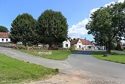 Centre of Hlohová | |
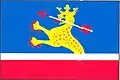 Flag 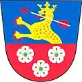 Coat of arms | |
 Hlohová Location in the Czech Republic | |
| Coordinates: 49°32′3″N 13°4′29″E / 49.53417°N 13.07472°E | |
| Country | |
| Region | Plzeň |
| District | Domažlice |
| First mentioned | 1357 |
| Area | |
• Total | 6.66 km2 (2.57 sq mi) |
| Elevation | 412 m (1,352 ft) |
| Population (2025-01-01)[1] | |
• Total | 294 |
| • Density | 44/km2 (110/sq mi) |
| Time zone | UTC+1 (CET) |
| • Summer (DST) | UTC+2 (CEST) |
| Postal code | 345 61 |
| Website | www |
Hlohová is a municipality and village in Domažlice District in the Plzeň Region of the Czech Republic. It has about 300 inhabitants.
Hlohová lies approximately 15 kilometres (9 mi) north-east of Domažlice, 33 km (21 mi) south-west of Plzeň, and 115 km (71 mi) south-west of Prague.
Demographics
| Year | Pop. | ±% |
|---|---|---|
| 1869 | 507 | — |
| 1880 | 504 | −0.6% |
| 1890 | 522 | +3.6% |
| 1900 | 573 | +9.8% |
| 1910 | 601 | +4.9% |
| 1921 | 648 | +7.8% |
| 1930 | 584 | −9.9% |
| 1950 | 455 | −22.1% |
| 1961 | 421 | −7.5% |
| 1970 | 377 | −10.5% |
| 1980 | 321 | −14.9% |
| 1991 | 256 | −20.2% |
| 2001 | 244 | −4.7% |
| 2011 | 233 | −4.5% |
| 2021 | 273 | +17.2% |
| Source: Censuses[2][3] | ||
References
- ^ "Population of Municipalities – 1 January 2025". Czech Statistical Office. 2025-05-16.
- ^ "Historický lexikon obcí České republiky 1869–2011" (in Czech). Czech Statistical Office. 2015-12-21.
- ^ "Population Census 2021: Population by sex". Public Database. Czech Statistical Office. 2021-03-27.
External links
Wikimedia Commons has media related to Hlohová.