Hermsdorf, Thuringia
Hermsdorf | |
|---|---|
.png) Coat of arms | |
Location of Hermsdorf within Saale-Holzland-Kreis district 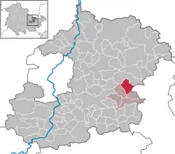 | |
 Hermsdorf 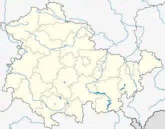 Hermsdorf | |
| Coordinates: 50°53′53″N 11°51′24″E / 50.89806°N 11.85667°E | |
| Country | Germany |
| State | Thuringia |
| District | Saale-Holzland-Kreis |
| Municipal assoc. | Hermsdorf |
| Government | |
| • Mayor (2024–30) | Benny Hofmann[1] (Ind.) |
| Area | |
• Total | 7.49 km2 (2.89 sq mi) |
| Elevation | 330 m (1,080 ft) |
| Population (2024-12-31)[2] | |
• Total | 8,210 |
| • Density | 1,100/km2 (2,800/sq mi) |
| Time zone | UTC+01:00 (CET) |
| • Summer (DST) | UTC+02:00 (CEST) |
| Postal codes | 07629 |
| Dialling codes | 036601 |
| Vehicle registration | SHK, EIS, SRO |
| Website | www.hermsdorf-thueringen.de |
Hermsdorf (German pronunciation: [ˈhɛʁmsˌdɔʁf] ⓘ) is a town in the Saale-Holzland district of the state of Thuringia in eastern Germany. It is especially known for the motorway junction "Hermsdorfer Kreuz" where the two German autobahns A 4 (Frankfurt - Dresden) and A 9 (Berlin - Munich) meet.
Hermsdorf-Klosterlausnitz station is on the Weimar–Gera railway.
Personalities
References
- ^ Gewählte Bürgermeister - aktuelle Landesübersicht, Freistaat Thüringen. Retrieved 25 June 2024.
- ^ "Bevölkerung der Gemeinden vom Thüringer Landesamt für Statistik" (in German). Thüringer Landesamt für Statistik.
External links
In German:
- Official website of Hermsdorf
- hermsdorf-thueringen.de
- SVHermsdorf.de
- 750-jahre-hermsdorf.de
- jugendhaus-hermsdorf.de
- holzlandgymnasium.de