Harmony Township, Union County, Indiana
Harmony Township | |
|---|---|
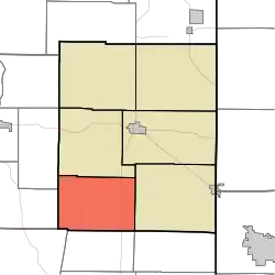 Location in Union County | |
| Coordinates: 39°33′17″N 84°59′07″W / 39.55472°N 84.98528°W | |
| Country | United States |
| State | Indiana |
| County | Union |
| Government | |
| • Type | Indiana township |
| Area | |
• Total | 22.99 sq mi (59.5 km2) |
| • Land | 20.65 sq mi (53.5 km2) |
| • Water | 2.34 sq mi (6.1 km2) 10.18% |
| Elevation | 807 ft (246 m) |
| Population (2020) | |
• Total | 527 |
| • Density | 23/sq mi (8.9/km2) |
| Time zone | UTC-5 (Eastern (EST)) |
| • Summer (DST) | UTC-4 (EDT) |
| ZIP codes | 47331, 47353 |
| Area code | 765 |
| GNIS feature ID | 453375 |
Harmony Township is one of six townships in Union County, Indiana, United States. As of the 2020 census, its population was 527 and it contained 286 housing units.[2]
| Census | Pop. | Note | %± |
|---|---|---|---|
| 1890 | 611 | — | |
| 1900 | 595 | −2.6% | |
| 1910 | 549 | −7.7% | |
| 1920 | 524 | −4.6% | |
| 1930 | 429 | −18.1% | |
| 1940 | 432 | 0.7% | |
| 1950 | 443 | 2.5% | |
| 1960 | 442 | −0.2% | |
| 1970 | 335 | −24.2% | |
| 1980 | 377 | 12.5% | |
| 1990 | 419 | 11.1% | |
| 2000 | 628 | 49.9% | |
| 2010 | 543 | −13.5% | |
| 2020 | 527 | −2.9% | |
| Source: US Decennial Census[3] | |||
Geography
According to the 2010 census, the township has a total area of 22.99 square miles (59.5 km2), of which 20.65 square miles (53.5 km2) (or 89.82%) is land and 2.34 square miles (6.1 km2) (or 10.18%) is water.[4]
Unincorporated towns
(This list is based on USGS data and may include former settlements.)
Adjacent townships
- Liberty Township (north)
- Union Township (east)
- Bath Township, Franklin County (southeast)
- Fairfield Township, Franklin County (south)
- Blooming Grove Township, Franklin County (southwest)
- Jackson Township, Fayette County (west)
- Jennings Township, Fayette County (northwest)
Cemeteries
The township contains these two cemeteries: New Hope and Old Bath Springs.
School districts
- Union County-College Corner Joint School District
Political districts
- Indiana's 6th congressional district
- State House District 55
- State Senate District 43
References
- United States Census Bureau 2007 TIGER/Line Shapefiles
- United States Board on Geographic Names (GNIS)
- IndianaMap
- ^ "US Board on Geographic Names". United States Geological Survey. October 25, 2007. Retrieved May 9, 2017.
- ^ "Explore Census Data". data.census.gov. Retrieved April 12, 2024.
- ^ "Township Census Counts: STATS Indiana".
- ^ "Population, Housing Units, Area, and Density: 2010 - County -- County Subdivision and Place -- 2010 Census Summary File 1". United States Census. Archived from the original on February 12, 2020. Retrieved May 10, 2013.
External links
Municipalities and communities of Union County, Indiana, United States | ||
|---|---|---|
| Towns | 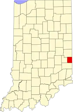 | |
| Townships | ||
| CDP | ||
| Other communities | ||