Greene Township, Parke County, Indiana
Greene Township | |
|---|---|
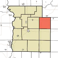 Location in Parke County | |
| Coordinates: 39°49′11″N 87°04′06″W / 39.81972°N 87.06833°W | |
| Country | |
| State | |
| County | Parke |
| Government | |
| • Type | Indiana township |
| Area | |
• Total | 35.65 sq mi (92.3 km2) |
| • Land | 35.55 sq mi (92.1 km2) |
| • Water | 0.09 sq mi (0.2 km2) 0.25% |
| Elevation | 676 ft (206 m) |
| Population (2020) | |
• Total | 413 |
| • Density | 12/sq mi (4.5/km2) |
| Time zone | UTC-5 (Eastern (EST)) |
| • Summer (DST) | UTC-4 (EDT) |
| ZIP codes | 46175, 47872, 47989 |
| Area code | 765 |
| GNIS feature ID | 453350 |
Greene Township is one of thirteen townships in Parke County, Indiana, United States. As of the 2020 census, its population was 413 and it contained 181 housing units.[2]
| Census | Pop. | Note | %± |
|---|---|---|---|
| 1890 | 1,126 | — | |
| 1900 | 1,077 | −4.4% | |
| 1910 | 1,009 | −6.3% | |
| 1920 | 981 | −2.8% | |
| 1930 | 805 | −17.9% | |
| 1940 | 758 | −5.8% | |
| 1950 | 616 | −18.7% | |
| 1960 | 502 | −18.5% | |
| 1970 | 470 | −6.4% | |
| 1980 | 524 | 11.5% | |
| 1990 | 416 | −20.6% | |
| 2000 | 439 | 5.5% | |
| 2010 | 423 | −3.6% | |
| 2020 | 413 | −2.4% | |
| Source: US Decennial Census[3] | |||
History
The Portland Mills Bridge was listed on the National Register of Historic Places in 1978.[4]
Geography
According to the 2010 census, the township has a total area of 35.65 square miles (92.3 km2), of which 35.55 square miles (92.1 km2) (or 99.72%) is land and 0.09 square miles (0.23 km2) (or 0.25%) is water.[5]
Unincorporated towns
- Guion at 39°50′34″N 87°06′41″W / 39.842820°N 87.111400°W
- Milligan at 39°50′44″N 87°02′18″W / 39.845599°N 87.038344°W
- Parkeville at 39°49′01″N 87°05′04″W / 39.816987°N 87.084456°W
(This list is based on USGS data and may include former settlements.)
Cemeteries
The township contains these nine cemeteries: Bruin, Clodfelter, Jarvis, Lane, Mount Moriah, Philadelphia, Raccoon, Seybold and Spencer.
School districts
Political districts
- State House District 44
- State Senate District 38
References
- "Greene Township, Parke County, Indiana". Geographic Names Information System. United States Geological Survey, United States Department of the Interior. Retrieved November 1, 2009.
- United States Census Bureau 2009 TIGER/Line Shapefiles
- IndianaMap
- ^ "US Board on Geographic Names". United States Geological Survey. October 25, 2007. Retrieved May 9, 2017.
- ^ "Explore Census Data". data.census.gov. Retrieved April 13, 2024.
- ^ "Township Census Counts: STATS Indiana".
- ^ "National Register Information System". National Register of Historic Places. National Park Service. July 9, 2010.
- ^ "Population, Housing Units, Area, and Density: 2010 - County -- County Subdivision and Place -- 2010 Census Summary File 1". United States Census. Archived from the original on February 12, 2020. Retrieved May 10, 2013.
- ^ Geography Division (December 18, 2020). 2020 CENSUS - SCHOOL DISTRICT REFERENCE MAP: Parke County, IN (PDF) (Map). U.S. Census Bureau. Retrieved June 6, 2025. - Text list
External links
- Indiana Township Association
- United Township Association of Indiana
- City-Data.com page for Greene Township
Places adjacent to Greene Township, Parke County, Indiana | |
|---|---|
Municipalities and communities of Parke County, Indiana, United States | ||
|---|---|---|
| Towns | 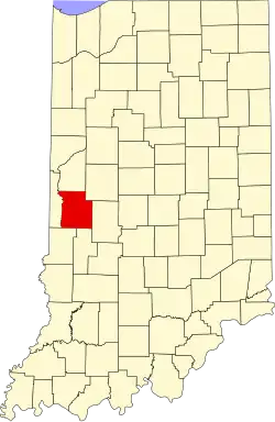 | |
| Townships | ||
| CDPs | ||
| Other communities |
| |
| Ghost town | ||
| Footnotes | ‡This populated place also has portions in an adjacent county or counties | |