Graham Township, Jefferson County, Indiana
Graham Township | |
|---|---|
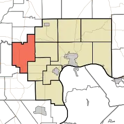 Location in Jefferson County | |
| Coordinates: 38°46′54″N 85°37′52″W / 38.78167°N 85.63111°W | |
| Country | United States |
| State | Indiana |
| County | Jefferson |
| Government | |
| • Type | Indiana township |
| Area | |
• Total | 42.31 sq mi (109.6 km2) |
| • Land | 42.09 sq mi (109.0 km2) |
| • Water | 0.22 sq mi (0.6 km2) 0.52% |
| Elevation | 666 ft (203 m) |
| Population (2020) | |
• Total | 1,618 |
| • Density | 38/sq mi (15/km2) |
| GNIS feature ID | 0453333 |
Graham Township is one of ten townships in Jefferson County, Indiana, United States. As of the 2020 census, its population was 1,618 (slightly down from 1,668 at 2010[1]) and it contained 705 housing units.[2]
| Census | Pop. | Note | %± |
|---|---|---|---|
| 1890 | 1,184 | — | |
| 1900 | 1,186 | 0.2% | |
| 1910 | 1,213 | 2.3% | |
| 1920 | 1,228 | 1.2% | |
| 1930 | 903 | −26.5% | |
| 1940 | 1,062 | 17.6% | |
| 1950 | 1,170 | 10.2% | |
| 1960 | 1,231 | 5.2% | |
| 1970 | 1,262 | 2.5% | |
| 1980 | 1,446 | 14.6% | |
| 1990 | 1,448 | 0.1% | |
| 2000 | 1,666 | 15.1% | |
| 2010 | 1,668 | 0.1% | |
| 2020 | 1,618 | −3.0% | |
| Source: US Decennial Census[3] | |||
Geography
According to the 2010 census, the township has a total area of 42.31 square miles (109.6 km2), of which 42.09 square miles (109.0 km2) (or 99.48%) is land and 0.22 square miles (0.57 km2) (or 0.52%) is water.[1] The streams of Dry Branch, Lewis Creek, Little Creek, Neils Creek and Walton Creek run through this township.
Unincorporated towns
Extinct towns
- Parkers Station
Adjacent townships
- Montgomery Township, Jennings County (north)
- Lancaster Township (northeast)
- Smyrna Township (east)
- Republican Township (southeast)
- Lexington Township, Scott County (south)
- Johnson Township, Scott County (west)
- Marion Township, Jennings County (northwest)
Cemeteries
The township contains three cemeteries: Carmel, Robertson and Valley.
Major highways
References
- "Graham Township, Jefferson County, Indiana". Geographic Names Information System. United States Geological Survey, United States Department of the Interior. Retrieved September 24, 2009.
- United States Census Bureau cartographic boundary files
- ^ a b "Population, Housing Units, Area, and Density: 2010 - County -- County Subdivision and Place -- 2010 Census Summary File 1". United States Census. Archived from the original on February 12, 2020. Retrieved May 10, 2013.
- ^ "Explore Census Data". data.census.gov. Retrieved April 10, 2024.
- ^ "Township Census Counts: STATS Indiana".
External links
Municipalities and communities of Jefferson County, Indiana, United States | ||
|---|---|---|
| City | 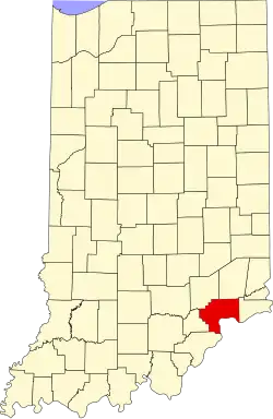 | |
| Towns | ||
| Townships | ||
| CDPs | ||
| Other communities | ||
| Footnotes | ‡This populated place also has portions in an adjacent county or counties | |